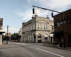
Martinsville Historic District
|
Martinsville Historic District | |
 | |
|
Martinsville Historic District, July 2010 | |
 | |
| Location | Roughly bounded by VA 457, Danville RR tracks, Clay St., and Market St., Martinsville, Virginia |
|---|---|
| Coordinates | 36°41′30″N 79°52′21″W / 36.69167°N 79.87250°WCoordinates: 36°41′30″N 79°52′21″W / 36.69167°N 79.87250°W |
| Area | 45.5 acres (18.4 ha) |
| Built | 1883 |
| Architect | Tucker, George, et al. |
| Architectural style | Federal, Romanesque, Colonial Revival |
| NRHP Reference # | 98001317[1] |
| VLR # | 120-5001 |
| Significant dates | |
| Added to NRHP | October 30, 1998 |
| Designated VLR | April 22, 1998 [2] |
Martinsville Historic District is a national historic district located at Martinsville, Virginia. It encompasses 94 contributing buildings, 1 contributing site, and 3 contributing structures in the central business district of Martinsville. The buildings range in date from the early-19th century through the mid- 20th century and include notable examples of the Romanesque, Federal, and Colonial Revival styles. Notable buildings include the Henry County Courthouse (1824), People's Bank (1891), Globman's Department Store (c. 1915), Ford Building (1908), U.S. Post Office (1939), the Masonic Temple, the Henry Hotel (1921), the Martinsville Hotel (c. 1930), First National Bank Building (1925), the Knights of Pythias Building (1922), Oakley Apartment / Office Building (1935), the Chief Tassel Building (1930), First United Methodist Church of Martinsville (1922), Richardson's Motor Co. (c. 1918), Gravely Pin Factory (1907), and Sale Knitting Plant (1937).[3]
It was listed on the National Register of Historic Places in 1998.[1]
References
- 1 2 Staff (2010-07-09). "National Register Information System". National Register of Historic Places. National Park Service.
- ↑ "Virginia Landmarks Register". Virginia Department of Historic Resources. Retrieved 19 March 2013.
- ↑ unknown (n.d.). "National Register of Historic Places Inventory/Nomination: Martinsville Historic District" (PDF). Virginia Department of Historic Resources. and Accompanying photo and Accompanying map
External links
- Henry County Courthouse, 1 East Main Street, Martinsville, Martinsville, VA: 1 photo and 1 photo caption page at Historic American Buildings Survey

