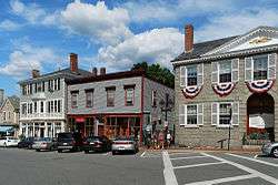
Marblehead Historic District
Marblehead Historic District is a historic district roughly bounded by Marblehead Harbor, Waldron Court, Essex, Elm, Pond, and Norman Streets in Marblehead, Massachusetts. Among its notable features are Fort Sewall, a coastal fortification with origins dating to 1644,[2] and two National Historic Landmarks, the General John Glover House,[3] and the Jeremiah Lee House.[4]
The district features Georgian, Federal and other styles of architecture. The area was added to the National Register of Historic Places in 1984.
See also
References
|
|---|
| | Topics | | |
|---|
| | Lists by county | |
|---|
| | Lists by city | Barnstable County | |
|---|
| Bristol County | |
|---|
| Essex County | |
|---|
| Hampden County | |
|---|
| Middlesex County | |
|---|
| Norfolk County | |
|---|
| Suffolk County | |
|---|
| Worcester County | |
|---|
|
|---|
| | Other lists | |
|---|
|
-
 Category Category
-
 NRHP portal NRHP portal
-
 Massachusetts portal Massachusetts portal
|
|


