Manapakkam
| Manapakkam | |
|---|---|
| Neighbourhood | |
|
Manapakkam traffic signal on Mount-Poonamallee Road | |
 Manapakkam | |
| Coordinates: 13°00′48″N 80°10′22″E / 13.013297°N 80.172858°ECoordinates: 13°00′48″N 80°10′22″E / 13.013297°N 80.172858°E | |
| Country | India |
| State | Tamil Nadu |
| District | Kanchipuram |
| Metro | Chennai |
| Government | |
| • Body | CMDA |
| Population (2001) | |
| • Total | 8,590 |
| Languages | |
| • Official | Tamil |
| Time zone | IST (UTC+5:30) |
| PIN | 600 125 |
| Vehicle registration | TN-85 |
| Planning agency | CMDA |
Manapakkam is a census town and part of the Chennai Metro city, in the Indian state of Tamil Nadu. Manapakkam is located along the Mount-Poonamallee Road in Chennai.It is now a home to a lot of IT companies.

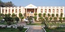
Dr. M. G. R. Home and Higher Secondary School for the Speech and Hearing Impaired, Manappakam
Geographic location
Manapakkam is located between Ramapuram and Mugalivakkam in the North, Nandambakkam (part) and St. Thomas Mount in the East, Nandambakkam (Part) and Meenambakkam in the South and Kulapakkam in the West.
Demographics
As of 2001 India census,[1] Manapakkam had a population of 8590. Males constitute 52% of the population and females 48%. Manapakkam has an average literacy rate of 73%, higher than the national average of 59.5%: male literacy is 77%, and female literacy is 69%. In Manapakkam, 11% of the population is under 6 years of age.
References
- ↑ "Census of India 2001: Data from the 2001 Census, including cities, villages and towns (Provisional)". Census Commission of India. Archived from the original on 2004-06-16. Retrieved 2008-11-01.
| ||||||||||||||||||||||||||||||||||||||||||||||||||||||||||||||||||||||||||||||||||||||||||||||||||||||||||||||||||||||||||||||||||||||||||||||||||||||||||||||||||||||||||||||||||||||||||||||||||||||||||||||||||||||||||||||||||||||||||||||||||||||||||||||||||||||||||||||||||||||||||||||||||
This article is issued from Wikipedia - version of the Sunday, September 27, 2015. The text is available under the Creative Commons Attribution/Share Alike but additional terms may apply for the media files.