List of mines in Temagami
This is a list of mines in Temagami, a municipality in the northern part of Nipissing District in Northeastern Ontario, Canada. Also included are their alias names, coordinates, workings and the commodities that were mined there. The list contains 32 mines, both surface and underground. They are located in 10 geographic townships, with Strathy Township having the largest mine capacity.
Mining is a significant part of Temagami's history. The municipality was the scene of active prospecting and mining ventures throughout most of the 20th century, resulting in the creation of trenches, open cuts, open pits, adits, shafts and drifts in the regional bedrock. Commodities extracted from these mines included iron, copper, nickel, gold, arsenic, molybdenum, platinum, palladium, lead, silver, cobalt, zinc, bismuth, uranium, graphite and pyrite.
The mines of Temagami are situated in a variety of geological formations. This includes the Nipissing diabase and Temagami greenstone belt, which hosts a variety of mineral deposits. Mining in these two geological features began in the early 1900s with the discovery of precious metals, such as gold and silver.
Strathy Township
| Official name |
Alias names |
Coordinates |
Primary commodities |
Secondary commodities |
Workings |
| Ajax[1] |
Cuniptau; Kanichee; Trebor[1] |
47°6′13.7″N 79°50′38.63″W / 47.103806°N 79.8440639°W / 47.103806; -79.8440639[2] |
Copper, nickel[2] |
Gold, platinum, palladium, silver[2] |
Open pit; drifts[1] |
| Beanland[3] |
A.E. Perron[3] |
47°5′28.71″N 79°49′30.83″W / 47.0913083°N 79.8252306°W / 47.0913083; -79.8252306[4] |
Gold, silver[4] |
No data[4] |
Vertical shaft; drifts; open pit[3] |
| Big Dan[5] |
United Reef Petroleum[5] |
47°5′30.62″N 79°46′28.17″W / 47.0918389°N 79.7744917°W / 47.0918389; -79.7744917[6] |
Gold, silver[6] |
Arsenic[6] |
Open cut; trench; adit; vertical and inclined shafts[5] |
| Canada-Thomas[7] |
No data[7] |
47°5′59.58″N 79°48′20.12″W / 47.0998833°N 79.8055889°W / 47.0998833; -79.8055889[8] |
Copper, gold[8] |
Cobalt, lead, nickel, silver, zinc[8] |
Open pit; trenches; stripped areas[7] |
| Hermiston-McCauley[9] |
Shaver Vein; Cominco South Vein[9] |
47°5′54.2″N 79°49′38.29″W / 47.098389°N 79.8273028°W / 47.098389; -79.8273028[10] |
Gold[10] |
No data[10] |
Shaft; open pit; trenches[9] |
| J.W. Barton[11] |
Net Lake[11] |
47°7′8.75″N 79°47′9.58″W / 47.1190972°N 79.7859944°W / 47.1190972; -79.7859944[12] |
Molybdenum[12] |
Bismuth, copper, gold, silver[12] |
Vertical and inclined shafts; trenches; open pit[11] |
| L.B. Norrie[13] |
No data[13] |
47°6′59.59″N 79°46′27.63″W / 47.1165528°N 79.7743417°W / 47.1165528; -79.7743417[14] |
Copper, nickel[14] |
Gold, lead, silver, zinc[14] |
Trenches; open pit[13] |
| Manitoba and Eastern[15] |
Leckie; Little Dan; Penrose[15] |
47°5′36.34″N 79°47′48.68″W / 47.0934278°N 79.7968556°W / 47.0934278; -79.7968556[16] |
Gold[16] |
Arsenic, copper, silver[16] |
Open cut; open pit; trenches; shafts; drifts; stripped area[15] |
| Oslund-Hurst[17] |
Keevil[17] |
47°4′57.77″N 79°50′46.34″W / 47.0827139°N 79.8462056°W / 47.0827139; -79.8462056[18] |
Gold[18] |
Silver[18] |
Open pits; trenches[17] |
| Sey-Bert[19] |
J.A. Jones[19] |
47°5′47.82″N 79°47′15.83″W / 47.0966167°N 79.7877306°W / 47.0966167; -79.7877306[20] |
Gold[20] |
Lead, zinc[20] |
Trenches[19] |
| Sherman[21] |
East Pit; North Pit; South Pit; West Pit[21] |
47°4′14.48″N 79°51′59.83″W / 47.0706889°N 79.8666194°W / 47.0706889; -79.8666194[22] |
Iron[22] |
No data[22] |
Open pits[21] |
| Temagami[23] |
No data[23] |
47°5′29.9″N 79°50′16.25″W / 47.091639°N 79.8378472°W / 47.091639; -79.8378472[24] |
Gold, silver[24] |
Arsenic, copper, zinc[24] |
Trenches; open pits; stripped areas[23] |
Best Township
Belfast Township
Cassels Township

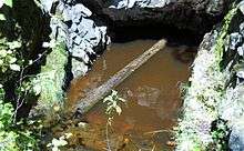
Flooded shaft at Gosselin Mine
Mining in Cassels Township dates from 1900 when the area was being explored for silver and cobalt. This work was carried out by Temagami-Lorrain Mining Limited in the Sauvé Lake area and Temagami-Cobalt Mining Company Limited in the Gosselin Lake area. Trenches and shafts were constructed in Nipissing diabase along with rock stripping.[41] In 1946, Hermes Mines Limited created pits in a 0.61 to 0.91 m (2.0 to 3.0 ft) wide fault zone containing minor pyrite and very minor chalcopyrite mineralization.[42] This work was in the Outlet Bay area of Net Lake.[41]
Vogt Township
Phyllis Township
Cynthia Township
Joan Township
Strathcona Township
Torrington Township
See also
References
- 1 2 3 "Ajax". Abandoned Mines Information System, Ministry of Northern Development and Mines. Retrieved 2012-03-30.
- 1 2 3 "Ajax". Mineral Deposits Inventory, Ministry of Northern Development, Mines and Forestry. Retrieved 2012-03-30.
- 1 2 3 "Beanland". Abandoned Mines Information System, Ministry of Northern Development and Mines. Retrieved 2012-03-30.
- 1 2 3 "Beanland". Mineral Deposits Inventory, Ministry of Northern Development, Mines and Forestry. Retrieved 2012-03-30.
- 1 2 3 "Big Dan". Abandoned Mines Information System, Ministry of Northern Development and Mines. Retrieved 2012-03-30.
- 1 2 3 "Big Dan". Mineral Deposits Inventory, Ministry of Northern Development, Mines and Forestry. Retrieved 2012-03-30.
- 1 2 3 "Canada-Thomas". Abandoned Mines Information System, Ministry of Northern Development and Mines. Retrieved 2012-03-30.
- 1 2 3 "Canada-Thomas". Mineral Deposits Inventory, Ministry of Northern Development, Mines and Forestry. Retrieved 2012-03-30.
- 1 2 3 "Hermiston-McCauley". Abandoned Mines Information System, Ministry of Northern Development and Mines. Retrieved 2012-03-30.
- 1 2 3 "Hermiston-McCauley". Mineral Deposits Inventory, Ministry of Northern Development, Mines and Forestry. Retrieved 2012-03-30.
- 1 2 3 "Barton, J.W.". Abandoned Mines Information System, Ministry of Northern Development and Mines. Retrieved 2012-03-30.
- 1 2 3 "Barton, J.W.". Mineral Deposits Inventory, Ministry of Northern Development, Mines and Forestry. Retrieved 2012-03-30.
- 1 2 3 "Norrie, L.B.". Abandoned Mines Information System, Ministry of Northern Development and Mines. Retrieved 2012-03-30.
- 1 2 3 "Norrie, L.B.". Mineral Deposits Inventory, Ministry of Northern Development, Mines and Forestry. Retrieved 2012-03-30.
- 1 2 3 "Manitoba and Eastern". Abandoned Mines Information System, Ministry of Northern Development and Mines. Retrieved 2012-03-30.
- 1 2 3 "Manitoba and Eastern". Mineral Deposits Inventory, Ministry of Northern Development, Mines and Forestry. Retrieved 2012-03-30.
- 1 2 3 "Oslund-Hurst". Abandoned Mines Information System, Ministry of Northern Development and Mines. Retrieved 2012-03-30.
- 1 2 3 "Oslund-Hurst". Mineral Deposits Inventory, Ministry of Northern Development, Mines and Forestry. Retrieved 2012-03-30.
- 1 2 3 "Sey-Bert". Abandoned Mines Information System, Ministry of Northern Development and Mines. Retrieved 2012-03-30.
- 1 2 3 "Sey-Bert". Mineral Deposits Inventory, Ministry of Northern Development, Mines and Forestry. Retrieved 2012-03-30.
- 1 2 3 "Sherman". Abandoned Mines Information System, Ministry of Northern Development and Mines. Retrieved 2012-03-30.
- 1 2 3 "Sherman". Mineral Deposits Inventory, Ministry of Northern Development, Mines and Forestry. Retrieved 2012-03-30.
- 1 2 3 "Temagami". Abandoned Mines Information System, Ministry of Northern Development and Mines. Retrieved 2012-03-30.
- 1 2 3 "Temagami". Mineral Deposits Inventory, Ministry of Northern Development, Mines and Forestry. Retrieved 2012-03-30.
- 1 2 3 "Acana East". Abandoned Mines Information System, Ministry of Northern Development and Mines. Retrieved 2012-03-30.
- 1 2 3 "Acana East". Mineral Deposits Inventory, Ministry of Northern Development, Mines and Forestry. Retrieved 2012-03-30.
- 1 2 3 "Danlou". Abandoned Mines Information System, Ministry of Northern Development and Mines. Retrieved 2012-03-30.
- 1 2 3 "Danlou". Mineral Deposits Inventory, Ministry of Northern Development, Mines and Forestry. Retrieved 2012-03-30.
- 1 2 3 "Friday Creek". Abandoned Mines Information System, Ministry of Northern Development and Mines. Retrieved 2012-03-30.
- 1 2 3 "Friday Creek". Mineral Deposits Inventory, Ministry of Northern Development, Mines and Forestry. Retrieved 2012-03-30.
- 1 2 3 "Northland Pyrite". Abandoned Mines Information System, Ministry of Northern Development and Mines. Retrieved 2012-03-30.
- 1 2 3 "Northland Pyrite". Mineral Deposits Inventory, Ministry of Northern Development, Mines and Forestry. Retrieved 2012-03-30.
- 1 2 3 "Wkt". Abandoned Mines Information System, Ministry of Northern Development and Mines. Retrieved 2012-03-30.
- 1 2 3 "Wkt". Mineral Deposits Inventory, Ministry of Northern Development, Mines and Forestry. Retrieved 2012-03-30.
- 1 2 3 "Obabika". Abandoned Mines Information System, Ministry of Northern Development and Mines. Retrieved 2012-03-30.
- 1 2 3 "Obabika". Mineral Deposits Inventory, Ministry of Northern Development, Mines and Forestry. Retrieved 2012-03-30.
- 1 2 3 "Obabika Inlet Showing". Abandoned Mines Information System, Ministry of Northern Development and Mines. Retrieved 2012-03-30.
- 1 2 3 "Obabika Inlet Showing". Mineral Deposits Inventory, Ministry of Northern Development, Mines and Forestry. Retrieved 2012-03-30.
- 1 2 3 "St. Belfast Silver Occurrence". Abandoned Mines Information System, Ministry of Northern Development and Mines. Retrieved 2012-03-30.
- 1 2 3 "St. Belfast Silver Occurrence". Mineral Deposits Inventory, Ministry of Northern Development, Mines and Forestry. Retrieved 2012-03-30.
- 1 2 Born, P. (1988). "Geology of Cassels and Riddell Townships District of Nipissing". Queen's Printer for Ontario: 53, 59, 62.
- ↑ Sampson, C. J. (1969). "Wabi-Cassels Property (Wabi River Mining Syndicate Option) Cassels Township, near Temagami, Ontario". Toronto, Ontario: Rio Tinto Canadian Exploration Limited: 8. AFRI 31M04SE0005.
- 1 2 3 "Brochu". Abandoned Mines Information System, Ministry of Northern Development and Mines. Retrieved 2012-03-30.
- 1 2 3 "Brochu". Mineral Deposits Inventory, Ministry of Northern Development, Mines and Forestry. Retrieved 2012-03-30.
- 1 2 3 "Gosselin". Abandoned Mines Information System, Ministry of Northern Development and Mines. Retrieved 2012-03-30.
- 1 2 3 4 "Gosselin". Mineral Deposits Inventory, Ministry of Northern Development, Mines and Forestry. Retrieved 2012-03-30.
- 1 2 3 "Temagami-Lorrain". Abandoned Mines Information System, Ministry of Northern Development and Mines. Retrieved 2012-03-30.
- 1 2 3 4 "Temagami-Lorrain". Mineral Deposits Inventory, Ministry of Northern Development, Mines and Forestry. Retrieved 2012-03-30.
- 1 2 3 "Island Number 364". Abandoned Mines Information System, Ministry of Northern Development and Mines. Retrieved 2012-03-30.
- 1 2 3 "Island Number 364". Mineral Deposits Inventory, Ministry of Northern Development, Mines and Forestry. Retrieved 2012-03-30.
- 1 2 3 "Krefeld". Abandoned Mines Information System, Ministry of Northern Development and Mines. Retrieved 2012-03-30.
- 1 2 3 "Krefeld". Mineral Deposits Inventory, Ministry of Northern Development, Mines and Forestry. Retrieved 2012-03-30.
- 1 2 3 "Prosco". Abandoned Mines Information System, Ministry of Northern Development and Mines. Retrieved 2012-03-30.
- 1 2 3 "Prosco". Mineral Deposits Inventory, Ministry of Northern Development, Mines and Forestry. Retrieved 2012-03-30.
- 1 2 3 "Temagami". Abandoned Mines Information System, Ministry of Northern Development and Mines. Retrieved 2012-03-30.
- 1 2 3 "Temagami". Mineral Deposits Inventory, Ministry of Northern Development, Mines and Forestry. Retrieved 2012-03-30.
- 1 2 3 "Billfield". Abandoned Mines Information System, Ministry of Northern Development and Mines. Retrieved 2012-03-30.
- 1 2 3 "Billfield". Mineral Deposits Inventory, Ministry of Northern Development, Mines and Forestry. Retrieved 2012-03-30.
- 1 2 3 "Coppersand". Abandoned Mines Information System, Ministry of Northern Development and Mines. Retrieved 2012-03-30.
- 1 2 3 "Coppersand". Mineral Deposits Inventory, Ministry of Northern Development, Mines and Forestry. Retrieved 2012-03-30.
- 1 2 3 "Lahay". Abandoned Mines Information System, Ministry of Northern Development and Mines. Retrieved 2012-03-30.
- 1 2 3 "Lahay". Mineral Deposits Inventory, Ministry of Northern Development, Mines and Forestry. Retrieved 2012-03-30.
- 1 2 3 "O'Connor". Abandoned Mines Information System, Ministry of Northern Development and Mines. Retrieved 2012-03-30.
- 1 2 3 "O'Connor". Mineral Deposits Inventory, Ministry of Northern Development, Mines and Forestry. Retrieved 2012-03-30.
- 1 2 3 "Cross Lake". Abandoned Mines Information System, Ministry of Northern Development and Mines. Retrieved 2012-03-30.
- 1 2 Pain, S. A. (1955). "Notes on Cross Lake Mining Co. Ltd". Toronto, Ontario: Cross Lake Mining Company Limited: 1. AFRI 31L13SW0001.
- 1 2 "Cross Lake". Mineral Deposits Inventory, Ministry of Northern Development, Mines and Forestry. Retrieved 2012-03-30.
|
|---|
| | Provinces | |
|---|
| | Territories | |
|---|
|
-
 Book Book
-
 Category Category
-
 Portal Portal
-
 WikiProject WikiProject
|
|


