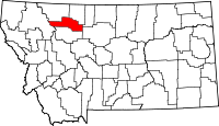
List of lakes in Pondera County, Montana
- This list is incomplete; you can help by expanding it.
There are at least 29 named lakes and reservoirs in Pondera County, Montana.
Lakes
- Abbott Lake, 48°24′24″N 112°13′36″W / 48.40667°N 112.22667°W, el. 3,619 feet (1,103 m)[1]
- Alkali Lake, 48°24′32″N 112°27′40″W / 48.40889°N 112.46111°W, el. 3,786 feet (1,154 m)[2]
- Blue Lake, 48°09′05″N 113°05′33″W / 48.15139°N 113.09250°W, el. 5,863 feet (1,787 m)[3]
- Cody Lake, 48°10′23″N 112°49′09″W / 48.17306°N 112.81917°W, el. 4,695 feet (1,431 m)[4]
- Deep Lake, 48°10′30″N 112°47′23″W / 48.17500°N 112.78972°W, el. 4,678 feet (1,426 m)[5]
- Emerald Lake, 48°09′30″N 113°01′18″W / 48.15833°N 113.02167°W, el. 6,585 feet (2,007 m)[6]
- Eyraud Lakes, 48°01′03″N 111°58′55″W / 48.01750°N 111.98194°W, el. 3,720 feet (1,130 m)[7]
- Fish Lake, 48°09′13″N 112°48′50″W / 48.15361°N 112.81389°W, el. 4,934 feet (1,504 m)[8]
- Green Lake, 48°14′36″N 112°52′01″W / 48.24333°N 112.86694°W, el. 4,826 feet (1,471 m)[9]
- Heron Lake, 48°22′48″N 112°01′14″W / 48.38000°N 112.02056°W, el. 3,451 feet (1,052 m)[10]
- Hidden Lake, 48°10′03″N 112°50′46″W / 48.16750°N 112.84611°W, el. 4,678 feet (1,426 m)[11]
- Horn Lake, 48°17′13″N 112°54′19″W / 48.28694°N 112.90528°W, el. 4,751 feet (1,448 m)[12]
- Howes Lakes, 48°10′17″N 112°48′11″W / 48.17139°N 112.80306°W, el. 4,734 feet (1,443 m)[13]
- Kiyo Crag Lake, 48°18′19″N 113°07′14″W / 48.30528°N 113.12056°W, el. 6,211 feet (1,893 m)[14]
- Letz Lake, 48°13′55″N 111°49′33″W / 48.23194°N 111.82583°W, el. 3,366 feet (1,026 m)[15]
- Mitten Lake, 48°18′13″N 112°58′52″W / 48.30361°N 112.98111°W, el. 4,747 feet (1,447 m)[16]
- Round Lake, 48°09′42″N 112°47′08″W / 48.16167°N 112.78556°W, el. 4,757 feet (1,450 m)[17]
- Slippery Hoof Lake, 48°16′11″N 113°02′31″W / 48.26972°N 113.04194°W, el. 4,842 feet (1,476 m)[18]
- Stetler Lakes, 48°25′45″N 112°12′37″W / 48.42917°N 112.21028°W, el. 3,602 feet (1,098 m)[19]
- Twin Lakes, 48°09′11″N 112°47′31″W / 48.15306°N 112.79194°W, el. 4,800 feet (1,500 m)[20]
- Waddel Lakes, 48°11′09″N 112°47′52″W / 48.18583°N 112.79778°W, el. 4,682 feet (1,427 m)[21]
Reservoirs
- Conrad Reservoir, 48°11′25″N 112°01′20″W / 48.19028°N 112.02222°W, el. 3,714 feet (1,132 m)[22]
- Fowler Reservoir, 48°13′18″N 111°26′03″W / 48.22167°N 111.43417°W, el. 3,314 feet (1,010 m)[23]
- Fowler Reservoir, 48°12′45″N 111°36′19″W / 48.21250°N 111.60528°W, el. 3,353 feet (1,022 m)[24]
- Green Lake, 48°14′36″N 112°51′39″W / 48.24333°N 112.86083°W, el. 4,823 feet (1,470 m)[25]
- Lake Frances, 48°15′46″N 112°12′28″W / 48.26278°N 112.20778°W, el. 3,819 feet (1,164 m)[26]
- Swift Reservoir, 48°09′49″N 112°52′20″W / 48.16361°N 112.87222°W, el. 4,862 feet (1,482 m)[27]
- Tedson Reservoir, 48°09′05″N 112°44′27″W / 48.15139°N 112.74083°W, el. 4,678 feet (1,426 m)[28]
See also
Notes
- ↑ "Abbott Lake". Geographic Names Information System. United States Geological Survey.
- ↑ "Alkali Lake". Geographic Names Information System. United States Geological Survey.
- ↑ "Blue Lake". Geographic Names Information System. United States Geological Survey.
- ↑ "Cody Lake". Geographic Names Information System. United States Geological Survey.
- ↑ "Deep Lake". Geographic Names Information System. United States Geological Survey.
- ↑ "Emerald Lake". Geographic Names Information System. United States Geological Survey.
- ↑ "Eyraud Lakes". Geographic Names Information System. United States Geological Survey.
- ↑ "Fish Lake". Geographic Names Information System. United States Geological Survey.
- ↑ "Green Lake". Geographic Names Information System. United States Geological Survey.
- ↑ "Heron Lake". Geographic Names Information System. United States Geological Survey.
- ↑ "Hidden Lake". Geographic Names Information System. United States Geological Survey.
- ↑ "Horn Lake". Geographic Names Information System. United States Geological Survey.
- ↑ "Howes Lakes". Geographic Names Information System. United States Geological Survey.
- ↑ "Kiyo Crag Lake". Geographic Names Information System. United States Geological Survey.
- ↑ "Letz Lake". Geographic Names Information System. United States Geological Survey.
- ↑ "Mitten Lake". Geographic Names Information System. United States Geological Survey.
- ↑ "Round Lake". Geographic Names Information System. United States Geological Survey.
- ↑ "Slippery Hoof Lake". Geographic Names Information System. United States Geological Survey.
- ↑ "Stetler Lakes". Geographic Names Information System. United States Geological Survey.
- ↑ "Twin Lakes". Geographic Names Information System. United States Geological Survey.
- ↑ "Waddel Lakes". Geographic Names Information System. United States Geological Survey.
- ↑ "Conrad Reservoir". Geographic Names Information System. United States Geological Survey.
- ↑ "Fowler Reservoir". Geographic Names Information System. United States Geological Survey.
- ↑ "Fowler Reservoir". Geographic Names Information System. United States Geological Survey.
- ↑ "Green Lake". Geographic Names Information System. United States Geological Survey.
- ↑ "Lake Frances". Geographic Names Information System. United States Geological Survey.
- ↑ "Swift Reservoir". Geographic Names Information System. United States Geological Survey.
- ↑ "Tedson Reservoir". Geographic Names Information System. United States Geological Survey.
| |||||||||||||||||||||||||||||||||
This article is issued from Wikipedia - version of the Monday, August 29, 2011. The text is available under the Creative Commons Attribution/Share Alike but additional terms may apply for the media files.
