| Name |
Web-
site |
Location |
Size |
Established |
Status |
Remarks |
| Bear Creek Lake State Park |
|
Cumberland, Virginia |
7006227433330938880♠562 acres (2.27 km2)[1] |
1939[1] |
Open |
|
| Belle Isle State Park |
|
Lancaster County, Virginia |
7006302300174753280♠747 acres (3.02 km2)[1] |
1993[1] |
Open |
|
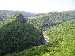
| Breaks Interstate Park |
|
Breaks, Virginia |
7007182108539008000♠4,500 acres (18 km2) |
1954 |
Open |
|
| Caledon Natural Area |
|
King George, Virginia |
7007105542015496192♠2,608 acres (10.55 km2)[1] |
1974[1] |
Open |
|
| Chippokes Plantation State Park |
|
Surry, Virginia |
7006787113574156800♠1,945 acres (7.87 km2)[1] |
1967[1] |
Open |
|
| Claytor Lake State Park |
|
Dublin, Virginia |
7006192630365706240♠476 acres (1.93 km2)[1] |
1951[1] |
Open |
|
| Douthat State Park |
|
Millboro, Virginia |
7007183929624398080♠4,545 acres (18.39 km2)[1] |
1933[1] |
Open |
|
| Fairy Stone State Park |
|
Stuart, Virginia |
7007189311943439872♠4,678 acres (18.93 km2)[1] |
1933[1] |
Open |
|
| False Cape State Park |
|
Virginia Beach, Virginia |
7007174864666011904♠4,321 acres (17.49 km2)[1] |
1968[1] |
Open |
|
| First Landing State Park |
|
Virginia Beach, Virginia |
7007145605894077952♠3,598 acres (14.56 km2)[1] |
1933[1] |
Open |
Originally Seashore State Park[1] |
| Grayson Highlands State Park |
|
Mouth of Wilson, Virginia |
7007196555816435968♠4,857 acres (19.66 km2)[1] |
1965[1] |
Open |
|
| High Bridge Trail State Park |
|
Farmville, Virginia |
7006246048870481920♠608 acres (2.46 km2)[1] |
2006[1] |
Open |
|
| Holliday Lake State Park |
|
Appomattox, Virginia |
7006101171410560000♠250 acres (1.0 km2)[1] |
1939[1] |
Open |
|
| Hungry Mother State Park |
|
Marion, Virginia |
7006948987831052800♠2,345 acres (9.49 km2)[1] |
1933[1] |
Open |
|
| James River State Park |
|
Gladstone, Virginia |
7006634547087032320♠1,568 acres (6.35 km2)[1] |
1993[1] |
Open |
|
| Kiptopeke State Park |
|
Cape Charles, Virginia |
7006216911504240640♠536 acres (2.17 km2)[1] |
1992[1] |
Open |
|
| Lake Anna State Park |
|
Spotsylvania County, Virginia |
7006999168850690560♠2,469 acres (9.99 km2)[1] |
1972[1] |
Open |
|
| Leesylvania State Park |
|
Woodbridge, Virginia |
7006206794363184640♠511 acres (2.07 km2)[1] |
1975[1] |
Open |
|
| Mason Neck State Park |
|
Lorton, Virginia |
7006753929351493120♠1,863 acres (7.54 km2)[1] |
1967[1] |
Open |
|
| Middle Peninsula State Park |
|
|
7006165111742033920♠408 acres (1.65 km2)[1] |
2006[1] |
Closed |
|
| Natural Tunnel State Park |
|
Duffield, Virginia |
7006356528050813440♠881 acres (3.57 km2)[1] |
1967[1] |
Open |
|
| New River Trail State Park |
|
Fosters Falls, Virginia |
7006495335226101760♠1,224 acres (4.95 km2)[1] |
1987[1] |
Open |
|
| Occoneechee State Park |
|
Clarksville, Virginia |
7007108860437762560♠2,690 acres (10.9 km2)[1] |
1968[1] |
Open |
|
| Pocahontas State Park |
|
Chesterfield, Virginia |
7007311243727446784♠7,691 acres (31.12 km2)[1] |
1946[1] |
Open |
|
| Powhatan State Park |
|
Powhatan, Virginia |
7006632523658821120♠1,563 acres (6.33 km2)[1] |
2003[1] |
Open |
|
| Sailor's Creek Battlefield State Park |
|
Rice, Virginia |
7006131118148085760♠324 acres (1.31 km2)[1] |
1937[1] |
Open |
|
| Seven Bends State Park |
|
|
7006431799580270080♠1,067 acres (4.32 km2)[1] |
2004[1] |
Closed |
|
| Shenandoah River Raymond R. "Andy" Guest Jr. State Park |
|
Bentonville, Virginia |
7006689584334376960♠1,704 acres (6.90 km2)[1] |
1994[1] |
Open |
|
| Shot Tower Historical State Park |
|
Austinville, Virginia |
7004283279949568000♠7 acres (0.028 km2)[1] |
1964[1] |
Open |
|
| Sky Meadows State Park |
|
Delaplane, Virginia |
7006654781369144320♠1,618 acres (6.55 km2)[1] |
1975[1] |
Open |
|
| Smith Mountain Lake State Park |
|
Huddleston, Virginia |
7006609456577213440♠1,506 acres (6.09 km2)[1] |
1967[1] |
Open |
|
| Southwest Virginia Museum Historical State Park |
|
Big Stone Gap, Virginia |
7003809371284480000♠2 acres (0.0081 km2)[1] |
1943[1] |
Open |
|
| Staunton River State Park |
|
Scottsburg, Virginia |
7007103720930106112♠2,563 acres (10.37 km2)[1] |
1933[1] |
Open |
|
| Staunton River Battlefield State Park |
|
Randolph, Virginia |
7006139616546572800♠345 acres (1.40 km2)[1] |
1955[1] |
Open |
|
| Tabb Monument |
|
Amelia County, Virginia |
7003404685642240000♠1 acre (0.0040 km2)[1] |
1936[1] |
Open |
|
| Twin Lakes State Park |
|
Green Bay, Virginia |
7006195867850844160♠484 acres (1.96 km2)[1] |
1939[1] |
Open |
|
| Westmoreland State Park |
|
Montross, Virginia |
7006561298985786880♠1,387 acres (5.61 km2)[1] |
1933[1] |
Open |
|
| Widewater State Park |
|
|
7006440702664399360♠1,089 acres (4.41 km2)[1] |
2006[1] |
Closed |
|
| Wilderness Road State Park |
|
Ewing, Virginia |
7005776996433100800♠192 acres (0.78 km2)[1] |
1993[1] |
Open |
|
| York River State Park |
|
Williamsburg, Virginia |
7007103316244463872♠2,553 acres (10.33 km2)[1] |
1969[1] |
Open |
|


