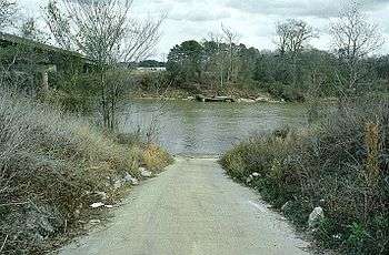
Leaf River (Mississippi)

The Leaf River is a river, about 180 mi (290 km) long, in southern Mississippi in the United States. It is a principal tributary of the Pascagoula River, which flows to the Gulf of Mexico.
Course

The Leaf River rises in the Bienville National Forest in southwestern Scott County and flows initially southward through eastern Smith, northeastern Covington, western Jones and northern Forrest Counties to Hattiesburg, where it collects the Bouie River. Below Hattiesburg, the river turns southeastward and flows through central Perry and southwestern Greene Counties, skirting the edge of the De Soto National Forest, into northern George County, where it joins the Chickasawhay River to form the Pascagoula River.
History
The Leaf River served as a trade route in the area before roads and trails were widely developed. It is recorded that traders made regular trips to people living near the river bringing with them supplies from Pascagoula. Legend says that one of these traders buried his profits, several thousand dollars in Spanish coins, near the banks of the Leaf River. The coins were later found in about 1854.[1]
Alleged pollution
While the upper stretches of the river enjoy an excellent reputation, the lower river has been the subject of claims of pollution since the 1990s. At that time, thousands of area residents filed suit against the Georgia-Pacific Corporation, claiming that its pulp mill released the dangerous chemicals, dioxins, into the river. In 1996, these suits were dismissed when the courts decided that there was no scientific proof that dangerous dioxin levels were present in the river or that Georgia-Pacific was negligent.[2]
Variant names
According to the Geographic Names Information System, the Leaf River has also been known as:
- Estapacha River
- Estopacha River
- Fiume
- Hashuphatchee River
- Hastabucha River
- Hastehatchee River
- Leaf Creek
- Pescaooula River (in part)
- Slapacha River
- Tallahoma River (in part)
- Tally Hooma Creek (in part)
See also
References
- ↑ Lowry, Robert; William H. McCardle (1891). A History of Mississippi:From the Discovery of the Great River by Hernando DeSoto to the Death of Jefferson Davis. University of Michigan: R.H. Henry & Co.
- ↑ Herndon, Ernest (2001). Canoeing Mississippi. University Press of Mississippi. ISBN 1-57806-222-5.
- Columbia Gazetteer of North America entry
- DeLorme (1998). Mississippi Atlas & Gazetteer. Yarmouth, Maine: DeLorme. ISBN 0-89933-346-X.
- U.S. Geological Survey Geographic Names Information System: Leaf River, retrieved 4 February 2006
- An Expanded Model: Flood-inundation Maps for the Leaf River at Hattiesburg. Mississippi, 2013 United States Geological Survey
Coordinates: 30°58′57″N 88°43′49″W / 30.98250°N 88.73028°W