Lanark
| Lanark | |
| Scottish Gaelic: Lannraig | |
| Scots: Lanrik | |
 Lanark High Street, August 2006 |
|
 Coat of Arms of the Royal Burgh of Lanark |
|
 Lanark |
|
| Population | 8,253 [1] |
|---|---|
| OS grid reference | NS8843 |
| – Edinburgh | 29 1⁄2 miles (47.5 km) |
| – London | 325 miles (523 km) |
| Council area | South Lanarkshire |
| Lieutenancy area | Lanarkshire |
| Country | Scotland |
| Sovereign state | United Kingdom |
| Post town | LANARK |
| Postcode district | ML11 |
| Dialling code | 01555 |
| Police | Scottish |
| Fire | Scottish |
| Ambulance | Scottish |
| EU Parliament | Scotland |
| UK Parliament | Lanark and Hamilton East |
| Scottish Parliament | Clydesdale |
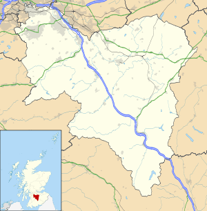
Coordinates: 55°40′30″N 3°46′37″W / 55.674903°N 3.777019°W
Lanark (/ˈlænərk/; Scottish Gaelic: Lannraig,[2] Scots: Lanrik)[3] is a small town in the central belt of Scotland. The name is believed to come from the Cumbric Lanerc meaning "clear space, glade".[4]
Lanark is traditionally the county town of Lanarkshire, though there are several larger towns in the county. Lanark railway station and coach station have frequent services to Glasgow. There is little industry in Lanark and some residents commute to work in Glasgow and Edinburgh. Its shops serve the local agricultural community and surrounding villages. There is a large modern livestock auction market on the outskirts of the town.
History
Lanark has served as an important market town since medieval times, and King David I made it a Royal Burgh in 1140, giving it certain mercantile privileges relating to government and taxation. King David I realised that greater prosperity could result from encouraging trade. He decided to create a chain of new towns across Scotland. These would be centres of Norman civilisation in a largely Celtic country, and would be established in such a way as to encourage the development of trade within their area. These new towns were to be known as Burghs. Bastides were established in France for much the same reason.
When a site had been selected for a new town the King’s surveyors would lay out an area for the town’s market. Each merchant who came to the town was granted a plot of land (usually rent free for the first few years) bordering on the marketplace. These plots were known as feus or rigs. Each feu in a burgh was the same size, though the size varied between burghs. In Forres in the north of Scotland each feu was 24 feet 10 inches (7.57 m) wide and 429 feet (131 m) deep. The layout of the feus in Lanark can still be easily seen between the north side of Lanark High Street (the former market place) and North Vennel, a lane which runs behind the feus. A motte and bailey castle was also constructed at the bottom of Castlegate.
Lanark had four town gates, West Port, East port, Wellgate and Castlegate. West Port gate was demolished in the 1770s.[5]
The first aviation meeting to be held in Scotland was held at Lanark Racecourse between 6 and 13 August 1910. This location was chosen because the land was relatively flat, the racecourse already had facilities for a paying public, there were stables to act as hangars for the aeroplanes and the racecourse was accessible by both road and by rail, especially as The Caledonian Railway Company were prepared to construct a new station near the main entrance. The aeroplanes were transported to the meeting by rail, as aviation technology at the time was not advanced enough to safely fly there. The Lanark meeting took place shortly after a similar event in Bournemouth at which Charles Rolls lost his life. Influenced by this, it was decided that no aircraft would fly closer than 300 yards (270 m) away from the spectators. For the first time, aeroplanes were accurately timed over a straight measured distance, allowing the first world records to be set, covering flights over 1 mile (1.6 km). The meeting was described by The Aero magazine as 'the most successful yet held in Britain'.[6]
A permanent military presence was established in the town with the completion of Winston Barracks in 1930.[7]
Governance

The electorate in Lanark form part of various different constituencies. In local elections, they are part of the Clydesdale North constituency and elect representatives to South Lanarkshire Council. The most recent elections, held in 2012, saw Ed Archer (independent), Catherine McClymont (Labour) and Vivienne Shaw (SNP) elected to represent the constituency.[8] In elections to the Scottish Parliament, Lanark elects its representatives as part of the Clydesdale constituency, and also elects seven additional list members of parliament as part of the South of Scotland region. The current Clydesdale MSP is Aileen Campbell, SNP, who defeated the Labour incumbent, Karen Gillon, in the 2011 election after Gillon had held the seat since 1999. In Westminster elections, Lanark is part of the Lanark and Hamilton East constituency. Labour MP Jimmy Hood has represented the area in Parliament since 1987. In elections to the European Parliament, Lanark is part of the Scotland constituency which elects six MEPs.
Landmarks

Visitors to the town can visit the nearby World Heritage Site of New Lanark,[9] close to the Falls of Clyde, the Corehouse estate and the Scottish Wildlife Trust's Corehouse Nature Reserve.[10]
The Lanark Museum[11] is located in West Port, inside the YMCA building.
A large boating lake, Lanark Loch, adjoins Lanark Golf Club which has a lovely and historic 18 hole course for more experienced golf players and a 9 hole golf course. The former racecourse now offers pony-trekking activities.
The town's Castlebank Park lies near the former site of Lanark Castle,[12] and allows access to the River Clyde and the Clyde Walkway.
An ornate gas lamp, known as the 'Provost's Lamp' stands at the bottom of the high street. The lamp used to be placed outside the home of whoever was Provost of Lanark at the time.
One of the churches in the town bears the name of The Old Church of St Kentigern (perhaps better known as St Mungo), who set up many medieval churches in the Scottish Lowlands, including Glasgow, and died c.612 AD. The town's cemetery stands on the site of The Old Church of St Kentigern, and includes many Covenanter graves.

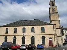
St. Nicolas' Parish Church stands at the bottom of the high street. The church bell is believed to date from 1110, and may be one of the oldest church bells in the world. It was moved from The Old Church of St Kentigern when St. Nicolas's Church was built in 1774. It has been recast four times, including 1659 and 1983. There is an 8-foot (2.45 m) statue of William Wallace in the steeple. This was sculpted by Robert Forrest, from an ancient drawing in the possession of the Society of Antiquaries.
Lanark Lanimer Day

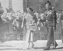
This historic background forms the basis for the Lanark Lanimer celebrations, which take place each year for one week in June. Local primary schoolchildren elect a Lanimer Queen and court; and a Lord Cornet is chosen from local businessmen. On the Monday night the Perambulation of the Marches takes place, when townspeople turn out to walk around half the town boundary, following the Lord Cornets past and present as they inspect the border-stones. Traditionally, the townspeople carry "birks", which are small branches of birch trees cut from the woods at the Glenburnie estate. This tradition was started in 1948 by Joseph Doolan, whose family owned the land. The other half of the boundary is inspected on the Wednesday night, again led by the Lord Cornet accompanied by many local riders who participate in the Riding of the Marches, locally referred to as the Rideout. On the Thursday morning, schools and other organisations parade before the Lanimer Queen in themed dress, accompanied by pipe bands. The best floats win prizes, and after the parade the crowning of the Queen takes place on a temporary stand erected in front of St Nicholas' Church, under the statue of William Wallace. The Queen holds a reception party in the town's Memorial Hall on the Thursday and Friday nights, where children perform songs and dances.
Music
Pipe Bands: Lanark & District Pipe Band previously had two units which competed in competitions run by the Royal Scottish Pipe Band Association - one competing in grade 4b and one in grade 3a, having been upgraded from 4b to 4a to 3b to 3a in consecutive years from 2004. In the 1980s, the band competed as high as grade 2 and as of 2011, the band is thriving in numbers and competes in Grade 4b.
The 'Music in Lanark' programme began in 2000 with the aim of bringing a variety of the highest quality live music to the town. In the first five years there were three classical concerts, one jazz concert and one traditional (Scottish) music concert. The programme continues to grow.
The Woodpecker
Where people in the town go for a night out. A typical Friday and Saturday night will see the place packed with many young folk out partying. A good place to go to get your hole.
Climate
As with the rest of the British Isles and Scotland, Lanark experiences a maritime climate with cool summers and mild winters. In terms of the local climate profile, Lanarks inland, rural, river valley setting means frost is very common, having been recorded in all months. Typically almost 100 nights[13] will report a frost per year, and even in a statistically average year the temperature should fall to as low as −14.3 °C (6.3 °F) on the coldest night.[14]
| Climate data for Carnwath 208 m asl, 1971–2000, extremes 1960– (Weather station 6 miles (10 km) to the East of Lanark) | |||||||||||||
|---|---|---|---|---|---|---|---|---|---|---|---|---|---|
| Month | Jan | Feb | Mar | Apr | May | Jun | Jul | Aug | Sep | Oct | Nov | Dec | Year |
| Record high °C (°F) | 12.0 (53.6) |
13.5 (56.3) |
18.9 (66) |
25.8 (78.4) |
26.2 (79.2) |
30.1 (86.2) |
29.4 (84.9) |
29.8 (85.6) |
27.0 (80.6) |
21.7 (71.1) |
17.2 (63) |
13.0 (55.4) |
30.1 (86.2) |
| Average high °C (°F) | 4.8 (40.6) |
5.5 (41.9) |
7.7 (45.9) |
10.6 (51.1) |
14.2 (57.6) |
16.4 (61.5) |
18.5 (65.3) |
18.0 (64.4) |
14.9 (58.8) |
11.4 (52.5) |
7.4 (45.3) |
5.5 (41.9) |
11.24 (52.23) |
| Average low °C (°F) | −1.5 (29.3) |
−1.1 (30) |
0.3 (32.5) |
1.3 (34.3) |
3.7 (38.7) |
6.6 (43.9) |
8.6 (47.5) |
8.3 (46.9) |
6.3 (43.3) |
3.8 (38.8) |
0.3 (32.5) |
−1.1 (30) |
4.7 (40.5) |
| Record low °C (°F) | −24.8 (−12.6) |
−21.2 (−6.2) |
−19.7 (−3.5) |
−9 (16) |
−7.6 (18.3) |
−3.8 (25.2) |
−1.2 (29.8) |
−2.2 (28) |
−5.5 (22.1) |
−9.9 (14.2) |
−14.6 (5.7) |
−20 (−4) |
−24.8 (−12.6) |
| Average precipitation mm (inches) | 83.77 (3.298) |
60.89 (2.3972) |
70.58 (2.7787) |
48.33 (1.9028) |
48.21 (1.898) |
59.45 (2.3406) |
64.16 (2.526) |
72.94 (2.8717) |
81.07 (3.1917) |
87.07 (3.428) |
84.85 (3.3406) |
88.54 (3.4858) |
849.86 (33.4591) |
| Source: Royal Dutch Meteorological Institute/KNMI[15] | |||||||||||||
Notable Lanarkians
William Wallace is one of the most notable people in Lanark's history. A key leader in the Scottish Wars of Independence, he is known to have first "drawn his sword to free his native land" in Lanark in 1297, killing the English sheriff Haselrig.[16][17] First year pupils at Lanark Grammar School study Wallace and the Wars of Independence in detail.[18] An 8-foot statue of Wallace sits on St Nicholas Church at the town cross dating back to 1817 which was sculpted by Carluke man Robert Forrest.[19]
Other important figures in Lanark history include:
- Margaret Agnes Bunn, actress (1799–1883)
- George Gray, born in Lanark in the 1620s, a POW from the Battle of Dunbar (1650), Durham Cathedral survivor, and New World refugee upon arrival to Berwick, Maine.[20]
- William Smellie (1697–1763), obstetrician
- Lord Braxfield (1722–1799), High Court Judge
- John Glaister (1856–1932), forensic scientist
- The rallying family of Jimmy, Alister and Colin McRae
- Robert (Rab) Douglas, Scotland and former Celtic F.C. goalkeeper,
- Stephen McManus, Scotland and Middlesbrough defender
- Walter Smith, Scotland and Rangers manager
- Henry Smith, Scotland and Hearts goalkeeper
- Billy Ritchie Rock music's first lead keyboard player, born in Lanark
- Lee Miller, Carlisle United striker
- Dougie Imrie, St. Mirren midfielder, started career with Lanark United
- Stephen Pearson, Derby County midfielder, formerly of Motherwell
- Johnny Reid, a Scottish/Canadian country music singer, who has two platinum albums and one gold album in Canada
- Darren Smith, former Motherwell winger
- Stewart Greacen (born 1988), footballer on Rangers F.C.
- John Downie, (1925–2013) Inside forward for Manchester United 1949–1953
- Shereen Cutkelvin (born 1996) former member of British girl group, Neon Jungle
Schools
Primary schools
There are three main primary schools in Lanark:
- Lanark Primary School (LPS) 1
- Robert Owen Memorial Primary School (ROMPS) 1
- St. Mary's Primary School 2
1 Indicates non-denominational school
2 Roman Catholic school
Secondary schools
There is now one secondary school in Lanark:
- Lanark Grammar School (LGS), a non-denominational school
previously there was St Mary's RC High School which closed in the 1990s
Religion
The religious buildings of Lanark are exclusively Christian, but cover a wide array of Christian denominations. At present, the following religious buildings still exist and remain in use:
- Christ Church
- EU Congregational Church
- Gospel Hall
- Greyfriars Parish Church
- Kingdom Hall of Jehovah's Witnesses
- St Mary's Roman Catholic Church
- St Nicholas Parish Church
The following buildings remain in Lanark, but are no longer used for religious purposes:
- Murray Chapel - in a state of disrepair, this church is within the council's St Catherine cemetery.
- St Kentigern's Church (Hope Street) - converted to and now used as office space and residences.
- St Kentigern's Church (Hyndford Road) - now in ruins, this church sits in the council-run St Kentigern's cemetery.
Finally, these buildings no longer exist:
- St Leonard's Church - space now occupied by Job Centre Plus Office.
Gallery
-

Town centre
-

High Street
-

Lanimers
-

Lanimers
-

Wellgate
-

Girnin Dug
See also
- Lanark Silver Bell
- Lanark County in Ontario, Canada
- Lanark, Ontario a village in Lanark County
- Lanark Grammar School
- Bonnington pavilion, Falls of Clyde A nearby historic feature.
- Whuppity Scoorie Day
References
- ↑ "Area Profiles". Scotland's Census 2011. National Records of Scotland. Retrieved 3 August 2014.
- ↑ Ainmean-Àite na h-Alba ~ Gaelic Place-Names of Scotland
- ↑ Scots Language Centre: Scottish Place Names in Scots
- ↑ Scottish place names, W. F. H. Nicolaisen, p.164, 172, London, 1976
- ↑ Rhona Wilson. Old Lanark, Stenlake Publishing, 1998. ISBN 1840330198
- ↑ Arthur W.J.G. Ord-Hume. Scotland's Aviation History, Stenlake Publishing, 2014. ISBN 9781840336535
- ↑ "Winston Barracks, Officers' Mess: Listed Building Report". Historic Scotland. Retrieved 17 June 2011.
- ↑ "Election results - all wards declared". South Lanarkshire Council. 4 May 2012. Retrieved 9 August 2014.
- ↑ New Lanark website, accessed 11th September, 2014
- ↑ Scottish Wildlife website, accessed 11th September, 2014
- ↑ Lanark Museum website, accessed 12th September, 2014
- ↑ Clarke, John; Glasgow Archaeological Society (1952). Miller, Steuart Napier, ed. The Roman occupation of south-western Scotland: being reports of excavations and surveys carried out under the auspices of the Glasgow Archaeological Society. Glasgow University Publications 83. R. MacLehose.
- ↑ "Average frost incidence". KNMI.
- ↑ "Average coldest night". KNMI.
- ↑ "Carnwath Climate". KNMI. Retrieved 4 Nov 2011.
- ↑ "William Wallace". Wars of Independence. BBC History. Retrieved 1 October 2011.
- ↑ Wallace, Andy. "Wallace in Lanark". The William Wallace Heritage Trust Lanark. Retrieved 1 October 2011.
- ↑ "Lanark Grammar School website". South Lanarkshire Council. Retrieved 1 October 2011.
- ↑ "Lanark from kings to convenanters [sic]". Local History and Heritage. South Lanarkshire Council. Retrieved 1 October 2011.
- ↑ The Gray Family of Hancock County, Maine, by Almon A. Gray, Walter A. Snow
- Historical Tours in the Clyde Valley. Published by the Clyde Valley Tourist Association and the Lanark & District Archaeological Association. Printed by Robert MacLehose and Company Limited, Renfrew, Scotland. 1982.
- Building the Royal Burghs by John Barrett and David Iredale. Published in The Scots Magazine. Volume 142, Number 1. January 1995. pp. 10–22.
- Upper Clydesdale: A History and Guide by Daniel Martin. Published by the Tuckwell Press, Phantassie, East Linton. 1999.
- Clydesdale District Guide. Published by Clydesdale District Guide. 1995.
- Lanark Heritage Trail. Published by South Lanarkshire Council. 2001.
External links
-
 Media related to Lanark at Wikimedia Commons