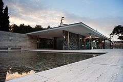
Lafayette Park, Detroit
|
Mies van der Rohe Residential District, Lafayette Park | |
 | |
|
View of Lafayette Park from Windsor, Ontario, Canada, 2007 | |
 | |
| Location | Roughly bounded by Lafayette Ave., Rivard, Antietam, and Orleans Sts., Detroit |
|---|---|
| Coordinates | 42°20′22″N 83°01′55″W / 42.3394°N 83.0319°WCoordinates: 42°20′22″N 83°01′55″W / 42.3394°N 83.0319°W |
| Area | 46 acres (19 ha) |
| Built | 1956 |
| Architect | Ludwig Mies van der Rohe, Ludwig Hilberseimer, et al. |
| Architectural style | International style |
| NRHP Reference # | 96000809 |
| Significant dates | |
| Added to NRHP | August 1, 1996[1] |
| Designated NHLD | July 21, 2015 |
Lafayette Park is a high rise residential neighborhood east of Downtown Detroit. The area is part of the Mies van der Rohe Residential District listed in the National Register of Historic Places.[2] In 2015 it was designated a National Historic Landmark District. Lafayette Park is located on the city's lower east side directly south of the Eastern Market Historic District.
Description
The 78-acre (32 ha) development was originally planned as Gratiot Park in 1946 to replace the Black Bottom neighborhood considered a slum.[3] Planned by Ludwig Mies van der Rohe, Ludwig Hilberseimer and Alfred Caldwell, the complex is a collection of one and two-story townhomes, a small neighborhood shopping center, and three high-rises set adjacent to a 19-acre municipally-operated park.[4]
The residential buildings of Lafayette Park are classic examples of Mies' International Style, with their simplicity, clean proportions, and cladding of tinted glass and aluminum.
The complex is located roughly half-way between downtown and Chene Park, and are also close to Belle Isle and the MacArthur Bridge. There is also easy access to I-375, Gratiot Avenue, and Jefferson Avenue. Lafayette Park is also near the architecturally significant St. Joseph's Catholic Church and the Eastern Market Historic District.
Constituent buildings
There are 186 one and two-story cooperative townhouses on 18 acres west of the park, built between 1958 and 1960.[5] The complex also includes:
| Building Name | Floors | Year Completed |
|---|---|---|
| 1300 Lafayette East Cooperative | 29 | 1961 |
| Lafayette Pavilion Apartments | 22 | 1958 |
| Lafayette Towers Apartments East | 22 | 1963 |
| Lafayette Towers Apartments West | 22 | 1963 |
| The Windsor Tower | 21 | 1965 |
Education
The community is zoned to Detroit Public Schools.
Residents are zoned to Chrysler Elementary School,[6] Bunche K-8 for middle school,[7] and Martin Luther King High School.[8] Previously Duffield K-8 served the community for middle school.[9]
Detroit Public Library operates the Elmwood Park Branch Library at 550 Chene. The branch first opened on April 21, 1975 in the Elmwood Park Plaza. The first owners of the shopping plaza included the branch after residents insisted on the inclusion of the library. As of 2009 it is the only branch located in a shopping plaza.[10]
Gallery
-

Lafayette Park Detroit includes shopping
-

1300 Lafayette East Cooperative in the foreground, Lafayette Pavilion Apartments in the background
-

Lafayette Park's constituent apartment buildings
-

1300 Lafayette East Cooperative
-

1300 Lafayette East
See also
- List of National Historic Landmarks in Michigan
- National Register of Historic Places listings in Detroit, Michigan
Notes
- ↑ Staff (2009-03-13). "National Register Information System". National Register of Historic Places. National Park Service.
- ↑ Vitullo-Martin, Julio, with photo by Mike Russell (December 22, 2007).The Biggest Mies Collection: His Lafayette Park residential development thrives in Detroit.The Wall Street Journal. Retrieved on January 1, 2009.
- ↑ detroitexpatroit (2011-01-24). "http://detroiturbandesign.blogspot.com/2011/01/005-lafayette-park-example-in.html". Detroiturbandesign.blogspot.com. Retrieved 2013-11-02. External link in
|title=(help) - ↑ http://www.miessociety.org/legacy/projects/lafayette-park/ Accessed 2/27/12
- ↑ City of Detroit, Proposed Lafayette Park/Mies van der Rohe Historic District Final Report 2002
- ↑ "Elementary School Boundary Map." Detroit Public Schools. Retrieved on October 20, 2009.
- ↑ "Middle School Boundaries - 2012/13 School Year." (Archive) Detroit Public Schools. Retrieved on November 1, 2012.
- ↑ "High School Boundary Map." Detroit Public Schools. Retrieved on October 20, 2009.
- ↑ "Middle School Boundary Map." Detroit Public Schools. Retrieved on November 7, 2009.
- ↑ "Elmwood Park Branch Library." Detroit Public Library. Retrieved on April 19, 2009.
References
- Waldheim, Charles (2004). Case: Lafayette Park Detroit. Prestel Publishing. ISBN 978-3-7913-3044-0.
- Hill, Eric J. and John Gallagher (2002). AIA Detroit: The American Institute of Architects Guide to Detroit Architecture. Wayne State University Press. ISBN 0-8143-3120-3.
- Garvin, Alexander (2002). The American City: What Works What Doesn't (2nd Ed.). McGraw Hill. ISBN 978-0-07-137367-8.
External links
| Wikimedia Commons has media related to Lafayette Park. |
- Google Maps location of the Lafayette Park
- Kathy Toth Flickr gallery: Photographs of Lafayette Park
- Ktoth.ca: Photographs of Lafayette Park
| |||||||||||||||||||||||||||||||||||||||||
| |||||||||||||||||||||||||
| |||||||||||||||||||||||||||||||||||||||||||||||||||||||||||||||
| |||||||||||||
| ||||||||||||||||||||||||||


