Kumasi
| Kumasi | |||||
|---|---|---|---|---|---|
| Metropolis | |||||
|
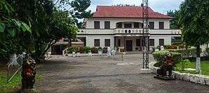
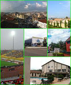
Top: Aerial view and public housing, bottom: Kumasi sports stadium, GC bank, armed forces museum and private housing. | |||||
| |||||
| Etymology: Comassie | |||||
| Nickname(s): The Garden City | |||||
| Motto: Working For A Cleaner City | |||||
| |||||
| Coordinates: 6°40′N 1°37′W / 6.667°N 1.617°WCoordinates: 6°40′N 1°37′W / 6.667°N 1.617°W | |||||
| Sovereign state | Ghana | ||||
| Autonomous region |
| ||||
| Metropolis |
| ||||
| Founded | 1680 | ||||
| Founded by | King Asantehene Osei Tutu I | ||||
| Seat | Kumasi Metropolis Hall | ||||
| Submetros | |||||
| Government | |||||
| • Type | Mayor–council monarchy | ||||
| • Body | Kumasi Metropolitan Assembly | ||||
| • King Asantehene | Osei Tutu II | ||||
| • City Mayor | Kojo Bonsu (KMA/NPP) | ||||
| • City Police Commander | DCOP. Kofi Boakye | ||||
| Area[1] | |||||
| • Capital City | 98 sq mi (254 km2) | ||||
| • Metro | 115.4 sq mi (299 km2) | ||||
| Elevation (AMSL) | 1,000 ft (300 m) | ||||
| Population (2015 est.)[2] | |||||
| • Capital City | 4,000,000 | ||||
| • Density | 41,000/sq mi (16,000/km2) | ||||
| • Metro | 7,000,000 | ||||
| • Metro density | 61,000/sq mi (23,000/km2) | ||||
| • Demography |
80.5% Ashantis[3] 10.3% Africans 9.2% others | ||||
| • Literacy rate[4] | 80.5% | ||||
| Demonym(s) | Kumasian | ||||
| Time zone | UTC+0 | ||||
| PO box | 1916 | ||||
| Area code(s) | 032 +52 | ||||
| Official languages | Ashanti Twi and Englishb[3] | ||||
| Website | Kumasi Government | ||||
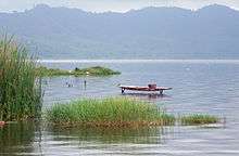
Kumasi /kuːˈmɑːsi/ (historically spelled Kumase or Coomassie) Kumasi Metropolis,[5] is a metropolis in Ghana and is the capital city of Ashanti situated on the semi-island exclave Ashantiland.[1] Ashanti is centered around the Ashanti capital city Kumasi – also spelled Kumasi metropolis.[6] The immediate territory surrounding the Ashanti capital Kumasi metropolis is called Ashanti.[6] Kumasi is situated 30 kilometers north-east of a Crater Lake the Lake Bosumtwi, in a rain forest region, and is the industrial commercial area and financial center of Ashanti and the Ashanti Kingdom as well as Ashantiland.[1] Kumasi metropolis is situated west and south of Lake Volta, a large artificial reservoir completed in 1965, and north of the Crater Lake Lake Bosumtwi situated within Ashanti and approximately 500 kilometres (300 mi) north of the Equator and 200 kilometres (100 mi) north of the Gulf of Guinea.[1] Kumasi metropolis is alternatively known as "The Garden City" because of its many beautiful species of flowers and plants.[1] Kumasi metropolis is also called Oseikrom in the Ashanti language (Ashanti Twi) the official language and major first language of Kumasi metropolis along with the English language.[3]
Kumasi was founded in 1680 the late 17th century following the foundation of the Ashanti kingdom in 1670 by Ashanti King Asantehene Osei Tutu I (the Emperor King of the Ashanti Kingdom) on the advice of Komfo Anokye, Osei Tutu I's premier.[7] Kumasi metropolis' strategic location within Ashanti contributed significantly to the growing wealth of the city.[8] Over the duration of Kumasi metropolis' existence, a number of peculiar factors have combined to transform Kumasi metropolis into a fitting financial center and political capital of Ashanti and the Ashanti kingdom as well as Ashantiland.[8] The main causal factors included the unquestioning loyalty to the Ashanti monarchy with Kumasi metropolis' growing wealth deriving in part from the Kumasi metropolis lucrative domestic-trade in items such as bullion gold bars with an array of other industrial minerals, technology, industrial crops with agricultural machinery as well as real estate development implemented by the Ashanti and Kumasi metropolis workforce driven by the domestic native Ashanti people population of Kumasi metropolis.[8][9]
History
Origins
There is evidence that the area around Kumasi has been kept cleared since the Neolithic age and that the first human settlement was at the Crater Lake of Lake Bosumtwi.[6]
Kumasi and Ashanti Kingdom
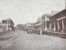
Kumasi rose to prominence in 1695 when it became capital of the Ashanti Confederacy due to the activities of its ruler Osei Tutu.[10] The ruler king of Kumasi metropolis, known as the King Asantehene, also served as ruler king of the Ashanti Confederacy.[10] With the Ashanti 1701 victory over Denkyira the Ashanti confederacy became the primary state among the Ashanti people ethnic group.[10] Parts of Kumasi metropolis, including the Royal Palace, were destroyed by British troops in the Third Anglo-Ashanti War of 1874.[11]
Lady Mary Alice Hodgson, the first English lady to visit Ashanti, wrote "The Siege of Kumasi" an account of the siege of the fort by the nationals of Ashanti Confederation and of the subsequent march to the coast.[11]
She was the daughter of Hon. W. A. G. Young, C.M.G., former Governor of the Gold Coast, and the wife of Sir Frederick Mitchell Hodgson, K.C.M.G., the Governor of the Gold Coast (1900).[11]
Kumasi remains a royal city of the Ashanti people; and in 1926, the Ashanti was restored ceremonial control over Kumasi, the full role of king was restored in 1935.[6] Kumasi metropolis holds an important place in the history of the Ashanti people, as legend claims that it was in Kumasi Okomfo Anokye received the Golden stool, an embodiment of the soul of the Ashanti people nation Ashanti.[6]
Geography
Kumasi metropolis is located in a transitional forest as Kumasi metropolis and was founded in 1680 by Ashanti King Asantehene Osei Tutu I to serve as the capital of Ashanti and the Ashanti Kingdom situated within the semi-island exclave Ashantiland. (Fynn, 1971). Given Kumasi metropolis's strategic location and political dominance, Kumasi metropolis as a matter of course, developed into a major commercial centre with all major trade routes converging on it. (Dickson, 1969). Kumasi is between latitude 6.35o – 6.40o and longitude 1.30o – 1.37o, an elevation which ranges between 250 – 300 metres above sea level with an area of 254 square kilometres and metro area of 299 square kilometres.[1] There are several small rivers and streams of Ashanti within Kumasi metropolis that serves as sources of clean drinking water for residents of Kumasi metropolis which are Offin river, Subin river, Aboabo river, Wiwi river, Owabi river, Sisa river, Daban river, and Oda river.[1]
Climate
Kumasi features a tropical wet and dry climate, with relatively constant temperatures throughout the course of the year. Kumasi averages around 1400 mm (55") of rain per year.[1]
Kumasi almost features two different rainy seasons, a longer rainy season from March through July and a shorter rainy season from September to November.[1]
In actuality, the months of February through to November is one long wet season in Kumasi, with a relative lull in precipitation in August.[1] Similar to the rest of Ashanti, Kumasi experiences the harmattan during the “low sun” months.[1] Lasting from December to February, the harmattan is the primary source of the city’s dry season.[1]
| Climate data for Kumasi Metropolis and Ashanti | |||||||||||||
|---|---|---|---|---|---|---|---|---|---|---|---|---|---|
| Month | Jan | Feb | Mar | Apr | May | Jun | Jul | Aug | Sep | Oct | Nov | Dec | Year |
| Record high °C (°F) | 36.7 (98.1) |
37.2 (99) |
37.8 (100) |
36.1 (97) |
35.0 (95) |
32.8 (91) |
31.1 (88) |
30.0 (86) |
31.7 (89.1) |
32.2 (90) |
32.8 (91) |
33.3 (91.9) |
37.8 (100) |
| Average high °C (°F) | 31.9 (89.4) |
33.5 (92.3) |
32.9 (91.2) |
32.3 (90.1) |
31.3 (88.3) |
29.5 (85.1) |
28.0 (82.4) |
27.7 (81.9) |
28.7 (83.7) |
30.1 (86.2) |
31.2 (88.2) |
30.7 (87.3) |
30.7 (87.3) |
| Average low °C (°F) | 20.4 (68.7) |
22.0 (71.6) |
22.3 (72.1) |
22.4 (72.3) |
22.2 (72) |
21.6 (70.9) |
21.2 (70.2) |
21.0 (69.8) |
21.1 (70) |
21.5 (70.7) |
21.7 (71.1) |
20.8 (69.4) |
21.5 (70.7) |
| Record low °C (°F) | 11.7 (53.1) |
13.3 (55.9) |
17.8 (64) |
19.4 (66.9) |
18.9 (66) |
18.9 (66) |
17.2 (63) |
16.1 (61) |
18.3 (64.9) |
15.6 (60.1) |
13.9 (57) |
10.6 (51.1) |
10.6 (51.1) |
| Average precipitation mm (inches) | 15.1 (0.594) |
66.3 (2.61) |
137.0 (5.394) |
129.3 (5.091) |
174.4 (6.866) |
214.3 (8.437) |
157.5 (6.201) |
89.9 (3.539) |
165.2 (6.504) |
153.3 (6.035) |
74.3 (2.925) |
25.8 (1.016) |
1,402.4 (55.213) |
| Average precipitation days | 2 | 5 | 9 | 10 | 14 | 17 | 14 | 12 | 17 | 17 | 8 | 3 | 128 |
| Mean monthly sunshine hours | 186.6 | 187.2 | 205.4 | 204.0 | 204.7 | 146.3 | 101.2 | 77.0 | 106.2 | 161.4 | 193.8 | 178.0 | 1,951.8 |
| Source #1: World Meteorological Organization,[12] Sistema de Clasificación Bioclimática Mundial (extremes)[13] | |||||||||||||
| Source #2: Deutscher Wetterdienst (sun, 1961–1990)[14][lower-alpha 1] | |||||||||||||
Government and submetros
The governmental and political administration of Kumasi metropolis is through the Kumasi Metropolitan Assembly (KMA), which is for effective administration sub-divided into ten sub-metros, namely Nhyiaeso, Asokwa, Subin, Bantama, Manhyia, Manso, Tafo, Kwadaso, Asawase, and Oforikrom. Each Kumasi metropolis submetro is administered by an electoral districts (constituencies) representing the Ashanti New Patriotic Party (NPP) Ashanti region central government which holds supermajority 10 out-of-a-total-of 11 Kumasi metropolis submetro electoral districts (parliamentary constituencies) but deriving authority from an Ashanti region assembly headed by a presiding member elected from among the members themselves with a functional and socio-cultural relationship between Ashanti region monarchy government situated at Manhyia Palace in submetro Manhyia, which is the traditional residential office of the Ashanti King Asantehene Osei Tutu II and the Kumasi Metropolitan Assembly (KMA) whose mayor is Kojo Bonsu for the effective governance and administration of Kumasi metropolis.[15]
| Submetros of Kumasi Metropolis | |||||||||
|---|---|---|---|---|---|---|---|---|---|
 | |||||||||
| Submetros of Kumasi Metropolis[16] | |||||||||
| # | Submetro | Settlements | # | Submetro | Settlements | ||||
| 1 | Nhyiaeso | Parliamentary Constituencies | 6 | Manhyia | 6 Settlements
|
Parliamentary Constituencies | |||
| Constituency
|
NPP | Constituencies
|
NPP | ||||||
| 2 | Bantama | 1 Settlement
|
Constituency
|
NPP | 7 | Asokwa | 7 Settlements
|
Constituencies
|
NPP |
| 3 | Tafo | 3 Settlements
|
Constituency
|
NPP | 8 | Subin | 4 Settlements
|
Constituency
|
NPP |
| 4 | Kwadaso | 6 Settlements
|
Constituency
|
NPP | 9 | Asawase | 5 Settlements
|
Constituencies
|
NPP |
| 5 | Suame | 5 Settlements
|
Constituency
|
NPP | 10 | Oforikrom | 13 Settlements
|
Constituency
|
NPP |
Economy
Kumasi metropolis's main occupations are professional occupations such as services and manufacturing in which as much as 92.5 percent of Ashanti region's real estate activities, 90.2 percent of financial and insurance activities, 85.8 percent of air conditioning supply; and 85.7 percent of professional scientific and technical activities are concentrated in Kumasi metropolis as Ashanti shares GDP figures with Kumasi metropolis in which the Ashanti gross regional product was ₵172 billion (Int$47.7 billion) in 2007-2008 and ₵1.06 trillion (Int$296.1 billion) in 2014-2015 with a GRP (Nominal) per person of Int$26,922 (₵97,005).[9] Kumasi metropolis is predominantly a commerce/trade service economy inclusive with an employment level of 71% and this being followed by industry with an employment level of 24% and agriculture with an employment level of 5%.[9] Kumasi metropolis has therefore established itself as a major commercial centre with commercial activity being centered on wholesaling and retailing with both financial and non-banking financial institutions also offer ancillary services for residents of Kumasi metropolis.[9]
Industrial mining and exports
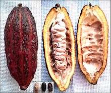
Due to large gold reserve deposits that are mined within the international borders of Ashanti the Kumasi metropolis is a wealthy city together with Ashanti and Kumasi city's major exports for Ashanti region includes gold bars in which Ashanti region is endowed with large deposits of gold as Kumasi metropolis with Ashanti region is a top-10 gold producer on Earth.[17][18] Kumasi metropolis with Ashanti region has large reserve deposits of manganese ores in which Kumasi metroplois with Ashanti region is a top-10 manganese producer on Earth.[18] Kumasi metropolis with Ashanti region has large reserve deposits of bauxite with a high content of aluminium and silica,[18] other industrial mineral deposits of economic value found in Kumasi metropolis and Ashanti region include iron, clay and limestone with traces of copper, platinum, lithium, tin arsenic and mica are also found in Kumasi metropolitan and Ashanti region,[18] timber, hardwood and cocoa in which Kumasi metropolis and Ashanti region is the second-largest cocoa producer on Earth.[19] The majority (58.7%) of Kumasi and Ashanti region's workforce are self-employed without employees.[17][17] Kumasi metropolis and Ashanti region produces 96% of Ghana's exports.[19]
Industrial agriculture
Industrial agricultural production is mainly undertaken for household consumption in Kumasi metropolis and Ashanti region, despite the huge demand for food by the large and relatively affluent Kumasi metropolis urban populace.[20][21] Therefore, Kumasi metropolis' modern agricultural activity on a large scale finds a ready large urban market demand for food produce in Kumasi metropolis and Ashanti region country.[19] Kumasi's centrality has been a significant factor in defining its role as a major market for agricultural produce from the hinterland of Ashanti region.[19][21] Kumasi's strategic location within Ashanti region has also endowed it with the status of the principal trucking terminal, and assured its pivotal role in the vast and profitable distribution of goods across the Ashanti region country.[19][20][21] The impact of these on the structure of the city has been the creation of a strong commercial centre covering Kejetia, Adum, Asafo and parts of Bantama.[19] Kumasi metropolis and Ashanti region has abundant food supplies to feed its Ashanti people population.[19] These Kumasi metropolis and Ashanti region food supplies include cooking plantain, rice, maize, cassava, taro-cocoyam, yam, vegetables and other cereals and legumes.[19][20] Irish potatoes also thrive well in Nsuta near Mampong in Ashanti region country. Kumasi metropolis and Ashanti region industrial crops grown include cocoa, palm oil, tobacco, bast fibre, cotton, citrus and cashew.[19][20]·Kumasi Metropolis and Ashanti region has a large number of poultry farming industries including Darko Farms, Mfum Farms, Asamoah Yamoah Farms, Asare Farms and many others; and Kumasi metropolis with Ashanti region also has large poultry feedmills.[19] Kumasi metropolis with Ashanti region is the second-largest yam (vegetable) producer on Earth and Ashanti region is the second-largest producer on Earth and Kumasi metropolis with Ashanti region is the second-largest cocoa producer on Earth.[19][20]
Manufacturing
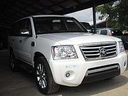
Kumasi metropolis with Ashanti has a large domestic timber industry and the Kaase Industrial Area situated within Kumasi metropolis plays an important role in the Kumasi metropolis and Ashanti industry with the Kumasi metropolis submetro Suame's renowned Suame Magazine amiable indigenous automobile and light industrial hub where small engineering based industries are sited is recognised as the most efficient mechanical and electrical and car body building workshop in Kumasi metropolis,[19] and Suame Magazine contributes immensely to the engineering based industries economy of Kumasi metropolis.[9] Ashanti people automobile company Kantanka cars mass-manufactures various brands of Kantanka zero-carbon electric cars contributing to Kumasi metropolis as a zero-carbon city with a zero-carbon economy at the Ashanti automobile company Kantanka major automobile assembly plant situated in Kumasi which mass-manufactures the various brands of Kantanka vehicles as well as Kantanka robots (robotics) and mass media diversified media technologies including various major appliances for Kumasi metropolis consumers and Ashanti region consumers.[22]
Energy
Kumasi metropolis has 5 electric power transmission bulk supply points with 231 kilometers of overhead lines and 140.6 kilometers underground cables as the status of electrical grid supply from the Kumasi metropolis grid to the 10 submetros of the Kumasi metropolis is generally good.[9] Kuamsi metropolis with Ashanti's electricity generation is fueled by biomass from Ashanti's vast timber reserve deposits and solar panels and zero-carbon housing are prevalent in Kumasi metropolis and Ashanti region as solar energy technology is a major energy source to zero-carbon housing in Kumasi metropolis and Ashanti region with solar energy being a major contributor of electricity generation in Kumasi metropolis and Ashanti region contributing to Kumasi metropolis as a zero-carbon city with a zero-carbon economy.[9]
Commerce
Much of the shopping and trading activity in Kumasi city takes place at Kumasi's shopping streets, in and around Kumasi Central Market (Kejetia Market) and Adum. These two areas; Kejetia and Adum are in close proximity with the two having a common boundary.[9] Kumasi metropolis contains the single largest traditional market in West Africa called the Kumasi Central Market which consists of over 10,000 department stores and markets fully occupied by retailers dealing in every conceivable product with Kumasi metropolis consumers and additionally Kumasi metropolis has about twenty-eight (28) satellite supermarkets there are however plans underway to develop some of the supermarkets to be modern markets as shopping malls and hypermarkets.[9]
Transportation
Air
Kumasi is served by Kumasi international airport which caters to all air travel to and from Kumasi metropolis located in Manhyia submetro of Kumasi metropolis.[9] As of May 2014 four airlines serviced Kumasi international airport which included Africa World Airlines, Antrak Air, Fly540 and Starbow Airlines. Kumasi international airport has completed undergoing construction to allow for night operations and access to and from the Kumasi international airport is excellent.[9]
Bus and taxicab
_Bus_Rapid_Transit_System.png)
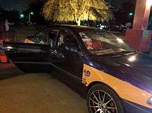
Public transport in the city is provided by Kumasi metropolis v.i.p transit buses, a mix of privately owned mini-buses known as Tro-Tros, taxicabs and buses. Tro-Tros are usually converted mini-buses that run regular, well-known routes. Some taxis also run regular routes, which cost more but provide for a more comfortable ride.[9]
In 2002, the city introduced the metro bus services a rapid transit system for public road transport in Kumasi (MetroMass).[23] This was in order to reduce congestion on roads and to make a larger and more organised bus routine system available in the city.[24]
Road
The predominant means of travel within Kumasi metropolis is by use of the road. Kumasi metropolis has been planned with arterial roads and collector roads the roads that link the arterial road network and local roads in which are the roads that link residences to the collector roads and within the ten submetros of Kumasi metropolis.[9] Kumasi metropolis has a 1700 km of road network infrastructure which include a few Ashanti regional highways such as the R52 and R106 .[9] Kumasi metropolis road transportation has been dominant in Kumasi since road transport accounts for the majority of the daily movements of goods and persons within Kumasi metropolis.[9] Kumasi metropolis road network is radial with Kejetia and Adum being the hub of the network. All the Kumasi metropolis major arterial roads radiate from the Kejetia/Adum area, which forms the core of the Kumasi metropolis central business district (CBD).[9]
Rail
Kumasi's railway lines and train service has been suspended for several years because of damaged track, bridges and locomotives. Currently, no train is running from and to Kumasi due to the collapse of the Railway Corporation some years back. A $6 billion project to upgrade the railways, was due to get underway in 2011 as the project is yet to be completed.[25]
Port
As of 2011, construction of the Boankra Inland Port, about 25 kilometres (16 mi) away from the Subin submetro of Kumasi metropolis, had came to a halt and is expected to be completed in 2015.[26]
Education and science
Kumasi metropolis educational facilities are provided by the Kumasi metropolis public and private individual sectors as the private sector provides the bulk of Kumasi metropolis educational institutions at the pre-school and first to second cycle levels whereas the educational public sector is the leader at teacher training colleges and tertiary levels with even distribution as the Kumasi metropolis educational sector focuses on three main levels in which are pre-school, basic school – primary and junior secondary schools; second cycle schools – senior secondary schools, teacher training colleges, special education and vocational/technical/commercial Schools.[27] The literacy rate in Kumasi metropolis is 80.5% (males 86.6 and females 75.0%) with an Ashanti Twi literacy of 97%,[4] and the English language literacy in Kumasi metropolis is at 69.6% (males 77.7% and females 62.3%).[4]
Senior High Schools and Colleges
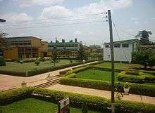
Kumasi metropolis has notable senior high schools like Kumasi High School, KNUST Senior High School, Osei Kyeretwie Secondary School, Yaa Asantewaa Secondary School, and Prempeh College which was founded in Kumasi by the King Osei Tutu Agyeman Prempeh II in 1949, and Opoku Ware School; named after the Asanteman King Opoku Ware I and founded in 1952.[27] Kumasi metropolis also has a polytechnic to boost its education called Kumasi Polytechnic.[27] Former president, John Kufuor attended and graduated from the Prempeh College.
Universities
The Kwame Nkrumah University of Science and Technology, Kumasi (formerly the Kumasi College of Technology) is the Premier University of Science and Technology in Ashanti region and West Africa.[27] The city's most famous son is the 7th Secretary-General of the United Nations, Kofi Annan, who attended and graduated from the Kwame Nkrumah University of Science and Technology. Kumasi metropolis's second university is the Garden City University College.[27]
Culture
Landmarks
Rich unadulterated culture is up for tourists viewing in Kumasi metropolis and for this, Kumasi metropolis has gained much recognition. Features of Kumasi metropolis include Fort Kumasi (built by in 1896 to replace an Ashanti fort and now a museum) and the Kumasi Hat Museum.[28]
Royal Ashanti attractions include the Kumasi National Cultural Centre (including the Prempeh II's Prempeh II Jubilee Museum with various Ashanti regalia including a reproduction of the Golden Stool), the Okomfo Anokye Akrafena Sword, the Asantehene's Palace (built in 1972), and the Manhyia Royal Palace, dating from 1925, and the Manhyia Palace Museum.[28]
Kumasi is also home to a zoo the Kumasi Zoo, the large Kumasi Central Market (Kejetia Market) and Asafo Market, and St. Peter's Cathedral Basilica is the seat of the Roman Catholic Archdiocese of Kumasi.[28]
Sports
Ashanti region and the local Kumasi metropolis football (soccer) team Kumasi Asante Kotoko which has the Asantehene as President has won many national and continental trophies and awards as the International Federation of Football History and Statistics ranked Asante Kotoko the African club of the 20th century.[29] Kumasi Asante Kotoko's stadium the Kumasi Sports Stadium also known as Baba Yara Stadium was built in 1959 then renovated in 1978 and renovated again in 2007 with a seating capacity of 40,000.[30] Kumasi metropolis is also the base of King Faisal Football Club a premier division club based at Abrankese Stadium. Kumasi metropolis also contains the Royal Golf Club which has the Asantehene as President.
Healthcare
_Health_Facilities_Map.png)
Kumasi metropolis has the highest number of health facilities in Ashanti region at 38% and Kumasi metropolis has a teaching hospital to support the medical training at the Kwame Nkrumah University of Science and Technology (Komfo Anokye Teaching Hospital), the West End Hospital, several other private hospitals, public clinics and small hospitals.[31] Kumasi metropolis health services are organized around five submetro health teams; namely, Bantama, Asokwa, Manhyia North, Manhyia South and Subin as each of the five Kumasi metropolis submetro health team is led by its director of health services who has the overall responsibility for planning, monitoring and evaluating the performance of the health sector in Kumasi metropolis. Kumasi metropolis has a number of health facilities in both the public and private sectors in which the notable among them are the Komfo Anokye Teaching Hospital (KATH) which is one of the 2 national autonomous hospitals in Kumasi metropolis, four quasi health institutions, 5 health care centres, and in addition Kumasi metropolis has over 200 known private health institutions and 13 industrial clinics in Kumasi metropolis. Kumasi metropolis also has 54 trained traditional birth attendants (TBAs), 9 maternal and child health (MCH) points and 119-outreach sites in which are evenly distributed.[31]
International relations
Twin towns and sister cities
Kumasi is twinned with:
| Sovereign state | City | County / District / Region / State | Date | |||
|---|---|---|---|---|---|---|
| |
Ivory Coast | |
Abidjan | |
Lagunes | 2004 |
| Treichville | ||||||
| |
USA | |
Atlanta | |
Georgia | 2010 |
| |
Netherlands | |
Almere | |
Flevoland | 2001 |
| |
USA | Charlotte | |
North Carolina | 1996 | |
| |
USA | |
Columbus | |
Ohio | 2008 |
| |
Canada | Kitchener | |
Ontario | 2010 | |
| |
USA | |
Newark | |
New Jersey | 1999 |
| |
South Africa | |
Gauteng | 2010 | ||
| |
USA | Winston-Salem | |
North Carolina | 2001 | |
See also
References
- 1 2 3 4 5 6 7 8 9 10 11 12 "Kumasi Metropolis Physical Characteristics". Kumasi Metropolitan Assembly. Retrieved 7 August 2015.
- ↑ "World Gazetteer online". World-gazetteer.com.
- 1 2 3 "Kumasi Fact Sheet". investinkumasi.com. Retrieved 7 August 2015.
- 1 2 3 Felix Engelhardt. "Creating an Environmental Geographic Information System for the City of Kumasi" (PDF). diva-portal.org (PDF). p. 5. Retrieved 7 August 2015.
- ↑ Coomassie and Magdala the story of two British campaigns in Africa
- 1 2 3 4 5 "Ashanti Academic Showcase". nd.digication.com.
- ↑ "United Asante States Under Nana Osei Tutu I". asantekingdom.org.
- 1 2 3 "History Of The Asante Confederay » Restoration Of The Asante Confederacy". asantekingdom.org.
- 1 2 3 4 5 6 7 8 9 10 11 12 13 14 15 16 "Kumasi Metropolis Economy". Kumasi Metropolitan Assembly. Retrieved 7 August 2015.
- 1 2 3 McCaskie, T. C. "Denkyira in the Making of Asante" in The Journal of African History vol. 48 (2007) no. 1, p. 1
- 1 2 3 Morgan, Henry James Types of Canadian women and of women who are or have been connected with Canada : (Toronto, 1903)
- ↑ "World Weather Information Service–Kumasi". World Meteorological Organization. Retrieved June 14, 2015.
- ↑ "Ghana–Kumasi". Centro de Investigaciones Fitosociológicas. Retrieved June 14, 2015.
- ↑ "Station 65442: Kumasi". Global station data 1961–1990—Sunshine Duration. Deutscher Wetterdienst. Retrieved June 14, 2015.
- ↑ "Kumasi Good Governance". Retrieved 7 August 2015.
- ↑ Ashanti Region. Geohive.com.
- 1 2 3 "GHANGOLD Case". Retrieved 7 August 2015.
- 1 2 3 4 "Mineral exploration & Mining industry". drabeny.com. Retrieved 7 August 2015.
- 1 2 3 4 5 6 7 8 9 10 11 12 "Meet-the-Press: Ashanti Region". Retrieved 7 August 2015.
- 1 2 3 4 5 "Overview: Agricultural Sector in the Ashanti region". investinkumasi.com. Retrieved 7 August 2015.
- 1 2 3 "Kumasi Metropolis Agricultural Extension". Kumasi Metropolitan Assembly. Retrieved 7 August 2015.
- ↑ "Updates on Kwadwo Safo's Works". kumatoo.com. 3 January 2014. Retrieved 7 August 2015.
- ↑ "Ashanti Region". Metro Mass Transit Ltd. Retrieved 1 December 2011.
- ↑ "Bus Rapid Transit System". Metro Mass Transit Ltd. Retrieved 1 December 2011.
- ↑ "Ghana, China signs railway contract". Ghana News Link. 30 November 2010. Retrieved 1 December 2011.
- ↑ "Baonkra Inland Port Project, stuck?". Kapital News. Kapital Radio 97.1 FM. 7 February 2011. Retrieved 1 December 2011.
- 1 2 3 4 5 "Kumasi Metropolis Educational Sector". Kumasi Metropolitan Assembly. Retrieved 7 August 2015.
- 1 2 3 "Kumasi Metropolis Tourism Attractions". Kumasi Metropolitan Assembly. Retrieved 7 August 2015.
- ↑ "Africa's club of the Century". IFFHS official website. Retrieved 2015-08-07.
- ↑ Kumasi Sports Stadium Ready. TheStatesManOnline.com.
- 1 2 "Kumasi Metropolis Health Sector". Kumasi Metropolitan Assembly. Retrieved 7 August 2015.
Notes
- ↑ Station ID for Kumasi is 65442 Use this station ID to locate the sunshine duration
- 1 Kumasi shares the same GDP figures with Ashanti (see economy of Ashanti).
- 2 Ashanti Twi is spoken by 97% of the Kumasi population and English is spoken by 69.6% of the Kumasi population.
External links
| Wikimedia Commons has media related to Kumasi. |
| Wikivoyage has a travel guide for Kumasi. |
- Invest in Kumasi
- Kumasi News
- MyGardenCity Interactive Community Platform for Ashanti Region
- MSN Map
- KNUST home page
- Kumasi Market Video
- The Siege of Kumasi on Internet Archive
| ||||||||||||||||||||||||||||||||||||||||||||||||||||||||||||||||||||||||||||||||||||||||||||||
|

_of_Kumasi.png)


