Kuchurhan
| Kuchurhan Кучурган | |
|---|---|
|
Kuchurhan border checkpoint in Jan 2005 | |
 Kuchurhan Location in Ukraine | |
| Coordinates: 46°43′25″N 29°58′39″E / 46.72361°N 29.97750°ECoordinates: 46°43′25″N 29°58′39″E / 46.72361°N 29.97750°E | |
| Country |
|
| Oblast |
|
| Raion | Rozdilnianskyi Raion |
| Founded | 1808 |
| Area | |
| • Total | 3.42 km2 (1.32 sq mi) |
| Population (2011) | |
| • Total | 3,765 |
| • Density | 1,100/km2 (2,900/sq mi) |
| Time zone | +2 (UTC+3) |
| Postal code | 67450 |
| Area code(s) | +380 4853 |
Kuchurhan (Ukrainian or Russian: Кучурган) is a village in the Rozdilnianskyi Raion of the Odessa Oblast in Ukraine. It is located along the Kuchurhan River at the north end of the Kuchurhan Reservoir along the border with Transnistria in Moldova. It is the site of highway, rail, and power line border crossings between Ukraine and Moldova.
The village was established in 1808 as Strassburg by Roman Catholic German and French Alsatian immigrants to the Kutschurgan Valley, then part of the Russian Empire. It received its present name in 1944 after the remaining German residents were driven from the area by the advancing Soviet army.

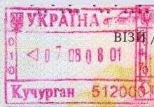
Kuchurhan exit stamp for passport
See also
- Roads in Ukraine
- State Highways (Ukraine)
- Transport in Moldova
- Kuchurgan power station
- Eugeniu Ştirbu
External links
- (Ukrainian) Kuchurhan
- Straßburg Village Information
- Kutschurgan Map
- Founders of the Village of Strassburg
| ||||||||||||||||||||||||||||
This article is issued from Wikipedia - version of the Friday, April 24, 2015. The text is available under the Creative Commons Attribution/Share Alike but additional terms may apply for the media files.