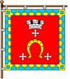
Kovel
| Kovel Ковель Kowel | |||
|---|---|---|---|
| City of regional significance | |||
|
Square in Kovel, 2002 | |||
| |||
 Kovel | |||
 Kovel | |||
| Coordinates: 51°13′0″N 24°43′0″E / 51.21667°N 24.71667°ECoordinates: 51°13′0″N 24°43′0″E / 51.21667°N 24.71667°E | |||
| Country |
| ||
| Oblast |
| ||
| Raion | Kovel City Municipality | ||
| Founded | 13th century | ||
| Magdeburg law | 1518 | ||
| Government | |||
| • Mayor | Oleh Kinder[1] | ||
| Area | |||
| • Total | 47.3 km2 (18.3 sq mi) | ||
| Population (2013) | |||
| • Total | 68,912 | ||
| • Density | 1,400/km2 (4,000/sq mi) | ||
| Time zone | EET (UTC+2) | ||
| • Summer (DST) | EEST (UTC+3) | ||
| Postal code | 45000 | ||
| Area code(s) | +380 3352 | ||
| Website | Municipal official site in Ukrainian | ||
Kovel (Ukrainian: Ковель; Russian: Ковель, translit. Kovel’, Polish: Kowel, Yiddish: קאָוועל) is a town in Volyn Oblast (province), in northwestern Ukraine. Serving as the administrative center of Kovel Raion (district), the town itself is designated as a town of oblast significance and is not part of the raion. Population: 68,912 (2013 est.)[2].
Kovel gives its name to one of the oldest Runic inscriptions which were lost during World War II. The Kovel spearhead, unearthed near the town in 1858, contained text in Gothic language (illustration).
History
Kovel (Kowel) was first mentioned in 1310.[3] It received city rights from the Polish King Sigismund I the Old in 1518.[3] In 1547 the owner of Kowel became Bona Sforza, Polish queen.[3] In 1564 starost of Kowel became Kurbski (d. 1584).[3] From 1566 to 1795 it was part of the Volhynian Voivodeship. Kowel was a royal city of Poland.

After the Partitions of Poland the town fell into the Russian Empire for over a hundred years. During the First World War, the city was a site of the Battle of Kovel between the Central Powers and the Russian Empire. In the interwar period, Kovel served as the capital of Kovel County in Volhynian Voivodeship of the Polish Republic. It was an important garrison of the Polish Army, here the headquarters of the 27th Volhynian Infantry Division was located. Furthermore, at the village of Czerkasy, a large depot of the Polish Army was located. In 1924, construction of the St. Stanislaus Bishop and Martyr Roman Catholic church began.
In World War II, following the Nazi German invasion of Poland and subsequently, their Operation Barbarossa the Germans murdered 18,000 Jews in Kovel, mostly during August and September 1942. Later on, in March and April 1944, Kovel was a site of fierce fighting between the 5th SS Panzer Division Wiking and the Red Army.
During the Volhynian Genocide, the town was a shelter for ethnic Poles, escaping the genocide. In that period, Ukrainian nationalists murdered app. 3,700 Polish inhabitants of Kovel county. In early spring of 1944, the 27th Infantry Division of the Home Army operated in the area. Kovel was captured by the Red Army in July 1944. In 1945, at the insistence of Joseph Stalin (following the Tehran Conference of 1943) Poland's borders were redrawn, the Polish population was forcibly resettled and Kovel was incorporated into the Ukrainian Soviet Socialist Republic. It has been a part of sovereign Ukraine since 1991.
Transportation
Kovel is the north-western hub of the Ukrainian rail system, with six rail lines radiating outward from the city. The first of these was built in 1873, connecting the city with Brest-Litovsk and Rivne. In 1877 Kovel was first linked by rail with Lublin and Warsaw in Congress Poland.
Gallery
-

Resurrection Church in Kovel
-
.jpg)
St.Michael Church in Kovel
-

St. Anne church in Kovel
-
Holy Trinity Orthodox Cathedral in Kovel
-
Saint Pantaleon Orthodox church in Kovel
-
Former synagogue in Kovel
-

Historical building in Volynska Street
-
.jpg)
Historical building in Independence Street
-
.jpg)
Historical building in Independence Street
-
.jpg)
Lesia Ukrainka monument
-

Downtown Kovel
-
School of Arts
-
.jpg)
Water Tower in Kovel
-
.jpg)
Railway Station in Kovel
-
College of Industry and Economy
-
.jpg)
WW2 memorial in Independence Street
-
.jpg)
WW2 memorial in Independence Street
-
.jpg)
WW2 memorial at public cemetery
-
_Radyns'kyh_Voyiniv_02_(YDS_6549).jpg)
Brothery Graves of WW2 warrirors at public cemetery
-
.jpg)
Memorial to railway workers-WW2 warriors
Notable people
- Lesya Ukrainka (1871–1913), Ukrainian poet
- Abraham Zapruder (1905–1970), clothing manufacturer who filmed the Assassination of John F. Kennedy
- Meir Auerbach (1815–1877), first Ashkenazi Chief Rabbi of Jerusalem.
- Israel Friedlander, rabbi, educator and biblical scholar
- Kazimierz Dejmek, Polish actor, theatre and film director
- Michal Waszynski, Polish (later American) film producer
- Ryszard Horodecki, Polish physicist, professor of University of Gdańsk
Sister cities
Kovel is twinned with
References
- ↑ "Municipal official site in Ukrainian".
- ↑ "Чисельність наявного населення України (Actual population of Ukraine)" (in Ukrainian). State Statistics Service of Ukraine. Retrieved 21 January 2015.
- 1 2 3 4 Rąkowski, Grzegorz (2005). Wołyń. Pruszków: Oficyna Wydawnicza "Rewasz". p. 85. ISBN 83-89188-32-5.
- ↑ Photograph from the Boris Feldblyum Collection
External links
| Wikimedia Commons has media related to Kovel. |
- Short history of Kowel (English)
- Carrier "Kowel" leased by Poland during World War II
- Tineke Looijenga, Texts & contexts of the oldest Runic inscriptions Published by BRILL. Page 127
- A Testament of a Jewish Woman from Kowel, Poland Source: Safira Rapoport (Ed.), Yesterdays and then Tomorrows, Yad Vashem 2002, p. 183 (in the Hebrew edition).
- David Pentland, "Fight for Kowel, Poland, March/April 1944", Gerhard Fischer Knights Cross signature series
- Historic images of Kovel
- Soviet topographic map 1:100 000
- Photos of Kovel at "Ukraine Photos"
- http://www.shtetlinks.jewishgen.org/kovel/kovel.htm
- http://www.israeli-kovel-org.org/english.html
| ||||||||||||||||||||||||||||
|


