Kielder Water
| Kielder Reservoir | |
|---|---|
|
Kielder Dam in 2007 | |
| Location | Northumberland |
| Coordinates | 55°11′N 2°30′W / 55.183°N 2.500°WCoordinates: 55°11′N 2°30′W / 55.183°N 2.500°W |
| Lake type | reservoir |
| Primary inflows | River North Tyne, Kielder Burn, Lewis Burn |
| Primary outflows | River North Tyne |
| Basin countries | England |
| Managing agency | Northumbrian Water |
| Built | 1975–1981 |
| First flooded | 1982 |
| Max. length | 5.65 miles (9.09 km) |
| Max. width | 2 miles (3.2 km) |
| Surface area | 10.86 square kilometres (2,680 acres) |
| Water volume | 200 billion litres (44 billion imperial gallons) |
| Shore length1 | 27.5-mile (44.3 km) |
| Surface elevation | 184 m (604 ft) |
| Islands | 1 |
| Sections/sub-basins | Bakethin Reservoir |
| 1 Shore length is not a well-defined measure. | |
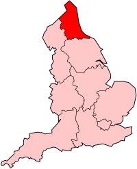
Kielder Water is a large artificial reservoir in Northumberland in North East England. It is the largest artificial lake in the United Kingdom by capacity and it is surrounded by Kielder Forest, the largest man-made woodland in Europe. The scheme was planned in the late 1960s to satisfy an expected rise in demand for water to support a booming UK industrial economy. But the decline of traditional heavy industry, together with more water-efficient industrial processes and better control of water supply leakage, served to undermine the original justification for the reservoir and many came to criticise the government-funded project as a white elephant.[1]
Kielder Water is owned by Northumbrian Water, and holds 200 billion litres (44 billion gallons, or 0.2 cubic km), making it the largest reservoir in the UK by capacity (Rutland Water is the largest by surface area). It has a 27.5-mile (44.3 km) shoreline, and is 39.7 km (24.6 miles) from the sea.[2]
Construction
After the scheme was approved by Parliament in 1974, work to build the reservoir and the dam in the Kielder Valley began in 1975. The reservoir and dam was designed for Northumbrian Water by consulting engineers Babtie, Shaw and Morton.[3][4][5] with Sir Frederick Gibberd and Partners as consulting architect.[6] Earth moving and infrastructure construction was undertaken in a joint venture with AMEC and Balfour Beatty.[7]
The design meant the loss of numerous farms and a school. The former permanent way of the Border Counties Railway was also taken away through the development of the reservoir.
Work was completed in 1981. Elizabeth II officially opened the project the following year. The valley took a further two years to fill with water completely.
Hydro electric plant
Kielder Water is also the site of England's largest hydro electric plant. It was opened by Queen Elizabeth II on 26 May 1982 and is owned by Northumbrian Water. In December 2005, RWE Npower Renewables bought the rights to operate the plant and sell the electricity generated by it, with a contract lasting until 2025. Following the takeover, the turbines were refurbished in 2005–2006, which increased the efficiency of the electricity generation. Controls were also updated, meaning that the plant can be operated from Dolgarrog in Wales.
The plant generates electricity using dual turbines which produce 6 megawatts (MW) of electricity. This comes from a combination of a 5.5 MW Kaplan turbine, which generates electricity when water release takes place, and a 500 kilowatt (kW) Francis turbine that generates constantly from the compensation flow of water from the reservoir into the North Tyne. This gives the reservoir an average production of 20,000 MWh of electricity per year, a saving of 8,600 tonnes of carbon dioxide per year compared to fossil fuel based methods of generation.[8]
Operations
The reservoir's main use is to provide compensating discharges into the North Tyne to support abstractions of water further downstream. It also underpins the £167m Kielder Transfer Scheme, where water can be transferred to the Wear and the Tees rivers, to meet shortfalls in those areas. In recent years, Kielder Water has become increasingly important, with underground springs ensuring that it always remains at high levels, regardless of the prevailing climate condition. This means that while the south of England is often forced to implement drought strategies and hosepipe bans, north east England enjoys plentiful water supplies.
There are two main visitor centres at Kielder Water—Leaplish waterside park and Tower Knowe visitor centre—and other facilities at Kielder, Falstone and Stannersburn villages. It is also one of the region's major tourist venues, attracting more than 250,000 visitors a year who come to enjoy the wide range of leisure opportunities on offer
Notes
Citations
- ↑ "Parliamentary Business". Hansard. 30 July 2009.
- ↑ http://www.britishlakes.info/27698-kielder-water-northumberland
- ↑ Coats, D.J. and Ruffle, N.J. (1982) "The Kielder Water Scheme" Proc. Instn. Civ. Engrs, Part 1, Vol 72, May, 135-147.
- ↑ Coats, D.J. and Rocke, G. (1982) "The Kielder Headworks" Proc. Instn. Civ. Engrs, Part 1, Vol 72, May, 149-176.
- ↑ Coats, D.J., Berry, N.S.M.B. and Banks, D.J. (1982) "The Kielder Transfer Works" Proc. Instn. Civ. Engrs, Part 1, Vol 72, May, 177-208.
- ↑ "NORTH TYNE – KIELDER RESERVOIR". Retrieved 26 February 2013.
- ↑ "Structure Images of the North East". University of Newcastle upon Tyne.
- ↑ "Water power on a large scale" (PDF). Tynedale Renewable Energy Trail. p. 1. Archived (PDF) from the original on 7 November 2015. Retrieved 7 November 2015.
References
- McCulloch, C.S. "The Kielder Water Scheme: the last of its kind?" (PDF). University of Oxford.
External links
| Wikimedia Commons has media related to Kielder Water. |
