Kidder Mountain
| Kidder Mountain | |
|---|---|
|
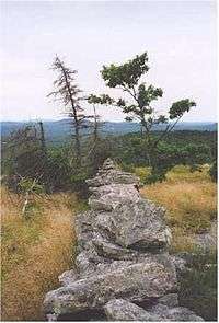
View from Kidder Mountain | |
| Highest point | |
| Elevation | 1,805 ft (550 m) [1] |
| Coordinates | 42°47′03″N 71°52′56″W / 42.7842524°N 71.8822994°WCoordinates: 42°47′03″N 71°52′56″W / 42.7842524°N 71.8822994°W [2] |
| Geography | |
| Location | New Ipswich and Temple, New Hampshire |
| Parent range | Wapack Range |
| Geology | |
| Age of rock | 400 million years |
| Mountain type | metamorphic rock |
| Climbing | |
| Easiest route | Wapack Trail + Kidder Mountain Trail |
Kidder Mountain is a 1,805 feet (550 m) summit located in south-central New Hampshire within the Wapack Range of mountains. It lies within New Ipswich and Temple, New Hampshire just off the 22 mi (35 km) Wapack Trail on a 0.9-mile (1.4 km) side trail. Temple Mountain is located directly to the north along the Wapack ridgeline; Barrett Mountain to the south. The summit of the mountain is mostly open and offers expansive views from old pastures.
The east side of the mountain drains into the Souhegan River watershed, thence into the Merrimack River and Atlantic Ocean; the west side drains into the Gridley River, thence the Contoocook River into the Merrimack River.
References
- ↑ "Kidder Mountain". ListsOfJohn.com. Retrieved 2013-02-02.
- ↑ "Kidder Mountain". Geographic Names Information System. United States Geological Survey. Retrieved 2013-02-02.
- Southern New Hampshire Trail Guide (1999). Boston: The Appalachian Mountain Club.
External links
This article is issued from Wikipedia - version of the Friday, December 18, 2015. The text is available under the Creative Commons Attribution/Share Alike but additional terms may apply for the media files.
