Kentstown
| Kentstown Baile an Cheantaigh | |
|---|---|
| Town | |
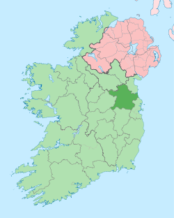
 Kentstown Location in Ireland | |
| Coordinates: 53°37′39″N 6°31′59″W / 53.62750°N 6.53306°WCoordinates: 53°37′39″N 6°31′59″W / 53.62750°N 6.53306°W | |
| Country | Ireland |
| Province | Leinster |
| County | County Meath |
| Elevation | 55 m (180 ft) |
| Population (2011)[1] | |
| • Urban | 1,099 |
| Time zone | WET (UTC+0) |
| • Summer (DST) | IST (WEST) (UTC-1) |
| Irish Grid Reference | N970651 |
_-_geograph.org.uk_-_1817494.jpg)
Kentstown (Irish: Baile an Cheantaigh) is a village in County Meath in Ireland at the junction of the R153 and R150 regional roads. The ruins of the medieval church can be found in Danestown, Kentstown,[2] while in the present St. Mary's Parish Church (Church of Ireland) an effigy in the shape of a medieval Norman knight is carved on a slab. The knight wears a tight-fitting jupon and has a dagger on his right hip. An inscription, in Latin, accompanies it: "Here lies Thomas de Tuite, Knight, once Lord of Kentstown, who died on 2nd June 1363".[3]
Demographics
In 2006 the village had a population of 912, a rise from the 355 it had in 2002.
Transport
Bus Éireann route 107 (Navan-Ashbourne-Finglas-Dublin-UCD) provides a limited service to/from the village Mondays to Saturdays inclusive. [4]
Nanny river
The Nanny rises outside of Kentown, and flows about 18 miles to the Irish sea at Laytown.[5]
Notes
- ↑ http://cso.ie/en/media/csoie/census/documents/census2011vol1andprofile1/Table%205.pdf
- ↑ http://www.meath.ie/LocalAuthorities/Heritage/ArchitecturalHeritage/ProtectedStructures/File,6838,en.pdf
- ↑ http://www.octavehouse.com/historic_meath.htm
- ↑ http://www.buseireann.ie/pdf/1318429076-107.pdf
- ↑ Peter O'Reilly. Rivers of Ireland: A Flyfisher's Guide. Stackpole Books, Apr 1, 2003, p. 226.
