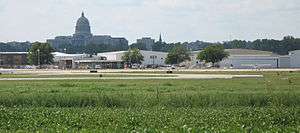
Jefferson City Memorial Airport
| Jefferson City Memorial Airport | |||||||||||||||
|---|---|---|---|---|---|---|---|---|---|---|---|---|---|---|---|
 | |||||||||||||||
| IATA: JEF – ICAO: KJEF – FAA LID: JEF | |||||||||||||||
| Summary | |||||||||||||||
| Airport type | Public | ||||||||||||||
| Owner | City of Jefferson City | ||||||||||||||
| Location | Jefferson City, Missouri | ||||||||||||||
| Elevation AMSL | 549 ft / 167 m | ||||||||||||||
| Coordinates | 38°35′28″N 092°09′22″W / 38.59111°N 92.15611°W | ||||||||||||||
| Website | http://www.jeffcitymo.org/publicworks/airport/airport.html | ||||||||||||||
| Runways | |||||||||||||||
| |||||||||||||||
| Statistics (2004) | |||||||||||||||
| |||||||||||||||

Jefferson City Memorial Airport (IATA: JEF, ICAO: KJEF, FAA LID: JEF) is a public airport located two miles (3 km) northeast of the central business district of Jefferson City, in Callaway County, Missouri, United States. It is owned by the City of Jefferson City.[1]
Facilities and aircraft
Jefferson City Memorial Airport covers an area of 469 acres (190 ha) which contains two paved runways: 12/30 measuring 6,001 x 100 ft (1,829 x 30 m) and 9/27 measuring 3,401 x 75 ft (1,037 x 23 m).[1]
For the 12-month period ending June 30, 2004, the airport had 34,402 aircraft operations, an average of 94 per day: 83% general aviation, 15% military and 2% air taxi. There are 67 aircraft based at this airport: 48% single engine, 22% multi-engine, 7% jet aircraft, 9% helicopters and 13% military.[1]
Accidents
On October 14, 2004, Pinnacle Airlines Flight 3701 crashed short of Jefferson City Memorial Airport. Both persons on board the aircraft were killed.
References
External links
- Jefferson City Flying Service
- Resources for this airport:
- FAA airport information for JEF
- AirNav airport information for KJEF
- ASN accident history for JEF
- FlightAware airport information and live flight tracker
- NOAA/NWS latest weather observations
- SkyVector aeronautical chart, Terminal Procedures