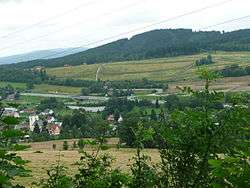
Jeřmanice
| Jeřmanice | |
|---|---|
| Municipality | |
 | |
 Jeřmanice | |
| Coordinates: 50°41′59″N 15°5′38″E / 50.69972°N 15.09389°ECoordinates: 50°41′59″N 15°5′38″E / 50.69972°N 15.09389°E | |
| Country |
|
| Region | Liberec |
| District | Liberec |
| Area | |
| • Total | 4.37 km2 (1.69 sq mi) |
| Elevation | 456 m (1,496 ft) |
| Population (2013) | |
| • Total | 481 |
| • Density | 110/km2 (290/sq mi) |
| Postal code | 463 12 |
Jeřmanice is a village and municipality (obec) in Liberec District in the Liberec Region of the Czech Republic. The municipality covers an area of 4.37 square kilometers (1.69 sq mi) and has a population of 481 (as of 2013).[1]
History
The first written mention of the village dates from 1543.[2]
Transport
The town lies on the railway line from Pardubice to Liberec. It is also on the R35 expressway.
References
- ↑ "JEŘMANICE" (PDF) (in Czech). Docs.liberec.cz. Retrieved 19 May 2015.
- ↑ "Jeřmanice" (in Czech). jizerky.cz. Retrieved 19 May 2015.
External links
![]() Media related to Jeřmanice at Wikimedia Commons
Media related to Jeřmanice at Wikimedia Commons
| ||||||
This article is issued from Wikipedia - version of the Wednesday, May 20, 2015. The text is available under the Creative Commons Attribution/Share Alike but additional terms may apply for the media files.