Independence, Mississippi
| Independence, Mississippi | |
|---|---|
| Unincorporated community | |
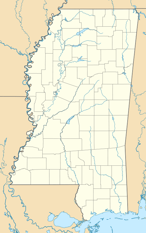
 Independence, Mississippi Location within the state of Mississippi | |
| Coordinates: 34°42′18″N 89°48′32″W / 34.70500°N 89.80889°WCoordinates: 34°42′18″N 89°48′32″W / 34.70500°N 89.80889°W | |
| Country | United States |
| State | Mississippi |
| County | Tate |
| Elevation | 335 ft (102 m) |
| Time zone | Central (CST) (UTC-6) |
| • Summer (DST) | CDT (UTC-5) |
| ZIP code | 38638 |
| Area code(s) | 662 |
| GNIS feature ID | 671662[1] |
Independence is an unincorporated community in Tate County, Mississippi, United States.
The settlement is approximately 7 miles (11 km) south of Cockrum and 11 miles (18 km) east of Coldwater along Mississippi Highway 305.
Although an unincorporated community, Independence has a zip code of 38638.
History
The settlement was first known as "Flewellenes Crossroads" and "Buck Snort".[1][2]
During the Civil War, R.W. Locke organized a company of soldiers in Buck Snort, which was dispatched to Virginia where they became Company D of the 42d Mississippi Infantry Regiment. Locke was elected company captain.[3]
The population in 1900 was 100.[4]
By 1907, Independence had a post office, several stores, two churches, and a school.[4]
Notable people
- Hugh Freeze, head coach of the Ole Miss Rebels football team at the University of Mississippi.[5]
- Michael Conner Humphreys, actor who played Young Forrest Gump in Forrest Gump
References
- 1 2 "Independence". Geographic Names Information System. United States Geological Survey.
- ↑ Biographical and Historical Memoirs of Mississippi 1. Goodspeed Publishing Company. 1891. p. 638.
- ↑ "Tate County and the Civil War". MSGenWeb. Retrieved July 2015.
- 1 2 Rowland, Dunbar (1907). Mississippi: Comprising Sketches of Counties, Towns, Events, Institutions, and Persons, Arranged in Cyclopedic Form 1. Southern Historical Publishing Association. p. 921.
- ↑ "Hugh Freeze". Olemisssports. Retrieved July 2015.
| |||||||||||||||||||||


