Huerfano County, Colorado
| Huerfano County, Colorado | |
|---|---|
|
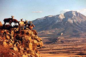
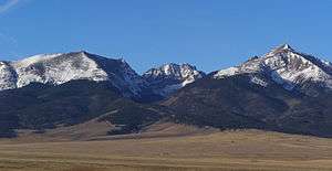
Huerfano County Courthouse and Jail | |
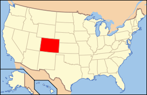
 Location in the state of Colorado | |
 Colorado's location in the U.S. | |
| Founded | November 1, 1861 |
| Named for | Huerfano Butte |
| Seat | Walsenburg |
| Largest city | Walsenburg |
| Area | |
| • Total | 1,593 sq mi (4,126 km2) |
| • Land | 1,591 sq mi (4,121 km2) |
| • Water | 2.2 sq mi (6 km2), 0.1% |
| Population (est.) | |
| • (2014) | 6,462 |
| • Density | 4.2/sq mi (2/km²) |
| Congressional district | 3rd |
| Time zone | Mountain: UTC-7/-6 |
| Website |
www |

Huerfano County (/ˈwɛərfənoʊ/; Spanish pronunciation: ['we̞ɾfäno̞]) is one of the 64 counties in the U.S. state of Colorado. As of the 2010 census, the population was 6,711.[1] The county seat is Walsenburg.[2] The county, whose name comes from the Spanish huérfano meaning "orphan", was named for the Huerfano Butte, a local landmark.
History
Huerfano County was one of the original 17 counties created by the Territory of Colorado on November 1, 1861, and was originally larger than its present size. On November 2, 1870, the Colorado General Assembly created Greenwood County from former Cheyenne and Arapaho tribal land and the eastern portion of Huerfano County.
Geography
According to the U.S. Census Bureau, the county has a total area of 1,593 square miles (4,130 km2), of which 1,591 square miles (4,120 km2) is land and 2.2 square miles (5.7 km2) (0.1%) is water.[3]
Local attractions and recreation
The Huerfano River Wind Farm, Colorado's largest producer of distributed generation (DG) power, is located ten miles north of Walsenburg, just off of Interstate 25. The farm uses Sany-made turbines and feeds into the San Isabel Electric Association grid. It is owned by Tamra-Tacoma Capital Partners, a New York-based investment firm.
Adjacent counties
- Pueblo County - northeast
- Las Animas County - southeast
- Costilla County - southwest
- Alamosa County - west
- Custer County - northwest
- Saguache County - northwest
Protected areas
- Greenhorn Mountain Wilderness
- Lathrop State Park
- San Isabel National Forest
- Sangre de Cristo Wilderness
- Spanish Peaks Wilderness
Scenic byway
Demographics
| Historical population | |||
|---|---|---|---|
| Census | Pop. | %± | |
| 1870 | 2,250 | — | |
| 1880 | 4,124 | 83.3% | |
| 1890 | 6,882 | 66.9% | |
| 1900 | 8,395 | 22.0% | |
| 1910 | 13,320 | 58.7% | |
| 1920 | 16,879 | 26.7% | |
| 1930 | 17,062 | 1.1% | |
| 1940 | 16,088 | −5.7% | |
| 1950 | 10,549 | −34.4% | |
| 1960 | 7,867 | −25.4% | |
| 1970 | 6,590 | −16.2% | |
| 1980 | 6,440 | −2.3% | |
| 1990 | 6,009 | −6.7% | |
| 2000 | 7,862 | 30.8% | |
| 2010 | 6,711 | −14.6% | |
| Est. 2014 | 6,462 | [4] | −3.7% |
| U.S. Decennial Census[5] 1790-1960[6] 1900-1990[7] 1990-2000[8] 2010-2014[1] | |||
As of the census[9] of 2000, there were 7,862 people, 3,082 households, and 1,920 families residing in the county. The population density was 5 people per square mile (2/km²). There were 4,599 housing units at an average density of 3 per square mile (1/km²). The racial makeup of the county was 80.96% White, 2.75% Black or African American, 2.70% Native American, 0.39% Asian, 0.08% Pacific Islander, 9.41% from other races, and 3.71% from two or more races. 35.14% of the population were Hispanic or Latino of any race.
There were 3,082 households out of which 25.00% had children under the age of 18 living with them, 48.40% were married couples living together, 10.40% had a female householder with no husband present, and 37.70% were non-families. 32.80% of all households were made up of individuals and 14.10% had someone living alone who was 65 years of age or older. The average household size was 2.25 and the average family size was 2.85.
In the county the population was spread out with 20.90% under the age of 18, 7.30% from 18 to 24, 27.40% from 25 to 44, 27.40% from 45 to 64, and 17.00% who were 65 years of age or older. The median age was 42 years. For every 100 females there were 118.80 males. For every 100 females age 18 and over, there were 122.80 males.
The median income for a household in the county was $25,775, and the median income for a family was $32,664. Males had a median income of $24,209 versus $21,048 for females. The per capita income for the county was $15,242. About 14.10% of families and 18.00% of the population were below the poverty line, including 23.70% of those under age 18 and 11.90% of those age 65 or over.
Communities

See also
- Outline of Colorado
- Index of Colorado-related articles
- National Register of Historic Places listings in Huerfano County, Colorado
References
- 1 2 "State & County QuickFacts". United States Census Bureau. Retrieved February 10, 2014.
- ↑ "Find a County". National Association of Counties. Retrieved 2011-06-07.
- ↑ "US Gazetteer files: 2010, 2000, and 1990". United States Census Bureau. 2011-02-12. Retrieved 2011-04-23.
- ↑ "Annual Estimates of the Resident Population for Incorporated Places: April 1, 2010 to July 1, 2014". Retrieved June 4, 2015.
- ↑ "U.S. Decennial Census". United States Census Bureau. Retrieved June 8, 2014.
- ↑ "Historical Census Browser". University of Virginia Library. Retrieved June 8, 2014.
- ↑ "Population of Counties by Decennial Census: 1900 to 1990". United States Census Bureau. Retrieved June 8, 2014.
- ↑ "Census 2000 PHC-T-4. Ranking Tables for Counties: 1990 and 2000" (PDF). United States Census Bureau. Retrieved June 8, 2014.
- ↑ "American FactFinder". United States Census Bureau. Retrieved 2011-05-14.
External links
- Huerfano County Government website
- Colorado County Evolution by Don Stanwyck
- Colorado Historical Society
 |
Custer County and Saguache County | Pueblo County |  | |
| Alamosa County | |
|||
| ||||
| | ||||
| Costilla County | Las Animas County |
| |||||||||||||||||||||
Coordinates: 37°41′N 104°58′W / 37.69°N 104.96°W