Huequi
| Huequi | |
|---|---|
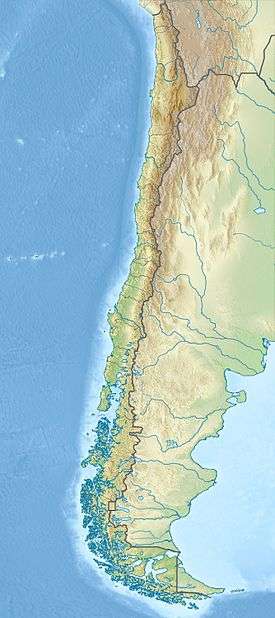
 Huequi Location of Huequi in southern Chile | |
| Highest point | |
| Elevation | 1,318 m (4,324 ft) |
| Coordinates | 42°22′36″S 72°34′41″W / 42.37667°S 72.57806°WCoordinates: 42°22′36″S 72°34′41″W / 42.37667°S 72.57806°W |
| Geography | |
| Location | Chile |
| Parent range | Andes |
| Geology | |
| Mountain type | Stratovolcano |
| Last eruption | 1920 (?) |
Huequi (Spanish pronunciation: [weki]) is a stratovolcano located in Los Lagos Region of Chile. It lies at the centre of the peninsula of the same name and close to the Gulf of Ancud. It has an elevation of 1,318 metres (4,324 ft). It has a sharp summit and reportedly "smoked" in the 1950s [1] and is made up from a lava dome complex situated in a depression of unclear origin, a postglacial lava dome Calle and a Pleistocene Porcelana volcano with Holocene parasitic cones.[2][3]
See also
References
- ↑ United States. Hydrographic Office (1952). Sailing Directions for South America: The west coast from Golfo Corcovado to the Gulf of Panama including off-lying islands. U.S. Government Printing Office. p. 69.
- ↑ J. Rabassa (22 September 2011). The Late Cenozoic of Patagonia and Tierra del Fuego. Elsevier. p. 101. ISBN 978-0-08-055889-9.
- ↑ Sebastian F.L. Watt, David M. Pyle, Tamsin A. Mather (July 2011). "Geology, petrology and geochemistry of the dome complex of Huequi volcano, southern Chile". Andean Geology 38 (2): 335–348 – via SciELO.
| ||||||||||||||||||||||
This article is issued from Wikipedia - version of the Tuesday, July 21, 2015. The text is available under the Creative Commons Attribution/Share Alike but additional terms may apply for the media files.