Henty Highway
| Henty Highway Victoria | |
|---|---|
 | |
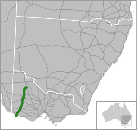
| Map of south-eastern Australia with Henty Highway highlighted in green | |
| General information | |
| Type | Highway |
| Length | 360 km (224 mi) |
| Route number(s) | |
| Former route number |
|
| Major junctions | |
| North end |
|
| |
| South end |
|
| Location(s) | |
| Major settlements | Hopetoun, Warracknabeal, Horsham, Hamilton, Heywood |
| Highway system | |
|
Highways in Australia National Highway • Freeways in Australia Highways in Victoria | |
Henty Highway[2] is a 360 kilometre highway in western Victoria, Australia. It's primarily a north-south route, and consists of a mix of 2 laned country highway standard and 4 lane arterial road within some of the larger towns along the route.
Henty Highway shares other roads along its route (this is called multiplexing), and these include:
- A1 (Princes Highway) from Heywood to Portland North for 27 km
- A8 (Western Highway) at Horsham for 3 km
- B160 (Glenelg Highway) at Hamilton for 3 km
- B240 (Wimmera Highway) from Horsham to Dooen for 10 km
- C188 (Natimuk-Hamilton Road and Penshurst-Dunkeld Road) at Cavendish for 500 m
- C234 (Borung Highway) at Warracknabeal for 1 km
Major intersections and towns
| Henty Highway | |||
| Northbound | Distance to Mildura (km) |
Distance to Portland (km) |
Southbound |
| End Henty Highway continues as Sunraysia Highway to Ouyen and Mildura |
169 | 354 | Start Henty Highway from Sunraysia Highway |
| Birchip Sunraysia Highway | |||
| Sea Lake, Swan Hill Hopetoun-Sea Lake Road |
186 | 337 | Sea Lake Hopetoun-Sea Lake Road |
| Patchewollock, Walpeup Hopetoun-Wallpeup Road |
190 | 333 | Patchewollock, Walpeup Hopetoun-Wallpeup Road |
| Rainbow Hopetoun-Rainbow Road |
193 | 330 | Hopetoun |
| Hopetoun | Rainbow Hopetoun-Rainbow Road | ||
| Rainbow, Birchip Birchip-Rainbow Road |
218 | 305 | Birchip, Rainbow Birchip-Rainbow Road |
| continues as |
254 | 269 | Rainbow Warracknabeal-Rainbow Road Donald, Charlton Borung Highway |
| Donald, Charlton Borung Highway Rainbow Warracknabeal-Rainbow Road |
| ||
| |
255 | 268 | Warracknabeal |
| Dimboola, Adelaide Borung Highway |
Dimboola, Adelaide Borung Highway | ||
| Stawell Stawell-Warracknabeal Road |
Stawell, Melbourne Stawell-Warracknabeal Road | ||
| Warracknabeal | continues as | ||
| Minyip, Donald Horsham-Minyip Road |
284 | 239 | Minyip, Donald Horsham-Minyip Road |
| continues as |
301 | 222 | Murtoa, St Arnaud Wimmera Highway |
| Murtoa, St Arnaud, Bendigo Wimmera Highway |
| ||
| Start continues with |
311 | 212 | Horsham |
| Dimboola, Adelaide Western Highway |
End | ||
| End |
Dimboola, Adelaide Western Highway | ||
| Horsham | Start continues with | ||
| |
312 | 211 | Edenhope, Naracoorte Wimmera Highway |
| Edenhope, Naracoorte Wimmera Highway |
continues as | ||
| Horsham-Drung South Road |
313 | 210 | Horsham-Drung South Road |
| |
314 | 209 | Ararat, Ballarat, Melbourne Western Highway |
| Ararat, Ballarat, Melbourne Western Highway |
continues as | ||
| continues as |
415 | 108 | Balmoral Natimuk-Hamilton Road |
| Balmoral Natimuk-Hamilton Road |
| ||
| |
415.5 | 107.5 | Cavendish |
| Dunkeld Dunkeld-Cavendish Road |
Dunkeld Dunkeld-Cavendish Road | ||
| Cavendish | continues as | ||
| continues as |
438 | 85 | Casterton, Mount Gambier Glenelg Highway |
| Casterton, Mount Gambier Glenelg Highway |
| ||
| |
440.5 | 82.5 | Hamilton |
| Town Centre, Ballarat Glenelg Highway | |||
| Town Centre, Ballarat Glenelg Highway |
continues as | ||
| continues as |
441.4 | 81.6 | Dartmoor Dartmoor-Hamilton Road |
| Dartmoor Dartmoor-Hamilton Road |
| ||
| |
441.5 | 81.5 | Town Centre Dartmoor-Hamilton Road |
| Town Centre To Dartmoor-Hamilton Road |
continues as | ||
| Hamilton | |||
| Port Fairy Hamilton-Port Fairy Road |
442.5 | 80.5 | Port Fairy Hamilton-Port Fairy Road |
| Macarthur Myamin-Macarthur Road |
483 | 40 | Macarthur Myamin-Macarthur Road |
| continues as |
499 | 24 | Mount Gambier, Adelaide Princes Highway |
| Mount Gambier, Adelaide Princes Highway |
| ||
| Woolsthorpe, Warrnambool via Town Bypass Woolsthorpe-Heywood Road |
499.5 | 23.5 | Woolsthorpe, Warrnambool via Town Bypass Woolsthorpe-Heywood Road |
| Heywood | 500 | 23 | Heywood |
| |
520 | 3 | To Warrmambool, Geelong, Melbourne Princes Highway |
| To Warrmambool, Geelong, Melbourne Princes Highway |
continues as | ||
| Town Centre New Street |
523 | 0 | Portland |
| Town Centre New Street | |||
| Nelson Portland-Nelson Road |
524.3 | -- | Nelson Portland-Nelson Road |
| Cape Bridgewater Bridgewater Road via Link Road |
525.5 | -- | Cape Bridgewater Bridgewater Road via Link Road |
| Madeira Packet Road |
526.5 | -- | Madeira Packet Road |
| Start Henty Highway from Madeira Packet Road |
529 | -- | End Henty Highway continues as Madeira Packet Road |
See also
References
- ↑ State Route Numbering System - The former route numbering in rural Victoria, Main Roads Victoria. Retrieved on 14 September 2013.
- ↑ Henty Highway (A/B200), Expressway - Paul Rands. Retrieved on 14 September 2013.
This article is issued from Wikipedia - version of the Friday, September 18, 2015. The text is available under the Creative Commons Attribution/Share Alike but additional terms may apply for the media files.