Haukipudas
| Haukipudas | ||
|---|---|---|
| Municipality | ||
| Haukiputaan kunta | ||
|
The church and the belfry of Haukipudas | ||
| ||
 Location of Haukipudas in Finland | ||
| Coordinates: 65°11′N 025°21′E / 65.183°N 25.350°ECoordinates: 65°11′N 025°21′E / 65.183°N 25.350°E | ||
| Country | Finland | |
| Region | Northern Ostrobothnia | |
| Sub-region | Oulu sub-region | |
| Charter | 1866 | |
| Government | ||
| • Municipality manager | Jarmo Ronkainen | |
| Area[1] | ||
| • Total | 1,023.62 km2 (395.22 sq mi) | |
| • Land | 798.67 km2 (308.37 sq mi) | |
| • Water | 224.95 km2 (86.85 sq mi) | |
| Population (2012)[2] | ||
| • Total | 19,053 | |
| • Density | 23.86/km2 (61.8/sq mi) | |
| Time zone | EET (UTC+2) | |
| • Summer (DST) | EEST (UTC+3) | |
| Website | www.haukipudas.fi | |
Haukipudas is a town and former municipality of Finland. It is located in the province of Oulu and part of the Northern Ostrobothnia region. Its shore runs along the Gulf of Bothnia, with the river Kiiminkijoki running through the province. Along with Kiiminki, Oulunsalo and Yli-Ii municipalities it was merged with the city of Oulu on 1 January 2013.
The municipality had a population of 19,053 (31 December 2012)[2] and covered an area of 1,023.62 km2 (395.22 sq mi) of which 224.95 km2 (86.85 sq mi) is water.[1] The population density is 23.8559/km2 (61.7865/sq mi).
The municipality was unilingually Finnish.[3]
There were 16 villages in Haukipudas: Kirkonkylä, Santaholma, Ukonkaivos, Martinniemi, Asemakylä, Onkamo, Halosenniemi, Holstinmäki, Häyrysenniemi, Jokikylä, Kalimeenkylä, Kello, Kiviniemi, Parkumäki, Takkuranta and Virpiniemi.
The educational department took part in Lifelong Learning Programme 2007–2013 in Finland.
Local sights
- The Haukipudas Church, built in 1762.
Haukipudas photo gallery
-

Municipal border sign
-

Haukipudas railway station
-

Kiiminki River railway bridge
-
Martinniemi sawmill
-
Haukipudas Church
-

Kiviniemi fishing village
-

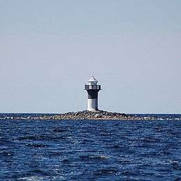
Island of Laitakari
-

Kalimeenoja creek
-
The wooden poorboy (vaivaisukko in Finnish) by the Belfry of Haukipudas Church.
-

Kurtinhauta fishing harbour
-

Finnish 'laavu'
References
- 1 2 "Area by municipality as of 1 January 2011" (PDF) (in Finnish and Swedish). Land Survey of Finland. Retrieved 9 March 2011.
- 1 2 "VÄESTÖTIETOJÄRJESTELMÄ REKISTERITILANNE 31.1.2012" (in Finnish and Swedish). Population Register Center of Finland. Retrieved 11 February 2014.
- ↑ "Population according to language and the number of foreigners and land area km2 by area as of 31 December 2008". Statistics Finland's PX-Web databases. Statistics Finland. Retrieved 29 March 2009.
External links
 Media related to Haukipudas at Wikimedia Commons
- Municipality of Haukipudas – Official website
| |||||||||||||||||


