Hasselroth
| Hasselroth | ||
|---|---|---|
| ||
 Hasselroth | ||
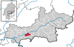
Location of Hasselroth within Main-Kinzig-Kreis district 
 | ||
| Coordinates: 50°10′N 09°06′E / 50.167°N 9.100°ECoordinates: 50°10′N 09°06′E / 50.167°N 9.100°E | ||
| Country | Germany | |
| State | Hesse | |
| Admin. region | Darmstadt | |
| District | Main-Kinzig-Kreis | |
| Government | ||
| • Mayor | Uwe Scharf (Ind.) | |
| Area | ||
| • Total | 18.92 km2 (7.31 sq mi) | |
| Population (2013-12-31)[1] | ||
| • Total | 7,259 | |
| • Density | 380/km2 (990/sq mi) | |
| Time zone | CET/CEST (UTC+1/+2) | |
| Postal codes | 63594 | |
| Dialling codes | 06055 | |
| Vehicle registration | MKK | |
| Website | www.hasselroth.de | |
Hasselroth is a municipality in the Main-Kinzig district, in Hesse, Germany.
Geography
Neighbouring places
The municipality of Gründau and the city of Gelnhausen is located in the north of Hasselroth. The municipality of Linsengericht is located in the east and the municipality of Freigericht is located in the south of Haselroth. The municipality of Rodenbach in southwest and the city of Langenselbold is located in the west of Hasselroth.
Subdivision of the municipality
The municipality consistst of three geographically separated districts:
- Gondsroth
- Neuenhaßlau (municipal administration)
- Niedermittlau
History
The first documentary reference of Gondsroth und Niedermittlau dates from 1151
Merger
As on 1. October 1971 the villages Neuenhaßlau and Gondsroth merged to form the new municipality of Hasselroth. On 1. July 1974 the former Niedermittlau municipality joined with the municipality of Hasselroth.[2]
Traffic
- The municipality of Haseltroth is located close to the A66 motorway which connects Fulda with Frankfurt.
- A train stop in the district of Niedermittlau provides access to the Kinzig Valley Railway the regional rail transport between Fulda and Frankfurt.
References
- ↑ "Die Bevölkerung der hessischen Gemeinden". Hessisches Statistisches Landesamt (in German). September 2014.
- ↑ Statistisches Bundesamt, ed. (1983) (in German), Historisches Gemeindeverzeichnis für die Bundesrepublik Deutschland. Namens-, Grenz- und Schlüsselnummernänderungen bei Gemeinden, Kreisen und Regierungsbezirken vom 27. 5. 1970 bis 31. 12. 1982, Stuttgart und Mainz: W. Kohlhammer GmbH, pp. 362 und 363, ISBN 3-17-003263-1
|
