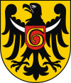
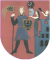
Głogów
| Głogów | |||
|---|---|---|---|
|
Sights of Głogów | |||
| |||
 Głogów | |||
| Coordinates: 51°39′32″N 16°4′49″E / 51.65889°N 16.08028°E | |||
| Country | Poland | ||
| Voivodeship | Lower Silesian | ||
| County | Głogów County | ||
| Gmina | Głogów (urban gmina) | ||
| Established | 10th century | ||
| City rights | 1253 | ||
| Government | |||
| • Mayor | Rafael Rokaszewicz | ||
| Area | |||
| • City | 35.37 km2 (13.66 sq mi) | ||
| Population (2007) | |||
| • City | 71,312 | ||
| • Density | 2,000/km2 (5,200/sq mi) | ||
| • Metro | 413,397 | ||
| Time zone | CET (UTC+1) | ||
| • Summer (DST) | CEST (UTC+2) | ||
| Postal code | 67-200 to 67-211 | ||
| Area code(s) | +48 76 | ||
| Car plates | DGL | ||
| Website | http://www.glogow.pl | ||
Głogów [ˈɡwɔɡuf] (German: Glogau, rarely Groß-Glogau, Czech: Hlohov) is a town in southwestern Poland. It is the county seat of Głogów County, in Lower Silesian Voivodeship (since 1999), and was previously in Legnica Voivodeship (1975–1998). It is also the administrative seat of Gmina Głogów, although it is not part of its territory (the town forms a separate urban gmina). Głogów is the sixth largest town in the voivodeship; according to the 2004 census estimate the town had a total population of 71,686. The name of the town derives from głóg, the Polish name for hawthorn.
Głogów consists of the following residential districts: Brzostów, Chrobry, Hutnik, Kopernik (Copernicus), Kościuszki, Ostrów Tumski (Church Island), Paulinów, Piastów Śląskich, Sportowe, Przemysłowe, Słoneczne, Stare Miasto (Old Town), Śródmieście, Żarków. Two villages, Biechów and Wróblin Głogowski, are also within Głogów's administrative borders.
History
Głogów is one of the oldest towns in Poland. It was founded as a grad by a West Slavic tribe called the Dziadoszanie.

Piast rule
The first known historic record comes from 1010, in Thietmar of Merseburg's chronicles,[1] after the troops of King Henry II of Germany in the conflict over the March of Lusatia and the Milceni lands had attacked the forces of the Polish Duke Bolesław I Chrobry and again besieged Głogów on August 9, 1017 without result. The next year Henry and Bolesław concluded the Peace of Bautzen.
In 1109, King Henry V of Germany, entangled in the fratricidal war between the Piast dukes Bolesław III Wrymouth and Zbigniew besieged the town, but could not overcome the Polish forces in the Battle of Głogów. In 1157 the town finally fell to the forces of Emperor Frederick I Barbarossa, invading the Silesian lands in aid of Duke Władysław II the Exile and his sons.
In 1180, under the rule of Władysław's II youngest son Konrad Spindleshanks, Głogów was rebuilt and became the residence of his principality, which fell back to the Duchy of Silesia upon his death about 1190. In the course of the fragmentation under Duke Bolesław II the Bald and his younger brother, the Duchy of Głogów under Duke Konrad I was established in 1251. Two years later he vested the town with Magdeburg rights. Likewise the many Duchies of Silesia, Głogów also fell under the overlordship of King John of Bohemia in 1329.
In 1504 century, the Głogów line of the Silesian Piasts died out with the death of Jan II the Mad. Jan's cruel measures had provoked the resistance of the Głogów citizens, and in 1488 the troops of King Matthias Corvinus appeared at the city gates and expelled the duke. From 1491-1506 Głogów was ruled by John Albert and Sigmund the Old, future kings of Poland.
Austrian and Prussian rule
The town was inherited together with all Silesia, then part of the Crown of Bohemia, by the Austrian House of Habsburg in 1526 and was incorporated into the Habsburg Monarchy. During the Thirty Years' War, Głogów was turned into a stronghold in 1630. It was conquered by Protestants in 1632, reconquered by Imperial troops in 1633, fell to Sweden in 1642, and finally reverted to the Habsburgs in 1648.
Głogów remained part of the Habsburg-ruled Crown of Bohemia until the First Silesian War. In March 1741 it was captured in a brilliant night attack by the Prussian Army under General Prince Leopold II of Anhalt-Dessau, and like the majority of Silesia became part of Prussia under King Frederick II. The city became known by the Germanized name of Groß-Glogau ("Greater Glogau") to differentiate it from the town of Oberglogau ("Upper Glogau", present-day Głogówek) in Upper Silesia.
During the Napoleonic Wars, the Polish forces of General Jan Henryk Dąbrowski were stationed in Glogau, and the city was also visited three times by Napoleon Bonaparte. Glogau was captured by French forces after the Battle of Jena in 1806. The town, with a garrison of 9,000 French troops, was besieged in 1813-14 by the Sixth Coalition; by the time the defenders surrendered on 10 April 1814, only 1,800 defenders remained.
Because the stronghold status had slowed down the city's development for many years, the citizens tried to abolish the stronghold status in the 19th century; the fortifications were only moved to the east in 1873, and finally taken down in 1902, which allowed the city to develop. In 1939 Glogau had 33,000 mostly German inhabitants.

1945
The town was made into a stronghold by the Nazi government in 1945 during World War II. Glogau was besieged for six weeks by the Soviet Red Army and was 98% destroyed. After the Yalta Conference, the city, like the majority of Lower Silesia, was given to Poland and German-speaking inhabitants were expelled. In May 1945 the first Polish settlers came to the renamed city of Głogów to find only ruins; the town has not been fully rebuilt to this day. The town started to develop again only in 1967, after a copper foundry was built there. It is still the largest industrial company in the town.
From 1945-1950, Głogów was part of Wrocław Voivodeship and in 1950 became part of the newly created Zielona Góra Voivodeship. From 1975-1998 it belonged to Legnica Voivodeship, and after the administrative reform of 1999 it became part of Lower Silesian Voivodeship.
Landmarks


- Town Hall
- Castle of the Dukes of Głogów (currently the site of an archaeological museum)
- Late Baroque Corpus Christi Church
- 16th century Church of St. Lawrence
- Early Gothic Church of St. Nicholas (in ruins)
- Gothic collegiate church
- Andreas Gryphius Theatre (ruins)
- Fragments of medieval city walls
- 17th century moat
- 19th century artillery tower
- 221 metres tall chimney of former power station
Notable residents
- B
- Bolesław I the Tall (1127–1201), Duke of Silesia
- Bolesław II the Bald (1220/25-1278), Duke of Silesia
- C - G
- David Cassel (1818–1893), historian and theologian
- Paulus Stephanus Cassel (1821–1892), writer and missionary
- Johannes Dümichen (1833–1894), Egyptologist
- Johann Samuel Ersch (1766–1828), bibliographer
- Johannes Fabian (born 1937), anthropologist
- Recha Freier née Schweitzer (1892-1984), founder of the Youth Aliyah organization
- Georg Gustav Fülleborn (1769–1803), philosopher and philologist
- Andreas Gryphius (1616–1664), poet and dramatist
- H
- Hedwig of Andechs (1174–1243), wife of Duke Henry I
- Henryk I the Bearded (1163–1238), Duke of Lower Silesia
- J
- Jan of Głogów (1445–1507), philosopher, polyhistor, professor at Kraków University
- Joannes-Henricus Cardinal de Franckenberg (1726–1804), archbishop
- John I of Poland (1459–1501), Duke of Lower Silesia and King of Poland
- L - P
- Jan Lubomirski (?-1736), nobleman
- Eduard Munk (1803–1871), philologist
- Salomon Munk (1803–1867), orientalist
- Joachim Pastorius (1611–1681), historian
- R - Z
- Bernhard Rosa (1624–1696), abbot at Grüssau Abbey
- Hieronymus Schulz (1460–1522) Bishop of Brandenburg and Havelberg
- Felix Stern (1884–1941), neurologist, most important German investigator of the disorder "encephalitis lethargica"
- Ferdinand Thieriot (1838–1919), composer
- Paul Winckler (1630–1686), jurist
- Hermann Zopff (1826–1883), composer and music historian
- Arnold Zweig (1887–1968), writer
International relations
Twin towns — sister cities
Głogów is twinned with:
References
- ↑ VI, 38
External links
| Wikimedia Commons has media related to Głogów. |
| Wikisource has the text of the 1911 Encyclopædia Britannica article Glogau. |
- Municipal website (Polish)
- Głogów Tourist Guide
- Jewish Community in Głogów on Virtual Shtetl
Coordinates: 51°40′N 16°05′E / 51.667°N 16.083°E
| ||||||||||||
| ||||||||||||
|


