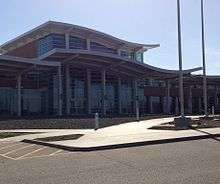
General Wayne A. Downing Peoria International Airport
| General Wayne A. Downing Peoria International Airport | |||||||||||||||
|---|---|---|---|---|---|---|---|---|---|---|---|---|---|---|---|
 | |||||||||||||||
 | |||||||||||||||
|
IATA: PIA – ICAO: KPIA – FAA LID: PIA – WMO: 72532 | |||||||||||||||
| Summary | |||||||||||||||
| Airport type | Public | ||||||||||||||
| Owner/Operator | Metropolitan Airport Authority of Peoria | ||||||||||||||
| Serves | Peoria, Illinois | ||||||||||||||
| Location | Limestone Township, Peoria County | ||||||||||||||
| Elevation AMSL | 661 ft / 201 m | ||||||||||||||
| Coordinates | 40°39′51″N 089°41′36″W / 40.66417°N 89.69333°WCoordinates: 40°39′51″N 089°41′36″W / 40.66417°N 89.69333°W | ||||||||||||||
| Website | www.FlyPIA.com | ||||||||||||||
| Maps | |||||||||||||||
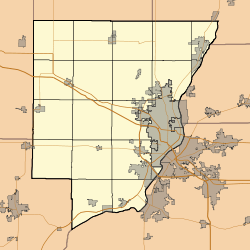
 Location of Peoria County in Illinois | |||||||||||||||
 PIA Location of airport in Peoria County | |||||||||||||||
| Runways | |||||||||||||||
| |||||||||||||||
| Statistics (2014, 2015) | |||||||||||||||
| |||||||||||||||
General Wayne A. Downing Peoria International Airport[3] (IATA: PIA[4], ICAO: KPIA, FAA LID: PIA) is a civil/military public airport five miles west of Peoria, in Peoria County, Illinois.[2] The airport is on the northwest edge of Bartonville, near Bellevue. It is owned by the Metropolitan Airport Authority of Peoria,[2] which often refers to it as Peoria International Airport.[5] It was formerly the Greater Peoria Regional Airport.[6][7]
This airport is in the National Plan of Integrated Airport Systems for 2011–2015, which called it a primary commercial service airport (more than 10,000 enplanements per year).[8] As per Federal Aviation Administration records, the airport had 278,426 passenger boardings (enplanements) in calendar year 2008,[9] 242,142 in 2009 and 249,595 in 2010.[10]
History
On May 19, 1932 the citizens of Peoria voted to have an airport. On 195 acres (0.8 km²), American Airways (now American Airlines) and Chicago and Southern Airlines brought in airmail and passenger service on 4 shale-surfaced runways. The land was purchased by 261 Peoria businessmen who formed the Peoria Airport, Inc.[11] It was turned over to the Peoria Park District in 1937, and then to newly formed The Metropolitan Airport Authority of Peoria in 1950.
Airport diagram for 1956
On April 25, 2007 the Greater Peoria Airport Authority announced a new 9 gate terminal will be built and the old terminal demolished. On October 10, 2008 the airport was renamed "General Wayne A. Downing Peoria International Airport" during a groundbreaking ceremony attended by Ross Perot, friend of the late Wayne A. Downing.[3] The new terminal, designed by Reynolds, Smith & Hills and built by Turner Construction, opened on April 27, 2011.[12] As of August 24, 2012 the airport was in negotiations for international flights using a temporary customs facility.[13]
Air National Guard / Army National Guard
The airport is co-located with the Peoria Air National Guard Base, which is home to the 182d Airlift Wing (182 AW) of the Illinois Air National Guard. This Air National Guard unit is operationally-gained by the Air Mobility Command (AMC) and consists of Lockheed C-130H Hercules aircraft. The airport is also home to the Illinois Army National Guard's Army Aviation Support Facility No. 3 and 1st Battalion, 106th Aviation Regiment, currently operating the Boeing CH-47 "Chinook" helicopter.
Facilities and aircraft

Peoria International Airport covers 3,800 acres (1,538 ha) at an elevation of 661 feet (201 m) above mean sea level. It has two runways: 13/31 is 10,104 by 150 feet (3,080 x 46 m) concrete; 4/22 is 8,004 by 150 feet (2,440 x 46 m) asphalt.[2]
In the year ending November 1, 2011 the airport had 39,961 aircraft operations, average 109 per day: 42% general aviation, 33% air taxi, 20% military, and 5% scheduled commercial. 68 aircraft were then based at this airport: 59% single-engine, 15% jet, 15% military, 7% helicopter, and 4% multi-engine.[2] As of December 2014, construction began on a $9 million International terminal and Customs Facility addition slated for completion during the Spring of 2016. This dual purpose facility is being constructed to handle both domestic and, eventual, international charter and commercial flights primarily to the Caribbean and Mexico.
Airlines and destinations
As of August 2014, Peoria International Airport has four passenger airlines. Allegiant Air is the only airline with larger jets; American Airlines, Delta Air Lines and United Airlines use smaller regional jets.
Passenger
| Airlines | Destinations |
|---|---|
| Allegiant Air | Fort Myers/Punta Gorda, Las Vegas, Orlando/Sanford, Phoenix/Mesa, St. Petersburg/Clearwater |
| American Eagle | Chicago-O'Hare, Dallas/Fort Worth |
| Delta Connection | Atlanta, Detroit, Minneapolis/St. Paul |
| United Express | Chicago-O'Hare, Houston-Intercontinental (ends April 4, 2016) |
Top destinations
| Carrier | Passengers (arriving and departing) |
|---|---|
| Allegiant | 176,000(28.03%) |
| ExpressJet | 130,000(20.68%) |
| Envoy | 113,000(17.98%) |
| Endeavor | 70,250(11.22%) |
| Trans States | 68,390(10.92%) |
| Rank | City | Passengers | Airlines |
|---|---|---|---|
| 1 | Chicago–O'Hare, Illinois | 92,000 | American Eagle, United Express |
| 2 | Atlanta, Georgia | 44,000 | Delta Connection |
| 3 | Dallas/Fort Worth, Texas | 38,000 | American Eagle |
| 4 | Las Vegas, Nevada | 25,000 | Allegiant |
| 5 | Detroit, Michigan | 24,000 | Delta Connection |
| 6 | St. Petersburg/Clearwater, Florida | 22,000 | Allegiant |
| 7 | Phoenix/Mesa, Arizona | 20,000 | Allegiant |
| 8 | Punta Gorda/Ft Myers, Florida | 19,000 | Allegiant |
| 9 | Minneapolis/St Paul, Minnesota | 12,000 | Delta Connection |
| 10 | Orlando/Sanford, Florida | 11,000 | Allegiant |
Cargo airlines
References
- ↑ General Wayne A. Downing Peoria International Airport
- 1 2 3 4 5 FAA Airport Master Record for PIA (Form 5010 PDF). Federal Aviation Administration. Effective November 15, 2012.
- 1 2 Haney, Dave (October 11, 2008). "He would have been proud". Peoria Journal Star (Peoria, Illinois). Retrieved November 18, 2008.
- ↑ "IATA Airport Code Search (PIA: Greater Peoria)". International Air Transport Association. Retrieved December 25, 2012.
- ↑ "Contact Information". Peoria International Airport. Retrieved December 25, 2012.
- ↑ "Greater Peoria Regional Airport". Archived from the original on September 14, 2008.
- ↑ "KPIA – Greater Peoria Regional Airport". FAA data republished by AirNav. December 17, 2009. Archived from the original on January 14, 2010.
- ↑ "2011–2015 NPIAS Report, Appendix A" (PDF, 2.03 MB). faa.gov. Federal Aviation Administration. October 4, 2010.
- ↑ "Enplanements for CY 2008" (PDF, 1.0 MB). faa.gov. Federal Aviation Administration. December 18, 2009.
- ↑ "Enplanements for CY 2010" (PDF, 189 KB). faa.gov. Federal Aviation Administration. October 4, 2011.
- ↑ "Brief History of the Airport". Peoria International Airport. Retrieved November 18, 2008.
- ↑ Haney, Dave (April 27, 2011). "Dignitaries Praise New Peoria Airport Terminal During Ceremony". Peoria Journal Star. Retrieved June 3, 2012.
- ↑ Buedel, Matt (August 24, 2012). "Peoria Airport Discussing Direct Flights to Caribbean, Mexico". Peoria Journal Star. Retrieved August 24, 2012.
- 1 2 "Peoria, IL: General Downing – Peoria International (PIA)". Bureau of Transportation Statistics (BTS), Research and Innovative Technology Administration (RITA), U.S. Department of Transportation. September 2015.
External links
| Wikimedia Commons has media related to Peoria International Airport. |
- General Wayne A. Downing Peoria International Airport – official website
- Peoria Air Guard – official website
- Aerial image as of April 1998 from USGS The National Map
- FAA Airport Diagram (PDF), effective February 4, 2016
- FAA Terminal Procedures for PIA, effective February 4, 2016
- Resources for this airport:
- AirNav airport information for KPIA
- ASN accident history for PIA
- FlightAware airport information and live flight tracker
- NOAA/NWS latest weather observations
- SkyVector aeronautical chart for KPIA
- FAA current PIA delay information
| |||||||||||||||||||||||||||||