Great Moulton

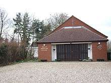
Great Moulton Chapel
| Great Moulton | |
 Great Moulton |
|
| Area | 5.66 km2 (2.19 sq mi) |
|---|---|
| Population | 751 |
| – density | 133/km2 (340/sq mi) |
| OS grid reference | TM166901 |
| Civil parish | Great Moulton |
| District | South Norfolk |
| Shire county | Norfolk |
| Region | East |
| Country | England |
| Sovereign state | United Kingdom |
| Post town | NORWICH |
| Postcode district | NR15 |
| Police | Norfolk |
| Fire | Norfolk |
| Ambulance | East of England |
| EU Parliament | East of England |
Coordinates: 52°27′59″N 1°11′19″E / 52.46645°N 1.18862°E
Map of Great Moulton in the Ordinance Survey first series, sheet 66

Total population of Great Moutlon Civil Parish, Norfolk, as reported by the cencus of population from 1801-2011
Great Moulton is a civil parish in the English county of Norfolk. It covers an area of 5.66 km2 (2.19 sq mi) and had a population of 699 in 289 households at the 2001 census,[1] increasing to 751 at the 2011 census.[2] For the purposes of local government, it falls within the district of South Norfolk. The parish is close to the nearby village of Aslacton.
In the 1870s, Great Moulton was described as:
... Adjacent to the Great Eastern railway, midway between Tivetshall and Forncett r. stations, and 7 miles NW of Harleston; and has a post office, of the name of Moulton, under Long Stratton. The parish contains also the hamlet of Little Moulton, and comprises 1,347 acres. The church has a round tower, surmounted by an octagonal lantern[3]
Notes
- ↑ "Great Moulton parish information". South Norfolk Council. 7 October 2008. Retrieved 20 June 2009.
- ↑ "Civil Parish population 2011". Retrieved 6 September 2015.
- ↑ Wilson, John Marius (1870–72). Imperial Gazetteer of England and Wales. Edinburgh.
This article is issued from Wikipedia - version of the Thursday, February 04, 2016. The text is available under the Creative Commons Attribution/Share Alike but additional terms may apply for the media files.