Great Man-Made River

The Great Man-Made River (GMR, النهر الصناعي العظيم) is a network of pipes that supplies water to the Sahara in Libya, from the Nubian Sandstone Aquifer System fossil aquifer. It is the world's largest irrigation project.[1]
According to its website, it is the largest underground network of pipes (2,820 kilometres (1,750 mi))[2] and aqueducts in the world. It consists of more than 1,300 wells, most more than 500 m deep, and supplies 6,500,000 m3 of fresh water per day to the cities of Tripoli, Benghazi, Sirte and elsewhere. The late Libyan Leader Muammar Gaddafi described it as the "Eighth Wonder of the World."[3]
History


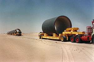
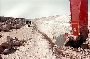
In 1953, efforts to find oil in southern Libya led to the discovery of large quantities of fresh water underground. The Great Man-made River Project (GMRP) was conceived in the late 1960s and work on the project began in 1984. The project's construction was divided into five phases. The first phase required 85 million m³ of excavation and was inaugurated on 28 August 1991. The second phase (dubbed First water to Tripoli) was inaugurated on 1 September 1996.
The project is owned by the Great Man-Made River Project Authority and was funded by the Gaddafi government. The primary contractor for the first phases was Dong Ah Consortium and the present main contractor is Al Nahr Company Ltd.
The imported goods were made in Korea and destined to the construction of the GMR arrived by sea via the entry port of Brega (Gulf of Sidra). The rest of goods were made in Libya.
The total cost of the project is projected at more than US$25 billion.[4] Libya has completed the work to date without the financial support of major countries or loans from world banks. Since 1990 UNESCO has provided training to engineers and technicians involved with the project.
The fossil aquifer from which this water is being supplied is the Nubian Sandstone Aquifer System. It accumulated during the last ice age and is not currently being replenished. If 2007 rates of retrieval are not increased, the water could last a thousand years.[5][6] Independent estimates indicate that the aquifer could be depleted of water in as soon as 60 to 100 years.[7] Analysts say that the costs of the $25 billion groundwater extraction system are 10% those of desalination.[8]
On 22 July during the 2011 Libyan civil war, one of the two plants making pipes for the project, the Brega Plant, was hit by a NATO air strike.[9] At a press conference on 26 July, NATO explained that rockets had been fired from within the plant area, and that military material, including multiple rocket launchers, was stored there according to intelligence findings, presenting a photo showing a BM-21 MRL as an example.[10]
Timeline
- 3 October 1983: The General People's Congress held an extraordinary session to draft the resolutions of the basic people's Congresses, which decided to fund and execute the Great Man-Made River Project.
- 28 August 1984: Muammar Gaddafi laid the foundation stone in Sarir area for the commencement of the construction of the Great Man-Made River Project.
- 28 August 1986: Muammar Gaddafi inaugurated the Brega plant for the production of the pre-stressed concrete cylinder pipes, which are considered the largest pipes made with pre-stressed steel wire (the majority of steel wire was made in Italy by the Redaelli Tecna S.p.A. company with its head office in Cologno Monzese-Milan and its factory in Caivano-Naples). The Sarir plant was also inaugurated on this date.
- 26 August 1989: Muammar Gaddafi laid the foundation stone for phase two of the Great Man-Made River Project.
First water arrival
- 11 September 1989: to Ajdabiya reservoir.
- 28 September 1989: to Grand Omar Muktar reservoir.
- 4 September 1991: to Ghardabiya reservoir.
- 28 August 1996: to Tripoli.
- 28 September 2007: to Gharyan.
- Great Manmade River images
-

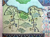
GMMR - 20 dinar note
-

GMMRA logo
See also
- Center pivot irrigation
- Dragon's Breath Cave: another fossil water store in an arid area in Africa
- Qanat
References
- ↑ Guinness World Records 2008 Book. ISBN 978-1-904994-18-3
- ↑ Keys, D., 2011, Libya Tale of Two Fundamentally Different Cities, BBC Knowledge Asia Edition, Vol.3 Issue 7
- ↑ Water-Technology
- ↑ Scholl, Adam. "Map Room: Hidden Waters". World Policy Journal. Retrieved 19 December 2012.
- ↑ Article from Saudi Aramco January/February 2007
- ↑ UN Environment Program
- ↑ Libya's Qaddafi taps 'fossil water' to irrigate desert farms - CSMonitor.com
- ↑ Colonel Qaddafi and the Great Man-made River – Water Matters - State of the Planet
- ↑ Missy Ryan, Giles Elgoodl, Tim Pearce (22 July 2013). "Libya says six killed in airstrike near Brega". Reuters.
- ↑ "NATO bombs the Great Man-Made River". Human Rights Investigations Blog. 27 July 2013.
- ↑ http://earth-chronicles.ru/news/2012-05-17-22874
Additional sources
- BBC News: Libya's thirst for 'fossil water' (article contains map of pipe network)
- Project article at Encyclopædia Britannica
- TEKFEN İNŞAAT official article
External links
| Wikimedia Commons has media related to Great Manmade River. |
- Nubian Sandstone Aquifer System Project Joint project of IAEA UNDP and GEF about the Great Manmade River logistics.
- Great Man-Made River International Water Prize
- Great Man-Made River website at AlGaddaf.org
| ||||||||||||||||||||||||||||||||||
Coordinates: 25°27′20″N 21°36′03″E / 25.45556°N 21.60083°E