Grand Central – 42nd Street (New York City Subway)
| Grand Central – 42nd Street | |||||||||||
|---|---|---|---|---|---|---|---|---|---|---|---|
| New York City Subway rapid transit station complex | |||||||||||
|
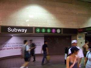
Southern entrance within Grand Central Terminal | |||||||||||
| Station statistics | |||||||||||
| Address |
East 42nd Street & Park Avenue New York, NY 10017 | ||||||||||
| Borough | Manhattan | ||||||||||
| Locale | Midtown Manhattan | ||||||||||
| Coordinates | 40°45′8.22″N 73°58′39.07″W / 40.7522833°N 73.9775194°WCoordinates: 40°45′8.22″N 73°58′39.07″W / 40.7522833°N 73.9775194°W | ||||||||||
| Division | A (IRT) | ||||||||||
| Line |
IRT 42nd Street Shuttle IRT Flushing Line IRT Lexington Avenue Line | ||||||||||
| Services |
4 5 6 7 S | ||||||||||
| Transit connections |
| ||||||||||
| Structure | Underground | ||||||||||
| Levels | 3 | ||||||||||
| Other information | |||||||||||
| Opened | June 22, 1915[1] | ||||||||||
| Accessible |
| ||||||||||
| Wireless service |
| ||||||||||
| Traffic | |||||||||||
| Passengers (2014) |
46,074,652 (station complex)[4] | ||||||||||
| Rank | 2 out of 421 | ||||||||||
| |||||||||||
Grand Central – 42nd Street is a major station complex of the New York City Subway. Located in Midtown Manhattan at the intersection of Park Avenue and 42nd Street, with parts of the station extending east to Lexington Avenue, it is the second busiest station in the system, with 46,074,652 passengers in 2014; only the Times Square station complex has more riders.[4] It serves trains on the IRT Lexington Avenue Line, the IRT Flushing Line and the 42nd Street Shuttle, making it an all-IRT transfer point. The stations of the complex lie next to and beneath Grand Central Terminal, which serves all Metro-North Railroad lines east of the Hudson River.
The complex is served by the:
- 4, 6, and 7 trains at all times
- 5 and 42nd Street Shuttle (S) trains at all times except late nights
- <6> trains during rush hours and middays in the peak direction
- <7> trains during rush hours and early evenings in the peak direction
IRT 42nd Street Shuttle platforms
| Grand Central | |||||||
|---|---|---|---|---|---|---|---|
| New York City Subway rapid transit station | |||||||
|
The shuttle leaves Track 4 bound for Times Square | |||||||
| Station statistics | |||||||
| Division | A (IRT) | ||||||
| Line | IRT 42nd Street Shuttle | ||||||
| Services |
S | ||||||
| Platforms | 2 island platforms | ||||||
| Tracks | 3 | ||||||
| Other information | |||||||
| Opened | October 27, 1904[5] | ||||||
| Rebuilt | 1964 (after fire)[6] | ||||||
| Station succession | |||||||
| Next north |
Times Square: S | ||||||
| Next south |
(Terminal): S 33rd Street: no regular service | ||||||
| |||||||
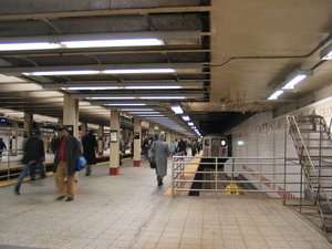
The Grand Central shuttle platforms date from the original IRT subway, opened in 1904. The station was an express stop with two island platforms between the local and express tracks.
The present configuration of the shuttle has three tracks coming into the station; the old southbound express track was removed. There is no connection between the northbound local track (track 4) and the other two. Island platforms are located between both pairs of tracks; the southernmost platform is wide, covering the area where the southbound express track (track 2) had been located. The two platforms connect directly, as tracks 3 and 4 terminate at bumper blocks. The south track (track 1) merges with the southbound local track of the Lexington Avenue Line. This merge is used to supply rolling stock to tracks 1 & 3 of the shuttle train (via a manual switch just west of station to track 3), and occasionally during special railfan excursions. The other three original tracks followed similar paths until the Lexington Avenue Line was extended north, turning this part of the line into a shuttle.
The Public Service Commission planned a new platform for the shuttle close to the Lexington Avenue Line station. The platform was constructed, but it was never used. The wall and roof of the old subway were removed at the curve just south of the old Grand Central station, and trackways were built continuing east under 42nd Street, to bring those two tracks into the new station, which was a narrow island platform between the two tracks. The unused trackways of the proposed shuttle platform were covered with wooden flooring, and the width of the station was finished up as a passageway between the Lexington Avenue Line and Shuttle stations.[7] The wooden flooring in the unused station platform was replaced by concrete in 1946. The space of the proposed platform is now used as a walkway that continues to the Lexington Avenue Line station.[8]
The former downtown express track between this station and Times Square – 42nd Street was removed in 1975.[9]
The platforms are actually wheelchair accessible as the mezzanine elevators are on the same level, but due to the platforms at Times Square being inaccessible, this shuttle itself is not accessible.
This section of the complex is frequently used for movie shooting when it is closed. Notable scenes include a famous scene in the 1971 film The French Connection, an episode of Fringe, an episode of Person of Interest, and an episode of 30 Rock (filling in for Rockefeller Center Station).
Image gallery
-
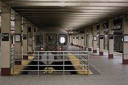
Train on track 3
-

Entrance from the Grand Central Terminal Main Concourse
-

Entering the subway from the new Grand Central Terminal, 1912
IRT Flushing Line platform
| Grand Central | |||||||||
|---|---|---|---|---|---|---|---|---|---|
| New York City Subway rapid transit station | |||||||||
|
View from the end of the platform, looking west | |||||||||
| Station statistics | |||||||||
| Division | A (IRT) | ||||||||
| Line | IRT Flushing Line | ||||||||
| Services |
7 | ||||||||
| Platforms | 1 island platform | ||||||||
| Tracks | 2 | ||||||||
| Other information | |||||||||
| Opened | June 22, 1915[1] | ||||||||
| Accessible |
| ||||||||
| Former/other names | 42nd Street – Grand Central | ||||||||
| Station succession | |||||||||
| Next north |
Vernon Boulevard – Jackson Avenue: 7 | ||||||||
| Next south |
Fifth Avenue: 7 | ||||||||
|
| |||||||||
| Next |
Court Square: 7 | ||||||||
| Next |
Times Square: 7 | ||||||||
| |||||||||
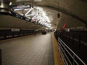
Grand Central (signed as 42nd Street – Grand Central) on the Flushing Line has a single island platform and two tracks.
There is a large round ceiling, making the platform similar to some stations in the London Underground, Paris Metro and systems in Eastern Europe (it is also similar to the Roosevelt Island, 168th Street (IRT platforms), and 181st Street stations in other parts of Manhattan). Along the platform are stairs and escalators to other lines and to a mezzanine and passageways under the Grand Central Terminal concourse. Exits and entrances are located at the center, west and east ends of the platform. There is an ADA-accessible elevator toward the west end. A newsstand/snack shop is located on the platform towards the east end.
There was a plan to connect the Flushing line to the 42nd Street shuttle, just west of the Grand Central station. Some ramp work was built just for this purpose.[10] The connecting walkways from the 42nd Street Shuttle to the Flushing Line platform are the ramps.[10] Also there are two remaining sections of the old trolley loop at Grand Central that remain intact and are accessible to MTA personnel via the southbound track approximately 200 feet outside of this station.[11] The third is between the tracks and is a pump room. Parts of the loop are being converted into CBTC circuit breaker rooms.[12]
Image gallery
-
Directional sign above the staircase to the Flushing Line platform
-
Metal sign on tunnel wall with "42nd Street - Grand Central" name
-

Looking down a staircase toward the IRT Flushing Line platform
-
An R188
 train being taken out of service
IRT Lexington Avenue Line platforms
| Grand Central – 42nd Street | |||||||||||||
|---|---|---|---|---|---|---|---|---|---|---|---|---|---|
| New York City Subway rapid transit station | |||||||||||||
|
| |||||||||||||
| Station statistics | |||||||||||||
| Division | A (IRT) | ||||||||||||
| Line | IRT Lexington Avenue Line | ||||||||||||
| Services |
4 5 6 | ||||||||||||
| Platforms |
2 island platforms cross-platform interchange | ||||||||||||
| Tracks | 4 | ||||||||||||
| Other information | |||||||||||||
| Opened | July 17, 1918[13] | ||||||||||||
| Accessible |
| ||||||||||||
| Former/other names | Diagonal Station | ||||||||||||
| Station succession | |||||||||||||
| Next north |
51st Street (local): 4 59th Street (express): 4 | ||||||||||||
| Next south |
33rd Street (local): 4 14th Street – Union Square (express): 4 | ||||||||||||
|
| |||||||||||||
| Next |
51st Street (local): 4 125th Street (express): 4 | ||||||||||||
| Next |
Bleecker Street (local): 4 Brooklyn Bridge – City Hall (express): 4 | ||||||||||||
| |||||||||||||
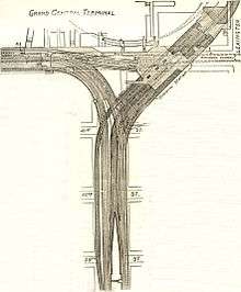
Grand Central – 42nd Street is an express station on the IRT Lexington Avenue Line. It was also known as the Diagonal Station at time of construction, being oriented 45° from the street grid. It has two island platforms, four tracks, and includes a crossover and a crossunder. The columns and beams here are massive, in order to support part of Grand Central Terminal and the office towers next to it.
On one wall, there is a stylized steam locomotive mosaic. The northbound platform's side wall includes tile depicting a big passageway; the first room, as seen from the platform, has doors to a second room which appears to be a mechanical room. There is a correctly oriented compass rose inlaid on the floor of the mezzanine.
The southbound local track south of the station merges into the original downtown local track from the IRT 42nd Street Shuttle. The track was part of the original four-track IRT subway. This track is now used for moving trains to and from the shuttle and for launching railfan trips from the shuttle tracks. This was the only track that is preserved.
Just south of the station, the tracks split, with two on each side of the 1870 New York and Harlem Railroad Murray Hill Tunnel which is now used for automobile traffic on Park Avenue.
The Grand Central complex is home to the master tower which controls the entire Lexington Avenue Line, located south of the Lexington Avenue Line platforms.
The uptown tracks are about ten feet below the original grade at the point where they turn off. The old uptown express and local trackways that used to lead to the 42nd Street Shuttle are visible from the uptown local track. As the alignment of the original trackways curves into the old Grand Central station on the 42nd Street Shuttle, it passes through the rebuilt area for the proposed Grand Central station shuttle platform. From the public passageway, none of the original support columns and roof are visible, since they were removed in exactly this area to open the way for the unused shuttle station. The unused ramps leading from the 42nd Street Shuttle are still in place, just south of this station.
The New York City Transit Authority had a scheme in the early 1950s to make a lower level to the station, also of four tracks. It would tap into the express tracks beyond the station and be used as an intermediate terminal stop for certain services. There is room between the station and the Flushing Line for such a new level.
Image gallery
-
Tile mosaic
-
Close-up
-
6 Train leaving local track
-

Platform in 1970
Station layout
| G | Street Level | Exit/Entrance |
| B1 | Mezzanine, shuttle platforms | To entrances/exits, station agent, MetroCard vending machines |
| Track 4 | ← | |
| Island platform, doors will open on the right for track 4 only | ||
| Track 3 | ← | |
| Island platform, doors will open on the left for track 1, right for track 3 | ||
| Track 1 | ← | |
| B2 | Northbound local | ← ← |
| Island platform, doors will open on the left for local trains, right for express trains | ||
| Northbound express | ← ← | |
| Southbound express | → → | |
| Island platform, doors will open on the left for local trains, right for express trains | ||
| Southbound local | → → | |
| B4 | Southbound | ← |
| Island platform, doors will open on the left | ||
| Northbound | → | |
An east-west passageway connects the mezzanine, above the Flushing Line and Lexington Avenue Line platforms, to the 42nd Street Shuttle and has numerous exits into Grand Central Terminal, to the street level at and directly into several buildings along 42nd Street, including: the Chrysler Building through a passage immediately to the left of the customer service booth on the station's mezzanine, 125 Park Avenue, 110 East 42nd Street through a passage downtown of the main mezzanine through their own fare control, 122 East 42nd Street through its own turnstiles directly accessing the escalators to the IRT Flushing Line platform (east of the mezzanine), and numerous others by walking through exits uptown and to the west into Grand Central Terminal.[14][15] An exit outside of the planned One Vanderbilt is proposed.[16]
The station has undergone various recent renovations, but some of the passages still require repair or renovation. At the same time, a project was ongoing to air cool the station in conjunction with Metro-North Railroad's project to cool Grand Central Terminal. However, as of 2006, only the Lexington Avenue Line station is air-cooled. The Lexington Avenue Line station, the 2009 South Ferry station,[17] and the 34th Street – Hudson Yards station are the only three artificially cooled stations in the New York City Subway, not counting three under-construction Second Avenue Subway stations which have not had cooling systems installed yet.[18][19] The Flushing Line platforms have been equipped with fans, but not an air-cooling system.
Original plans for PATH (at that time the Hudson and Manhattan Railroad) had it extending north and east from its current northern terminal at 33rd Street/6th Avenue to Grand Central. Space was left for the platforms and line, but it was never built.[20]
Except for the 42nd Street Shuttle (which is inaccessible at its other station at Times Square), the whole station is handicapped accessible, as is the connection to Grand Central Terminal.[21]
In 2014, the Metropolitan Transportation Authority installed an online, interactive touchscreen computer program called "On The Go! Travel Station" (OTG) in Grand Central. The self-updating kiosks allow people to route their trips, and check for delays.[22] The MTA set up the map as part of a pilot project that saw the OTGs initially installed in five subway stations. It lists any planned work or service changes occurring on the subway as well as information to help travelers find landmarks or locales near the stations with an OTG outlet, wherein the first station to test this new technology had been Bowling Green.[23][24][25]
Relative depths
- Metro-North Railroad upper level, 20 feet (6.1 m) below street
- 42nd Street Shuttle, 20 feet (6.1 m)
- Lexington Avenue Line, 50 feet (15 m)
- Metro-North Railroad lower level, 60 feet (18 m)
- Flushing Line, 80 feet (24 m)
- Long Island Rail Road upper level (under construction), 130 feet (40 m)
- Long Island Rail Road lower level (under construction), 150 feet (46 m)
IRT Third Avenue Line transfers
For a while, free transfers were provided between the subway station and 42nd Street on the elevated IRT Third Avenue Line. This started on June 14, 1942, the day after the IRT Second Avenue Line, which provided access to Queensboro Plaza and the IRT Flushing Line, was closed. The Third Avenue Line closed on May 12, 1955, rendering the transfer obsolete.[26]
Foiled terrorist attack
Najibullah Zazi and alleged co-conspirators were arrested in September 2009 as part of an al-Qaeda Islamist plan to engage in suicide bombings on trains in the New York City subway system, including near the Grand Central Station, during rush hour that month, and Zazi has pled guilty.[27][28][29][30]
References
- 1 2 New York Times, Steinway Tunnel Will Open Today, June 22, 1915, page 10
- ↑ NYC Subway Wireless
- ↑ Attached PDF to "Governor Cuomo Announces Wireless Service and New "Transit Wireless WiFi" in Queens and Manhattan Subway Stations", governor.ny.gov
- 1 2 "Facts and Figures: Annual Subway Ridership". Metropolitan Transportation Authority. Retrieved 2014-04-06.
- ↑ New York Times, Our Subway Open: 150,000 Try It, October 28, 1904
- ↑ Feinman, Mark. "The Automated Times Square – Grand Central Shuttle". nycsubway.org. Retrieved January 1, 2012.
- ↑ "We are in the northern trackway of the unused shuttle station, looking west toward the open shuttle station, which can be seen in the left background. In the left foreground is the last column in the row of heavy columns down the middle of the unfinished station. Beyond, the northern trackway would have run straight into the old uptown local track, which would be in view if we could remove the walled enclosure with the double doors. To the left of that, the space between the thinner rows of columns lines up with the old uptown station platform, and the other shuttle track would have run parallel to the left of that into the former uptown express track."
- ↑ YouTube. YouTube. Retrieved on 2013-07-26.
- ↑ "Abandoned Stations : proposed Grand Central shuttle platform". columbia.edu.
- 1 2 http://www.columbia.edu/~brennan/abandoned/GrandCentral.ps.gif
- ↑ "www.nycsubway.org". www.nycsubway.org.
- ↑ "mta.info - 7 Line Work & Planned Service Changes". mta.info.
- ↑ New York Times, Lexington Av. Line to be Opened Today, July 17, 1918, page 13
- ↑ "MTA Neighborhood Maps: Midtown East / Grand Central" (PDF). mta.info. Metropolitan Transportation Authority (New York). 2015. Retrieved 17 July 2015.
- ↑ Cox, Jeremiah. "Grand Central-42nd Street". Retrieved 4 October 2013.
- ↑ "One Vanderbilt Renderings: Before and After". Second Ave. Sagas.
- ↑ Jewler, Sam (August 30, 2009). "Does the New York Subway System Really Need to Be This Hot?". New York Magazine. Retrieved May 23, 2014.
However, New York’s system now has a few D.C.-style chiller units — some were installed in Grand Central’s 4,5,6 station during the Terminal’s recent restoration, and there are four in the brand new South Ferry station.
- ↑ Donohue, Pete (August 4, 2006). "Cooler Subways Coming – Eventually". Daily News (New York). Retrieved February 28, 2010.
- ↑ Roberts, Sam (September 30, 2013). "No Heel Hazards (or Gusts) as Subway Expands". New York Times (New York). Retrieved May 5, 2014.
- ↑ "Hudson Tubes / Hudson & Manhattan Railroad / PATH: Image Gallery". hudsoncity.net. line feed character in
|title=at position 57 (help) - ↑ "MTA Guide to Accessible Transit". MTA.info. Retrieved June 1, 2011.
- ↑ Bereznak, Alyssa. "Check Out New York City’s First Touchscreen Subway Map". Yahoo! Tech. Retrieved 21 February 2014.
- ↑ "MTA's First "On The Go" Touchscreen Unveiled In Bowling Green". NY1. September 19, 2011. Retrieved October 5, 2011.
- ↑ "MTA Introduces New On the Go! Touch-Screen Travel Station". MTA.info. September 19, 2011. Retrieved October 5, 2011.
- ↑ Brian Sozzi. "Sozzi: The Boring Old Subway is Now Digital, and That's Pretty Awesome". TheStreet.
- ↑ 'El' Will Cease Saturday, New York Times June 7, 1942 page 31
- ↑ Karen Zraik, David Johnston (September 15, 2009). "Man in Queens Raids Denies Any Terrorist Link". New York Times. Archived from the original on September 21, 2009.
- ↑ David Johnston, Al Baker (September 18, 2009). "Denver Man Admits to a Possible Al Qaeda Connection, Officials Say". The New York Times. Archived from the original on September 21, 2009.
- ↑ David Johnston, William K. Rashbaum (September 20, 2009). "Terror Suspect Had Bomb Guide, Authorities Say". The New York Times. Archived from the original on September 21, 2009.
- ↑ Zazi Reveals Details Of Foiled Terror Plot – retrieved from NY1 local news channel on 04/12/2010
Further reading
- Lee Stokey. Subway Ceramics : A History and Iconography. 1994. ISBN 978-0-9635486-1-0
External links
| Wikimedia Commons has media related to Grand Central – 42nd Street (New York City Subway). |
- nycsubway.org—IRT East Side Line: Grand Central
- nycsubway.org—IRT Flushing Line: Grand Central
- nycsubway.org—IRT Shuttle: Grand Central
- nycsubway.org — V-Beam Artwork by Christopher Sproat (2000)
- nycsubway.org — Fast Track & Speed Wheels Artwork by Dan Sinclair (1990)
- nycsubway.org — Arches, Towers, Pyramids Artwork by Jackie Ferrara (1997)
- Station Reporter — Grand Central Complex
- Abandoned Stations — Proposed Grand Central shuttle platform (includes a track diagram)
- Forgotten NY — Original 28 – NYC's First 28 Subway Stations
- The Subway Nut — Grand Central – 42nd Street (7) Pictures
- MTA's Arts For Transit — Grand Central – 42nd Street
- 42nd Street and Lexington Avenue entrance (NW corner) from Google Maps Street View
- 43rd Street and Lexington Avenue entrance via Hyatt hotel from Google Maps Street View
- 42nd Street and Lexington Avenue entrance (NE corner) from Google Maps Street View
- 42nd Street and Third Avenue entrance from Google Maps Street View
- 42nd Street and Vanderbilt Avenue entrance from Google Maps Street View
- 42nd Street and Vanderbilt Avenue entrance in office building from Google Maps Street View
- Ex-Bowery Savings Bank entrance from Google Maps Street View
- entrance between Madison Avenue and Fifth Avenue from Google Maps Street View
- Park Avenue entrance from Google Maps Street View
- entrance in Grand Central from Google Maps Street View
- Lexington Avenue Line platforms from Google Maps Street View
- Mezzanine from Google Maps Street View
