Goodna, Queensland
| Goodna Queensland | |||||||||||||
|---|---|---|---|---|---|---|---|---|---|---|---|---|---|
 Goodna Shopping Centre | |||||||||||||
| Population | 8,777 (2011 census)[1] | ||||||||||||
| Established | 1856 | ||||||||||||
| Postcode(s) | 4300 | ||||||||||||
| LGA(s) | City of Ipswich | ||||||||||||
| State electorate(s) | Bundamba | ||||||||||||
| Federal Division(s) | Oxley | ||||||||||||
| |||||||||||||
Goodna is a suburb on the eastern edge of the City of Ipswich in Queensland, Australia.
It is bounded to the north by the Brisbane River. Founded in 1856 when the area was still part of New South Wales, it celebrated its 150-year anniversary in 2006. Its beginnings can be traced back further to 1823 when it was originally visited by an exploration party led by John Oxley. Further still, Goodna sits on Jaggera land, the original Aboriginal grouping being the Yerongpan people who continue their culture today.
Goodna is only 20 kilometres (12 mi) from the Brisbane central business district, being just outside the Brisbane City Council area. Ideally located as a centre point between Brisbane and Ipswich, it was designated by the Queensland Government in the SEQ Plan as a major activity centre, a transport oriented development centre and as an economic activity centre.[2]
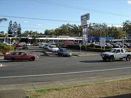
Goodna Shopping Centre (also known as St Ives)[3] is a major shopping centre, an easy walk to the Goodna train station (207 metres (679 ft) direct distance).[4] With the new Goodna Town Plan, released in 2009, it is now possible to build up to 12 stories in the main shopping centre area.
Geography

The Brisbane River runs to the north of Goodna. Goodna Boat Ramp is one of the only boat ramps on the Brisbane River and is part of the Brisbane River Canoe Trail. There are extensive old Jacaranda, Poinciana, Hoop Pine and Mango trees throughout the area. Parks are widespread with over 14 individual parks to be found and free electric barbecue facilities at the major ones. Names of some of the major parks include: Evan Marginson Sportsground, Richardson Park, Leslie Park, Kippen Park, Norma Mulvihill Park, Baines Meaney and Seymour Park. Fifty percent of The Pan Pacific Peace Gardens is also situated within Goodna. Wildlife is restricted with ongoing development, however possums and on a rare occasion koalas have also been spotted.
The Diggers Rest on the corner of Queen and Church Streets is the Goodna War Memorial. This was dedicated in September 1921. Many of the original central street names in Goodna originated from English kings, princes, and queens such as William, Albert, James and George.
Demographics
In the 2011 Census the population of Goodna is 8,777, 50.2% female and 49.8% male. The median/average age of the Goodna population is 30 years of age, 7 years below the Australian average. 59.4% of people living in Goodna were born in Australia. The other top responses for country of birth were New Zealand 9.1%, Samoa 3.5%, Vietnam 3.1%, England 3%, India 1.8%. 66.5% of people speak English as their first language 7.4% Samoan, 4.9% Vietnamese, 1.5% Spanish, 1% Hindi, 0.9% Tagalog.
History


Historically Goodna was a farming community, primarily in sugar, cotton, livestock (sheep and cattle), and also had a large local timber industry. Large amounts of timber were taken by bullock teams to the Goodna wharf and shipped to Ipswich and Brisbane.[5]
Woogaroo (as it was then known) had extensive beds of sandstone. In 1826 Patrick Logan established the Woogaroo Quarry to provide building materials for the Moreton Bay penal colony.[6]
As early as 1841 there was a sheep run called Woogaroo Station, H.S.Russell and Dr. Stephen Simpson (the Grenier family of South Brisbane were still in New Zealand in 1841 and did not reach Brisbane till 1845 and while having the Grenier Inn at South Brisbane farmed land known as "The Willows" where Archerfield airfield stands today). This name, which referred to a waterhole in the creek was superseded from 1865 onwards by the name Goodna.
By the early 1840s Dr Stephen Simpson, the lands commissioner and magistrate for the Moreton Bay district, was living in a slab hut and farming on the riverbank near the mouth of Woogaroo Creek. As the main road intersected with the track from Coopers Plains and the river, at the time it was a strategic location for Simpson. In 1851–1852 he purchased 2,000 acres (8 km2) of land, including 640 acres (2.6 km2) on Wolston Creek. Other well known pioneers settled or purchased land in the Goodna area: James Holmes arrived in 1851 and established himself as a grazier; Charles Pitt married Thomas Grenier's daughter Mary in 1855 and grew cotton and maize at Redbank Plains. According to "Aldines" Charles was the second to grow cotton in that area and received 400 pounds from the Government of the day. He was also a JP and on the Purga Divisional Board and involved in the beginnings of the Redbank School. ; Harriet Holmes bought 33 acres (130,000 m2) in 1860; and Joshua Jeays, later Mayor of Brisbane, bought 40 acres (160,000 m2) in the next year.

Further settlement took place after Goodna was proclaimed a village in 1856. In the following year Joseph and Ellen (née Thompson) Broad built a store on the site, and sold the store later to Edwin Pitt son of Charles and Mary Pitt. Edwin and his wife Cecilia (née Thompson sister of Ellen Broad) ran the store as a mixed business and Cecilia was the postmistress (see Aldines). They survived the 1893 Brisbane flood but a little later built Pitt's Hotel Cecil on the store site. It was later burnt down and the RSL is now on that site. Edwin and Cecilia's daughter Zora Brenda Pitt grew up and learnt to ride in Goodna and she became Royal National Show champion woman rider in the early 1900s, and the cemetery opened in 1859. By 1863 there was a small run to Holmes Inn, where Harriet Holmes was postmistress and the Congregational Church which was also opened in 1863. There was one acting police sergeant and a constable by 1868. W. Law established himself as a blacksmith in 1870, the year in which the Goodna State School opened.
On 30 January 1873 the ceremony of "turning the sod" for the first rail link between Ipswich and Brisbane took place at Goodna. Two thousand people attended the event, most arriving by paddle steamer. To officially start the work, the Queensland Governor George Phipps, 2nd Marquess of Normanby, used a solid silver spade to dig a small piece of earth and place it in a wheelbarrow. Cobb and Co coaches stopped at Goodna on their way to and from Brisbane (their only other stops were Oxley and Rocklea). This ended after the railway link was completed in 1875.[7]
Daniel Jones built the first sawmill in 1884, which was located below the Catholic Church/School grounds in the paddock that reached from Mill Street to Alice Street (known by locals as 'the mill paddock'). In the smaller paddock immediately behind the Presbyterian Church and Manse stood the wooden 'Honey Shed' used by Daniel's brother Harry in conjunction with his apiary. By the Second World War this use had been discontinued and the site was used by a group of CWA ladies who made camouflage nets for the war effort. The site was also used at one time by the Goodna Scout Group.
By 1888 the population of Goodna was 500, and there were three friendly societies, the Oddfellows, Loyal Rose of Denmark and Good Templars. The foundation stone of St Francis Xavier Catholic Church (formerly St Patrick's) had been laid in 1880 by Bishop James Quinn and opened in the following year. The Catholic school was opened in 1910 and the Sisters of Mercy Convent in 1911. Goodna today retains significant elements of its heritage.[8]
Heritage listings

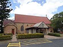
Goodna has a number of heritage-listed sites, including St Francis Xavier Church in Church Street.[9]
Amenities, facilities and services


A wide range of established amenities, facilities, and services are to be found close to the Goodna Shopping Centre and the Goodna train station. Amongst these are a range of government services, large range of medical services, large range of financial services, Woolworths, Goodna Neighbourhood House, diverse range of sporting clubs, the Goodna Aquatic Centre, Brisbane River Tce retirement village, Tully Lodge retirement village, Oak Trees retirement village, Goodna Little Athletics, Goodna Rugby League Football Club, Western Spirit Football Club, Goodna Lawn Bowls Club, Goodna Netball Association, Goodna Cultural and Arts Centre, Jacaranda 2000 Toastmasters Club (Goodna), as well as local Goodna Scout Group, which was founded in 1969, celebrating its 40-year anniversary in 2009 and Girl Guide groups amongst others.
Goodna has a couple of gyms located within the commercial precinct which includes Just Fitness [10] and Jetts.[11] Goodna was the first Brisbane/Ipswich suburb to receive the NBN (National Broadband Network) providing fast broadband services.[12]
Education
The first school in Goodna was the Goodna State School which founded in 1870, and by 1874 was being attended by 175 pupils.[13] Other schools in the Goodna area are St Francis Xavier School, Westside Christian College and Goodna Special School. Goodna is also home to a campus of The Bremer Institute of TAFE.
Events
Goodna Jacaranda Festival

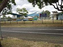
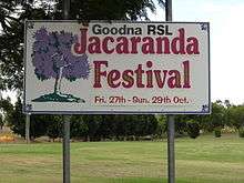
Goodna is renowned for its yearly Jacaranda Festival held towards the end of October.[14] This is held when the Jacaranda trees are flowering. In excess of 10,000 people attend the Jacaranda Festival annually, which has been run every year since 1968. The festival is held in Evan Marginson Park an easy walk from the Goodna train station.
Mall 2 Mall Bike Ride
This is an integral part of the annual Ipswich Festival which is held each April. Attracting 1,000 riders it was started in 2002. It was initiated by Bernie Ripoll, the local federal member (Federal Member for Oxley) who has his office in Goodna. Goodna is the major rest point for this event and it is possible to join the event here. This event starts in the Brisbane Mall and finishes in the heart of Ipswich, covering more than 50 kilometres (31 mi) and passing through 27 western Brisbane and Ipswich suburbs.
It delivers a message of continued co-operation and goodwill between the Brisbane and Ipswich Lord Mayors and raises much needed funds for the Ipswich Hospital Foundation and the Royal Children's Hospital Foundation.[15]
Transport
The Goodna train station was opened in 1875. Feeder bus services are operated by the Westside Bus Company which carry commuters from surrounding suburbs to and from the Goodna train station.
Politics
Goodna is located within the federal electorate of Oxley. Bernie Ripoll represents the electorate of Oxley in the House of Representatives. On a state basis it is in the State Electoral District of Bundamba and is represented by Jo-Ann Miller.
References
- ↑ Australian Bureau of Statistics (31 October 2012). "Goodna (Ipswich City) (State Suburb)". 2011 Census QuickStats. Retrieved 28 February 2008.
- ↑ South East Queensland Regional Plan 2005–2026 Queensland Government – Office of Urban Management.
- ↑ Goodna Shopping Centre (Also known as St Ives)
- ↑ http://pdonline.ipswich.qld.gov.au/pdonline/ Ipswich City Council PDOnline (Use measure function for 2 Smiths Road to train station.)
- ↑ Six Mile Woogaroo and Goodna Creek. Ipswich City Council. Retrieved on 28 December 2011.
- ↑ "Goodna". Queensland Places. Centre for the Government of Queensland, University of Queensland. Retrieved 5 January 2015.
- ↑ Goodna then and now. Ipswich City Council. Retrieved on 28 December 2011
- ↑ Suburb and Place Names. Ipswich City Council. Retrieved on 28 December 2011.
- ↑ "St Francis Xavier Church (entry 600553)". Queensland Heritage Register. Queensland Heritage Council. Retrieved 9 July 2013.
- ↑ Just Sports Fitness Goodna
- ↑ Jetts Goodna
- ↑ When will NBN be available in my area
- ↑ Goodna State School. Queensland State Archives. Retrieved on 18 December 2011.
- ↑ Goodna Jacaranda Festival
- ↑ Mall 2 Mall Bike Ride
External links
| Wikimedia Commons has media related to Goodna, Queensland. |
Coordinates: 27°37′00″S 152°54′00″E / 27.6167°S 152.9000°E