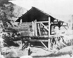
Gold Country

The Gold Country (also Mother Lode Country) is a historic region in the U.S. State of California, primarily located on the western slope of the Sierra Nevada.[1] It is famed for the mineral deposits and gold mines that attracted waves of immigrants, known as the 49ers, during the 1849 California Gold Rush.
Geology

The Gold Country lies on the western slope of the Sierra Nevada, reaching down to the Sacramento Valley. The oldest geology can be found along the easternmost portions of this region, closer to the Sierra Nevada summits. It consists of ancient sea floor and portions of islands which were added onto the western edge of North America during the late Paleozoic, about 275 million years ago. The western sections of the Mother Lode are significantly younger, from the mid Mesozoic about 150 million years ago, and also consist of material that was solidified on the ocean floor to the continental edge. Massive intrusions of granite forced their way into these formations. After ten miles of overlying material was eroded over the last 70 million years, these intrusions became visible throughout the Sierra Nevada. Over the last 50 million years, rivers and volcanoes deposited materials; these built up in thick layers found atop many of the high ridges of the Sierra Nevada foothills.
Climate
This part of California has a Mediterranean climate like much of Italy and Spain, making wine grapes and vineyards one of the region's primary crops and industry. Over 100 wineries are found throughout the Gold Country. Winters are cool and wet with occasional snowfall, especially in the higher elevations of the eastern reaches up the slopes of the Sierra Nevada mountains. Winter temperatures range from the upper twenties to mid fifties. Summers are dry and hot, with long stretches that reach triple digits. The average annual precipitation is around 30 in (760 mm).
Transportation
California State Route 49 is the primary north-south highway through the region, passing through many historic mining communities. Major east-west highways include Interstate 80 and U.S. Route 50.
Two Amtrak routes run through the area. The eastern terminus of the Capitol Corridor is in Auburn. The California Zephyr stops in Colfax.
Principal cities and towns
- Angels Camp, California
- Arnold, California
- Auburn, California
- Cameron Park, California
- Camino, California
- Camptonville, California
- Colfax, California
- Coloma, California
- Columbia, California
- Copperopolis, California
- Diamond Springs, California
- Downieville, California
- El Dorado, California
- El Dorado Hills, California
- Fair Play, California
- Fiddletown, California
- Folsom, California
- French Corral, California
- Georgetown, California
- Grass Valley, California
- Groveland-Big Oak Flat, California
- Jackson, California
- Jamestown, California
- Lotus, California
- Mariposa, California
- Meadow Vista, California
- Mount Aukum, California
- Murphys, California
- Nevada City, California
- Newcastle, California
- North Bloomfield, California
- Oroville, California
- Placerville, California
- Pleasant Valley, California
- Pollock Pines, California
- Rancho Cordova, California
- Rescue, California
- Rough and Ready, California
- Shingle Springs, California
- Somerset, California
- Sonora, California
- Sutter Creek, California
- Volcano, California
References
- ↑ "Gold Country". California State Parks. California Department of Recreation. Retrieved August 1, 2014.
External links
- Gold Country Visitors Association
- The Virtual California Gold Country: Highway 49 Revisited Online
- Building Materials of the California Gold Country: A Selective Photographic Tour from Mariposa in Mariposa County to Auburn in Placer County, on Stone Quarries and Beyond.
| ||||||||||||||||||||||||||||
| ||||||||||||||||||||||||||
Coordinates: 38°24′N 120°48′W / 38.4°N 120.8°W