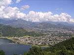
Ghandruk
| Ghandruk घान्द्रुक | |
|---|---|
| Village Development Committee | |
|
A view of Annapurna and Macchapucchre range from Ghandruk | |
 Ghandruk Location in Nepal | |
| Coordinates: 28°22′37″N 83°48′25″E / 28.377°N 83.807°ECoordinates: 28°22′37″N 83°48′25″E / 28.377°N 83.807°E | |
| Country |
|
| Zone | Gandaki Zone |
| District | Kaski District |
| Population (1991) | |
| • Total | 4,748 |
| Time zone | Nepal Time (UTC+5:45) |
Ghandruk is a town and Village Development Committee in Kaski District in the Gandaki Zone of northern-central Nepal. At the time of the 1991 Nepal census it had a population of 4,748 persons living in 1,013 individual households.[1]
Ghandruk is a popular place for treks in the Annapurna range of Nepal, with easy trails and various accommodation possibilities. From Ghandruk there are views to the mountains of Annapurna including Machapuchare.
References
- ↑ "Nepal Census 2001". Nepal's Village Development Committees. Digital Himalaya. Retrieved 30 September 2008.
External links
- UN map of the municipalities of Kaski District
- Nepal Village offer beautiful photos from Ghandruk Village. Some people called this village as Ghandrung Village as well. Ghandruk is famous for trekking from where you can see best views of Annapurna South and Fishtail mountain. From Pokhara it takes 42 kilometers drive and 5–6 hours walking distance.
This article is issued from Wikipedia - version of the Monday, November 23, 2015. The text is available under the Creative Commons Attribution/Share Alike but additional terms may apply for the media files.


