Fundusfeiler
| Fundusfeiler | |
|---|---|
|
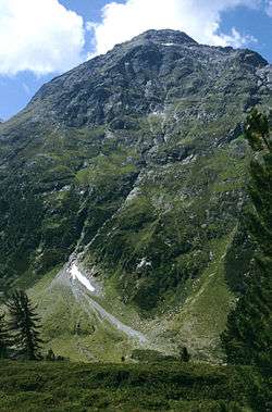
Fundusfeiler from the east. | |
| Highest point | |
| Elevation | 3,079 m (10,102 ft) |
| Prominence | 299 m (981 ft) |
| Parent peak | Blockkogel |
| Coordinates | 47°06′44″N 10°52′13″E / 47.11222°N 10.87028°ECoordinates: 47°06′44″N 10°52′13″E / 47.11222°N 10.87028°E |
| Geography | |
 Fundusfeiler Austria | |
| Location | Tyrol, Austria |
| Parent range | Ötztal Alps |
| Climbing | |
| Easiest route | Walk over south ridge |
The Fundusfeiler is a mountain in the Geigenkamm group of the Ötztal Alps.[1]
See also
References
- ↑ Garnweidner, Siegfried "Tiroler Wanderberge: 50 Touren zwischen Silvretta und Kaiser," Bergverlag Rother, 2002. Page 56. ISBN 978-3-7633-3019-5. Retrieved October 4, 2011
This article is issued from Wikipedia - version of the Thursday, April 18, 2013. The text is available under the Creative Commons Attribution/Share Alike but additional terms may apply for the media files.
