Fridaythorpe
| Fridaythorpe | |
 Fridaythorpe |
|
| Population | 319 (2011 census)[1] |
|---|---|
| OS grid reference | SE875590 |
| – London | 170 mi (270 km) S |
| Civil parish | Fridaythorpe |
| Unitary authority | East Riding of Yorkshire |
| Ceremonial county | East Riding of Yorkshire |
| Region | Yorkshire and the Humber |
| Country | England |
| Sovereign state | United Kingdom |
| Post town | DRIFFIELD |
| Postcode district | YO25 |
| Dialling code | 01377 |
| Police | Humberside |
| Fire | Humberside |
| Ambulance | Yorkshire |
| EU Parliament | Yorkshire and the Humber |
| UK Parliament | East Yorkshire |
Coordinates: 54°01′13″N 0°39′57″W / 54.020315°N 0.665898°W
Fridaythorpe is a village and civil parish in the East Riding of Yorkshire, England. It is situated approximately 8 miles (13 km) north-east of Pocklington town centre and lies on the A166 road. It is 550 feet (170 m) above sea level, making it the highest village in the Yorkshire Wolds.

According to the 2011 UK census, Fridaythorpe parish had a population of 319,[1] an increase on the 2001 UK census figure of 183.[2]
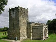
St Mary's Church, Fridaythorpe was restored in 1902–3 with the addition of a new north aisle designed by C. Hodgson Fowler and stained glass by Burlison and Grylls. In January 1967 the church was designated a Grade I listed building and is now recorded in the National Heritage List for England, maintained by Historic England.[3] It is on the Sykes Churches Trail devised by the East Yorkshire Churches Group.[4]
The Yorkshire Wolds Way National Trail, a long distance footpath passes through the village and the village is the midpoint of the trail.
Village amenities include a Mace general shop and petrol filling station, an agricultural store, a vehicle mechanic business, and a cafe.[5]
In 1823 Fridaythorpe inhabitants numbered 275. Occupations included eleven farmers, three wheelwrights, two blacksmiths, two grocers, two shoemakers, three tailors, a tanner, and the landlords of the Cross Keys and Hare & Hounds public houses. Carriers operated between the village and Driffield every Thursday, and York every Saturday. In the village was a Methodist chapel.[6]
The village previously hosted the World Championship Flat Cap Throwing Competition at its summer fete. The championship has not been contested since 2007.[7]
References
- 1 2 "Key Figures for 2011 Census: Key Statistics: Area: Fridaythorpe CP (Parish)". Neighbourhood Statistics. Office for National Statistics. Retrieved 4 February 2013.
- ↑ "2001 Census: Key Statistics: Parish Headcounts: Area: Fridaythorpe CP (Parish)". Neighbourhood Statistics. Office for National Statistics. Retrieved 16 May 2008.
- ↑ Historic England. "Church of St Mary (1346479)". National Heritage List for England. Retrieved 27 June 2013.
- ↑ "Sykes Churches Trail Southern Route". Beverley, East Yorkshire: East Yorkshire Historic Churches Group.
- ↑ "Time called at Fridaythorpe's Farmers Arms". Driffield Post. Johnston Press Digital Publishing. 8 March 2008. Retrieved 15 January 2010.
- ↑ Baines, Edward; History, Directory & Gazetteer of the County of York (1823), p.207. ISBN 1230139141
- ↑ "World Flat Cap Throwing Championships". Driffield Times & Post. 11 July 2007. Retrieved 5 February 2013.
- Gazetteer – A–Z of Towns Villages and Hamlets. East Riding of Yorkshire Council. 2006. p. 6.
External links
![]() Media related to Fridaythorpe at Wikimedia Commons
Media related to Fridaythorpe at Wikimedia Commons
- Fridaythorpe in the Domesday Book
| ||||||||||||||||||||||||||