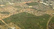
Franklin, Australian Capital Territory
| Franklin Canberra, Australian Capital Territory | |||||||||||||
|---|---|---|---|---|---|---|---|---|---|---|---|---|---|
|
Franklin wetlands | |||||||||||||
 | |||||||||||||
| Coordinates | 35°12′00″S 149°08′33″E / 35.20000°S 149.14250°ECoordinates: 35°12′00″S 149°08′33″E / 35.20000°S 149.14250°E | ||||||||||||
| Population | 3,804 (2011 census)[1] | ||||||||||||
| • Density | 1,650/km2 (4,280/sq mi) | ||||||||||||
| Established | 2007 | ||||||||||||
| Postcode(s) | 2913 | ||||||||||||
| Area | 2.3 km2 (0.9 sq mi) | ||||||||||||
| District | Gungahlin | ||||||||||||
| Territory electorate(s) | Molonglo | ||||||||||||
| Federal Division(s) | Fraser | ||||||||||||
| |||||||||||||
Franklin (postcode: 2913) is a suburb of Canberra, Australia in the district of Gungahlin. It is named after the novelist Miles Franklin. The streets in Franklin are named after writers.[2] It comprises an area of approximately 256 hectares. It is bounded by Flemington Road to the north and east, Wells Station Drive to the south, and Gungahlin Drive to the west.[3]
Franklin is serviced by ACTION bus routes 58 (weekdays) and 958 (weekends).[4]
Open space
The suburb of Franklin includes a number of large open space to provide a pedestrian and cyclist network, and to provide an ecological corridor for the movement of native wildlife.[5]
- The Red Hill Heritage Site including an old pipeclay mine;
- The Mulangarri and North Mitchell Grasslands;
- The Gungaderra Creek;
- Old Well Station Track which connects the Well Station Heritage Precinct (located in the neighbouring suburb of Harrison) with the Gungaderra Homestead, and Red Hill Heritage Site through to the Gungahlin Town Centre.
Demographics
In the 2011 Census, the population of Franklin was 3,804, including 43 (1.1%) Indigenous persons and 2,038 (53.6%) Australian-born persons.[1] 44.4% of the population was foreign born, the third highest for any Canberra suburb.[6] 7.8% were born in China, 6.7% in India, 2.7 in Vietnam, 2.2% in Sri Lanka and 2.1% in Bangladesh.[1]
Geology
Franklin is underlaid mostly by the Canberra Formation mudstone or volcanics from the late middle Silurian age.[7]
Education
Franklin residents get preference for:[8]
- Franklin Early Childhood School
- A shared PEA of Harrison School and Palmerston District Primary
- Harrison School
- Gungahlin College
References

- 1 2 3 Australian Bureau of Statistics (31 October 2012). "Franklin (State Suburb)". 2011 Census QuickStats. Retrieved 6 January 2014.
- ↑ "Suburb Name search results". ACT Environment and Sustainable Development. Retrieved 10 February 2014.
- ↑ Gungahlin Development Authority (2006), Franklin Residential Estate Concept Plan, ACT Planning and Land Authority
- ↑ "Routes and Timetables". ACTION buses. Retrieved 12 March 2009.
- ↑ Gungahlin Development Authority (2006), Franklin Residential Estate Concept Plan, ACT Planning and Land Authority
- ↑ "Where do migrants live? (4102.0 - Australian Social Trends, 2014)". Australian Bureau of Statistics. 17 March 2014. Retrieved 19 March 2014.
- ↑ Henderson G A M and Matveev G, Geology of Canberra, Queanbeyan and Environs 1:50000 1980.
- ↑ "Priority Enrolment Areas 2015 by Suburb" (Archive). Education Directorate, Australian Capital Territory. Retrieved on February 8, 2016.
| ||||||||||
| Wikimedia Commons has media related to Franklin, Australian Capital Territory. |