Florina
| Flórina Φλώρινα | ||
|---|---|---|
|
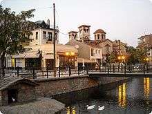
View of the city of Florina. | ||
| ||
 Flórina | ||
|
Location within the region  | ||
| Coordinates: 40°47′N 21°24′E / 40.783°N 21.400°ECoordinates: 40°47′N 21°24′E / 40.783°N 21.400°E | ||
| Country | Greece | |
| Administrative region | West Macedonia | |
| Regional unit | Florina | |
| Government | ||
| • Mayor | Stephanos Papanastasiou | |
| Area | ||
| • Municipality | 827.6 km2 (319.5 sq mi) | |
| • Municipal unit | 150.6 km2 (58.1 sq mi) | |
| Elevation | 663 m (2,175 ft) | |
| Population (2011)[1] | ||
| • Municipality | 32,881 | |
| • Municipality density | 40/km2 (100/sq mi) | |
| • Municipal unit | 19,985 | |
| • Municipal unit density | 130/km2 (340/sq mi) | |
| Community | ||
| • Population | 17907 | |
| Time zone | EET (UTC+2) | |
| • Summer (DST) | EEST (UTC+3) | |
| Postal code | 531 00 | |
| Area code(s) | 23850 | |
| Vehicle registration | ΡΑ | |
| Website | www.cityoflorina.gr | |
Florina (Greek: Φλώρινα, known also by several alternative names) is a town and municipality in mountainous northwestern Macedonia, Greece. Its motto is, 'Where Greece begins'.[2] It is also the Metropolitan seat for the region. It lies in the central part of Florina regional unit, of which it is the capital. Florina belongs to the region of West Macedonia. The town's population is 16,771 people (2001 census). It is in a wooded valley about 13 km (8 mi) south of the international border of Greece with the Republic of Macedonia.
Geography

It is the gateway to the Prespa Lakes and, until the modernisation of the road system, of the old town of Kastoria. It is located west of Edessa, northwest of Kozani, and northeast of Ioannina and Kastoria cities. Outside the Greek borders it is in proximity to Korçë in Albania and Bitola in Macedonia. The nearest airport is situated to the east. The mountains of Verno lie to the southwest and Varnous to the northwest.
Winters bring heavy snow and long periods of temperature below freezing point. During the hot summer months it becomes a busy market town.
Even though Florina was the site of the first rail line built in the southern Ottoman provinces in the late 19th century, its rail system remains undeveloped. Today, Florina is linked by a single track standard gauge line to Thessaloniki and Bitola, and to Kozani (meter gauge) where it was intended to continue south and link up with the terminal in Kalambaka, in Thessaly but this did not proceed due to the 1930s financial crisis.
Florina is passed by GR-2 (Lake Prespa - Edessa) and GR-3/E65 (Kozani - Florina - Niki - Bitola). The historic Via Egnatia is situated to the east. The new GR-3 superhighway will run east of Florina.
Climate
| Climate data for Florina (1961-1997) | |||||||||||||
|---|---|---|---|---|---|---|---|---|---|---|---|---|---|
| Month | Jan | Feb | Mar | Apr | May | Jun | Jul | Aug | Sep | Oct | Nov | Dec | Year |
| Record high °C (°F) | 18.0 (64.4) |
23.0 (73.4) |
25.8 (78.4) |
31.2 (88.2) |
33.8 (92.8) |
39.0 (102.2) |
40.8 (105.4) |
38.6 (101.5) |
36.0 (96.8) |
32.2 (90) |
26.6 (79.9) |
21.0 (69.8) |
40.8 (105.4) |
| Average high °C (°F) | 4.6 (40.3) |
7.3 (45.1) |
11.8 (53.2) |
16.7 (62.1) |
22.0 (71.6) |
26.2 (79.2) |
28.8 (83.8) |
28.7 (83.7) |
25.2 (77.4) |
19.0 (66.2) |
12.1 (53.8) |
6.3 (43.3) |
17.39 (63.31) |
| Daily mean °C (°F) | 0.5 (32.9) |
2.7 (36.9) |
6.7 (44.1) |
11.6 (52.9) |
16.8 (62.2) |
21.0 (69.8) |
23.1 (73.6) |
22.5 (72.5) |
18.4 (65.1) |
12.6 (54.7) |
7.0 (44.6) |
2.2 (36) |
12.09 (53.78) |
| Average low °C (°F) | −3.5 (25.7) |
−1.7 (28.9) |
1.3 (34.3) |
5.1 (41.2) |
9.2 (48.6) |
12.5 (54.5) |
14.4 (57.9) |
14.2 (57.6) |
11.2 (52.2) |
6.9 (44.4) |
2.5 (36.5) |
−1.6 (29.1) |
5.88 (42.58) |
| Record low °C (°F) | −29.0 (−20.2) |
−19.0 (−2.2) |
−13.6 (7.5) |
−5.0 (23) |
0.0 (32) |
2.4 (36.3) |
6.6 (43.9) |
4.0 (39.2) |
0.2 (32.4) |
−5.0 (23) |
−12.6 (9.3) |
−18.6 (−1.5) |
−29.0 (−20.2) |
| Average precipitation mm (inches) | 57.6 (2.268) |
52.3 (2.059) |
57.9 (2.28) |
57.9 (2.28) |
58.9 (2.319) |
37.3 (1.469) |
34.0 (1.339) |
31.0 (1.22) |
41.1 (1.618) |
62.1 (2.445) |
69.4 (2.732) |
86.2 (3.394) |
645.7 (25.423) |
| Average precipitation days | 12.0 | 12.0 | 12.3 | 11.3 | 11.2 | 7.4 | 6.1 | 5.8 | 6.1 | 8.4 | 10.8 | 12.9 | 116.3 |
| Average snowy days | 7.5 | 6.3 | 4.5 | 0.8 | 0.1 | 0 | 0 | 0 | 0 | 0.3 | 1.8 | 5.9 | 27.2 |
| Average relative humidity (%) | 82.1 | 78.1 | 70.9 | 64.0 | 63.4 | 59.8 | 57.4 | 58.3 | 63.9 | 72.1 | 78.7 | 81.8 | 69.21 |
| Source: Hellenic National Meteorological Service [3] | |||||||||||||
Name
The city's original Byzantine name, Χλέρινον (Chlérinon, "full of green vegetation"), derives from the Greek word χλωρός (chlōrós, "fresh" or "green vegetation"). The name was sometimes Latinized as Florinon (from the Latin flora, "vegetation") in the later Byzantine period, and in early Ottoman documents the forms Chlerina and Florina are both used, with the latter becoming standard after the 17th century. The form with [f] (φλωρός) is a local dialect form of χλωρός in Greek. The Slavic name for the city is Lerin (Лерин), which is a borrowing of the Byzantine Greek name, but with the loss of the initial [x] characteristic of the local dialect.
Municipality
The municipality Florina was formed at the 2011 local government reform by the merger of the following 4 former municipalities, that became municipal units:[4]
- Florina
- Kato Kleines
- Meliti
- Perasma
Subdivisions
The municipal unit of Florina is divided into the following communities:
- Alona
- Armenochori
- Florina
- Koryfi
- Mesonisi
- Proti
- Skopia
- Trivouno
History

Within the boundaries of the present-day city lie the remains of a Hellenistic settlement on the hill of Agios Panteleimon.[5] Archaeologists excavated on the site in 1930-1934, but a hotel was later built over the ruins. Excavations began again in the 1980s and the total excavated area is now around 8000 metres square. The buildings uncovered are mostly residential blocks, and the range of finds suggests that the site was continuously inhabited from the 4th century BC until its destruction by fire in the 1st century BC. Many of these finds are now on display in the Archaeological Museum of Florina.

The town is first mentioned in 1334, when the Serbian king Stefan Dušan established a certain Sphrantzes Palaeologus as commander of the fortress of Chlerenon.[6] By 1385, the place had fallen to the Ottomans.[7] An Ottoman defter (cadastral tax census) for the year 1481 records a settlement of 243 households.[8]
Austrian diplomat Johann Georg von Hahn visited the city in 1861 and wrote about it in his travel log From Belgrade to Salonica. In it he writes that "[a]bout the houses in Florina, we should indicate that there are at most 3000, with half of the population Albanian and Turkish Muslims and the other half Christian Bulgarians."[9]
The demographic composition of the area the 19th and early 20th centuries is unclear as many factors contributed to the ethnic orientation of the people; out of these religion was particularly important thus giving rise to a proselytism struggle between the Greek Ecumenical Patriarchate of Constantinople and the Bulgarian Exarchate (established in 1870). In 1886, 78.4% of the Christian population of the Florina kaza (district) - a part of Manastir Vilayet (province) - was aligned with the Ecumenical Patriarchate and 21.6% with the Bulgarian Exarchate, however by 1900 the Patriarchatists had dropped to 50.9% and Exarchatists had risen to 49.1%.[10] The actual Greek-speaking element in this area was concentrated in urban centres where it participated in the religious, administrative, social, and educational sectors of life, this presenting to the outside world a "Greek-like" picture of the area.[10]
Florina and its inhabitants greatly contributed to the Macedonian Struggle. Prominent leaders included Nikolaos Pyrzas,[11] and Petros Chatzitasis.[12] Former President Christos Sartzetakis originates from Florina through his mother.
In the late 19th century, it became a centre of Slavic agitation for independence from the Ottoman Empire, but in 1912 it became part of Greece following the First Balkan War. The town was again in the firing line during World War I, during which it was occupied by Bulgaria, and during the Axis Occupation in World War II, when the town became a centre of Slavic separatism.
For part of the Greek Civil War (1946–1949) the mountains of the Florina area were under communist control. The Slavic-Macedonian National Liberation Front, later simply the National Liberation Front or NOF, had a significant presence in the area:[13] by 1946, seven Slav Macedonian partisan units were operating in the Florina area,[14] and NOF had a regional committee based in Florina. When the NOF merged with the Democratic Army of Greece (DSE), many Slav Macedonians in the region enlisted as volunteers in the DSE.[15] When the Communists withdrew from Florina in 1949, thousands of people were evacuated or fled to Yugoslavia and the Eastern Bloc.
Economy

Florina is a market town with an economy dominated by agriculture, forestry, summer and winter tourism, cross-border trading and the sale of local produce such as grain, grapes, and vegetables including Florina peppers. It also has textile mills and is known for locally manufactured leather handicrafts.
The most notable industrial activity is the very large Ptolemaia-Florina lignite mine.
Its university changed in 2002 from being a branch of the Aristotle University of Thessaloniki, to a part of the University of Western Macedonia. After 2004, four departments that previously belonged to the Aristotle University, reinforced its potential.
Florina has 8 radio stations,[16] 2 daily political newspapers, 4 weekly ones, one women's press and two newspapers on sports.
During the 1950s and 1960s, the area lost much of its population to emigration, both to Athens and Thessaloniki as well as US, Canada, Australia and Germany. Following Greece's EU membership and the economic upturn, many from Germany returned.
Landmarks
%2C_Florina_prefecture%2C_Greece_-_Pedestrian_road_at_city_center_-_02.jpg)
- Archaeological Museum of Florina.[17]
- Florina Museum of Modern Art.[18]
- The Florina Art Gallery[19]
- Folklore Museum of the Aristotle Association
- Folklore Museum of the Culture Club
- Ptolemaida-Florina coal mine
Historical population
| Year | Town | Municipal unit | Municipality |
|---|---|---|---|
| 1981 | 12,573 | - | |
| 1991 | 12,355 | 14,873 | - |
| 2001 | 14,985 | 17,500 | - |
| 2011 | 17,907 | 19,985 | 32,881 |
Cinema
Movies of the Greek cinema filmed in the area, mostly by Theodoros Angelopoulos include:
Notable people
- Necati Cumalı - Turkish novelist, short-story writer and poet
- Alexis Alexoudis, footballer
- Pavlos Voskopoulos - leader of the Rainbow party, which describes itself as the "Political Party of Macedonian Minority in Greece".
- Mary Coustas, actress
- Nadia Tass, director and actress
- Vassy, singer
- Pavlos Voskopoulos, ethnic Macedonian minority rights activist
Gallery
-

Grave stele of the Roman period, Archaeological Museum of Florina
-

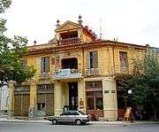
House in Florina. Scenery of Angelopoulos film O Melissokomos
References
- ↑ "Απογραφή Πληθυσμού - Κατοικιών 2011. ΜΟΝΙΜΟΣ Πληθυσμός" (in Greek). Hellenic Statistical Authority.
- ↑ Florina official website.
- ↑ "Mean Florina Climatic Averages". Hellenic National Meteorological Service. Retrieved 2 October 2014.
- ↑ Kallikratis law Greece Ministry of Interior (Greek)
- ↑ Maria Akamati-Lilibati & Ioannis M. Akamatis, The Hellenistic City of Florina. Ministry of Culture (Greece), 2006. ISBN 960-86162-3-9 p53ff
- ↑ Kravari, p. 247.
- ↑ Kravari, p. 55, n. 178.
- ↑ Kravari, p. 248.
- ↑ Johann Georg von Hahn: Reise von Belgrad nach Salonik. Viena: 1861, p. 121.
- 1 2 Richard Clogg, Minorities in Greece: Aspects of a Plural Society, pp. 123-124
- ↑ Douglas Dakin, the Macedonian Struggle, 1985, pp 65-67
- ↑ Hellenic Army General Staff, Directorate of Army History, The Macedonian Struggle and the events in Thrace, 1979, pp 115
- ↑ Simpson, Neil (1994). Macedonia Its Disputed History. Victoria: Aristoc Press, 105,106 & 94. ISBN 0-646-20462-9.
- ↑ "Les Archives de la Macedonine, Fond: Aegean Macedonia in NLW" - (Field report of Mihail Keramidzhiev to the Main Command of NOF), 8 July 1945
- ↑ Η Τραγική αναμέτρηση, 1945-1949 – Ο μύθος και η αλήθεια. Ζαούσης Αλέξανδρος" (ISBN 9607213432).
- ↑ greek radio guide, radiofono.gr
- ↑ "Archaeological Museum of Florina". Web.archive.org. 10 April 2007. Archived from the original on 10 April 2007. Retrieved 2009-07-25.
- ↑ "Florina Museum of Modern Art". Web.archive.org. 13 April 2007. Archived from the original on 13 April 2007. Retrieved 2009-07-25.
- ↑ Museums of Macedonia web site (text under Creative CommonsAttribution-Share Alike 3.0 Unported license)
- The Columbia Encyclopedia, 2004
- Encyclopædia Britannica, 2005
- The Penguin Encyclopedia of Places, 1999
- Rough Guide to Greece, Mark Ellingham et al., 2000
Notes
- ^ Kravari, Vassiliki (1989). Villes et villages de Macédoine occidentale. Realites byzantines (in French) 2. Paris: Editions P. Lethielleux. ISBN 2-283-60452-4.
External links
- City of Florina (Greek)
- Florina regional unit (Greek)
- Awarded "EDEN - European Destinations of Excellence" non traditional tourist destination 2007
| ||||||||||||||||||||||||||||||
| ||||||||||||||||||
| Wikimedia Commons has media related to Florina. |
|
%2C_Florina_prefecture%2C_Greece_-_From_the_Northwest_(National_Road_2_to_Vigla)_-_02.jpg)


.jpg)

