Fayetteville Shale
| Fayetteville Shale Sandstone Stratigraphic range: Mississippian | |
|---|---|
 Outcrop of the lower Fayetteville shale in northern Arkansas. | |
| Type | Geological formation |
| Underlies | Pitkin Limestone,[1] Morrow Hale Sandstone[2] |
| Overlies | Rudell Shale, Batesville Sandstone [1] Moorefield Shale[2] |
| Area | Arkansas |
| Thickness | 50 to 500 feet (15 to 152 m) |
| Location | |
| Region | Arkansas |
| Country | United States |
| Extent | 50 miles (80 km) |
| Type section | |
| Named for | Fayetteville, Arkansas |
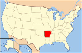
 The Fayetteville formation runs widespread across Arkansas | |
The Fayetteville Shale is a geologic formation of Mississippian age (354–323 million years ago) composed of tight shale within the Arkoma basin of Arkansas.[3] It is named for the city of Fayetteville, Arkansas, and requires hydraulic fracturing to release the natural gas contained within.
Natural gas

The formation holds natural gas in a fine-grained rock matrix which requires hydraulic fracturing to release the gas.[4] This process became cost-effective in some shales such as the Fayetteville after years of experimentation in the Barnett Shale in North Texas, especially when combined with horizontal drilling.
The US Energy Information Administration estimated that the 5,853 square miles (15,160 km2) shale play held 13,240 billion cubic ft (375 billion cubic meters) of unproved, technically recoverable gas.[3] The average well was estimated to produce 1.3 billion cubic feet of gas.[5]
References
- 1 2 Freemen, T. Fossils of Arkansas. Arkansas Geologic Commission.
- 1 2 "Major Stratigraphic Layers of the Fayetteville Shale Formation". Chesapeake Energy, Inc. Retrieved July 25, 2011.
- 1 2 Reed, Michael (June 2013). "Shale Play Should See Added Capacity Next 2 Years". Pipeline & Gas Journal (Houston, TX: Oildom Publishing Company) 240 (6): 46.
- ↑ "About the Fayetteville Shale". University of Arkansas. Retrieved July 25, 2011.
- ↑ US Energy Information Administration, Annual Energy outlook 2012, accessed 14 Sept. 2013.