Eunpyeong District
| Eunpyeong 은평구 | |
|---|---|
| Autonomous District | |
| 은평구 · 恩平區 | |
|
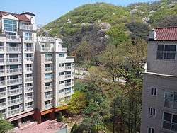
Jingwan-dong Residential Area | |
 Location of Eunpyeong-gu in Seoul | |
| Country | South Korea |
| Region | Sudogwon |
| Special City | Seoul |
| Administrative dong | 16[1] |
| Government | |
| • Mayor | Kim U-yeong |
| Area | |
| • Total | 29.7 km2 (11.5 sq mi) |
| Population (2010[2]) | |
| • Total | 450,583 |
| • Density | 15,000/km2 (39,000/sq mi) |
| Time zone | Korea Standard Time (UTC+9) |
| Website | Eunpyeong-gu official website |
Eunpyeong District (Eunpyeong-gu) is one of the 25 gu which make up the city of Seoul, South Korea.
The mayor of this district is Kim Uyeong (김우영) since July 2010.
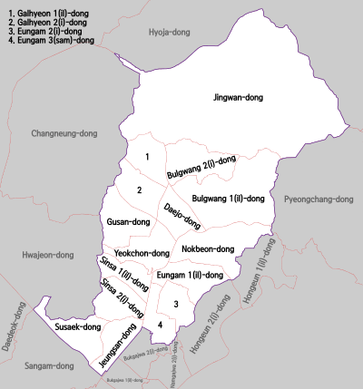
Administrative divisions

Administrative divisions
- Bulgwang-dong (불광동, 佛光洞)
- Daejo-dong (대조동, 大棗洞)
- Eungam-dong (응암동, 鷹岩洞)
- Galhyeon-dong (갈현동, 葛峴洞)
- Gusan-dong (구산동, 龜山洞)
- Jeungsan-dong (증산동, 繒山洞)
- Jingwan-dong (진관동, 津寬洞)
- Nokbeon-dong (녹번동, 碌磻洞)
- Sinsa-dong (신사동, 新寺洞)
- Susaek-dong (수색동, 水色洞)
- Yeokchon-dong (역촌동, 驛村洞)
Transportation
Railways
- (Deogyang-gu, City of Goyang) ← Gupabal ─ Yeonsinnae ─ Bulgwang ─ Nokbeon → (Seodaemun-gu)
Sister cities
References
- ↑ "은평구(Eunpyeong-gu, 恩平區)" (in Korean). Eunpyeong-gu. Retrieved 2015-01-06.
- ↑ Korean Statistical Information Service (Korean) > Population and Household > Census Result (2010) > Population by Administrative district, Sex and Age / Alien by Administrative district and Sex, Retrieved 2010-06-02.
External links
| Wikimedia Commons has media related to Eunpyeong-gu, Seoul. |
| ||||||||||||
Coordinates: 37°36′9.71″N 126°55′44.80″E / 37.6026972°N 126.9291111°E
This article is issued from Wikipedia - version of the Saturday, May 30, 2015. The text is available under the Creative Commons Attribution/Share Alike but additional terms may apply for the media files.

