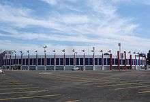
Estádio Vila Capanema
| Estádio Durival Britto e Silva | |
 | |
| Location | Curitiba, Paraná, Brazil |
|---|---|
| Owner | Paraná Clube |
| Capacity | 20,000[1] |
| Field size | 110 x 70m |
| Surface | Grass |
| Opened | January 23, 1947 |
| Tenants | |
|
Clube Atlético Ferroviário (1947-1971) Colorado Esporte Clube (1971-1989) Paraná Clube (since 1989) | |
Estádio Durival Britto e Silva, better known as Estádio Vila Capanema (Portuguese for Capanema Borough Stadium), is the main stadium of Paraná Clube in Curitiba, Paraná, Brazil. The other club stadium is Estádio Vila Olímpica, but it is currently being used for training. The stadium holds 20,000 people.[1] It is named after Colonel Durival Britto e Silva, who was president of the RFFSA, the Brazilian Federal railroad company.
History
It was built in 1947 for being Clube Atlético Ferroviário's home and the first match occurred on January 23 of that year, when Fluminense Football Club from Rio de Janeiro beat Clube Atlético Ferroviário 5-1. The first goal of the stadium was scored by Fluminense's Careca.

During many years Estádio Vila Capanema was Curitiba's most modern and comfortable stadium with a capacity of 15,000 spectators. It was built to host 1950 FIFA World Cup games and on June 25, 1950, Spain beat the United States of America and in the 29th day of that month, Paraguay played against Sweden.
Clube Atlético Ferroviário was extinct in 1971 and Vila Capanema became Paraná Clube's home since the foundation of the club, in 1989.
In 2006, Estádio Vila Capanema was modernized and Paraná Clube opened the stadium again after four years. The capacity of the stadium was boosted to 20,083 fans. The American rock band Pearl Jam played at the stadium on November 9, 2011, as part of their 20th anniversary tour.[2]

References
- 1 2 "CNEF - Cadastro Nacional de Estádios de Futebol" (PDF) (in Portuguese). Confederação Brasileira de Futebol. Retrieved January 21, 2010.
- ↑ "Pearl Jam Announces 2011 South and Central American Tour". pearljam.com. 2011-07-11. Retrieved 2011-07-11.
- Official website
- Especial Placar - Guia 2006 Brasileirão - São Paulo: Editora Abril, 2006.
- Enciclopédia do Futebol Brasileiro, Volume 2 - Lance, Rio de Janeiro: Aretê Editorial S/A, 2001.
External links
| ||||||
Coordinates: 25°26′22″S 49°15′21″W / 25.43944°S 49.25583°W