El Cerro del Aripo
| El Cerro del Aripo | |
|---|---|
 El Cerro del Aripo | |
| Highest point | |
| Elevation | 940 m (3,080 ft) [1][2][3] |
| Listing | Country high point |
| Coordinates | 10°43′00″N 61°15′00″W / 10.71667°N 61.25000°WCoordinates: 10°43′00″N 61°15′00″W / 10.71667°N 61.25000°W |
| Geography | |
| Location | Trinidad and Tobago |
| Parent range | Northern Range |
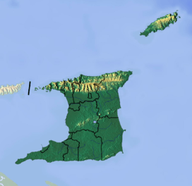
El Cerro del Aripo, at 940 metres (3,084 ft), is the highest point in the Republic of Trinidad and Tobago. It is part of the Aripo Massif and is located in the Northern Range on the island of Trinidad, northeast of the town of Arima.
Geography and climate
El Cerro Del Aripo stands as the highest elevation in the Republic of Trinidad and Tobago. Its climate is subtropical.
References
- ↑ "Aripo Peak" on Peakbagger.com Retrieved 2 October 2011
- ↑ Elevation extremes, CIA
- ↑ Mount Aripo, Encyclopaedia Britannica
- Dominique De-Light, Polly Thomas: The Rough Guide to Trinidad and Tobago. Rough Guides 2001, ISBN 1-85828-747-2, p. 167
External links
This article is issued from Wikipedia - version of the Monday, July 27, 2015. The text is available under the Creative Commons Attribution/Share Alike but additional terms may apply for the media files.