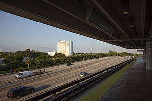
Earlington Heights station
Earlington Heights | |||||||||||||||
|---|---|---|---|---|---|---|---|---|---|---|---|---|---|---|---|
| Metrorail metro station | |||||||||||||||
 The Airport Expressway and Allapattah, as seen from the station platform | |||||||||||||||
| Location |
2100 NW 41st Street Miami, Florida 33142 | ||||||||||||||
| Coordinates | 25°48′45″N 80°13′48″W / 25.81250°N 80.23000°WCoordinates: 25°48′45″N 80°13′48″W / 25.81250°N 80.23000°W | ||||||||||||||
| Owned by | Miami-Dade County | ||||||||||||||
| Line(s) | |||||||||||||||
| Platforms | 1 island platform | ||||||||||||||
| Tracks | 2 | ||||||||||||||
| Connections |
| ||||||||||||||
| Construction | |||||||||||||||
| Parking | Garage (95 spaces) | ||||||||||||||
| Disabled access | Yes | ||||||||||||||
| Other information | |||||||||||||||
| Station code | EHT | ||||||||||||||
| History | |||||||||||||||
| Opened | December 17, 1984 | ||||||||||||||
| Traffic | |||||||||||||||
| Passengers (2011) |
456,000[1] | ||||||||||||||
| Services | |||||||||||||||
| |||||||||||||||
Earlington Heights is a station of the Metrorail rapid transit system in the unincorporated community of Brownsville in Miami-Dade County, Florida. This station is located at the intersection of Northwest 21st Avenue and the Airport Expressway (SR 112). The Metrorail Orange Line creation and extension of the metro to Miami International Airport (MIA) began construction from this rail station in May 2009, completed in July 2012. Passenger service between MIA, through Downtown Miami, and to the southern Miami suburb of Kendall opened in Summer 2012.
Places of interest
- Miami International Airport (via the Orange Line)
- Brownsville
- Allapattah
- Historic Miami Jackson High School
- Earlington Heights Elementary
Transit connections
Metrobus
| Route # | Route Name | Route Map | Note |
|---|---|---|---|
| 17 | Norwood (Miami Gardens) ↔ Flagler Street or Vizcaya Metrorail station via 17 Ave | Map | Weekday rush hour service to NW 103 St at 7 Ave (US 441) |
| 22 | The Mall at 163rd Street ↔ Coconut Grove Metrorail station via 22 Ave | Map | |
| 150 | Airport Flyer (MIA ↔ Miami Beach via Airport Expressway, Julia Tuttle Cswy, and Collins Avenue) | Map | Limited-stop service this route no longer serves this station it runs express from the beach to the Airport Metrorail Station |
| 238 | Dolphin Mall via Blue Lagoon & NW 25 St | Map | Service to Airport Station this route no longer serves this station |
Gallery
-

New sign indicating Orange Line transfer
References
External links
 Media related to Earlington Heights (Metrorail station) at Wikimedia Commons
- MDT – Metrorail Stations
- entrance from Google Maps Street View
This article is issued from Wikipedia - version of the Monday, January 25, 2016. The text is available under the Creative Commons Attribution/Share Alike but additional terms may apply for the media files.