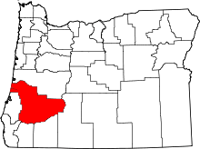
Drew, Oregon
Drew is an unincorporated community in Douglas County, Oregon, United States.[1] It is located about six miles south of Tiller and 21 miles north of Trail on Oregon Route 227, surrounded by the Umpqua National Forest.[2]
Drew was probably named after Robert Drew, a local resident.[3] Drew post office was established in 1902 and discontinued in 1971.[3] In 1915 the community had a public school, and the nearest railroad point was 32 miles away in Riddle.[4] As of 1990 there were only a few houses.[4] Drew has a general store and a museum in the former Tison School building, built of logs in 1906.[5]
At one time Drew's economy was based primarily on logging, but in a 2006 study, the federal government identified the Milo-Tiller-Drew area as a "community of concern" because of the negative impact the Northwest Forest Plan had on it.[6]
References
- ↑ "Drew". Geographic Names Information System. United States Geological Survey. November 28, 1980. Retrieved 2010-12-29.
- ↑ Oregon Atlas & Gazetteer (7th ed.). Yarmouth, Maine: DeLorme. 2008. p. 61. ISBN 0-89933-347-8.
- 1 2 McArthur, Lewis A.; McArthur, Lewis L. (2003) [First published 1928]. Oregon Geographic Names (7th ed.). Portland, Oregon: Oregon Historical Society Press. p. 302. ISBN 9780875952772. OCLC 53075956.
- 1 2 Friedman, Ralph (1990). In Search of Western Oregon (2nd ed.). Caldwell, Idaho: The Caxton Printers, Ltd. p. 554. ISBN 0-87004-332-3.
- ↑ "Our Town". News-Review. October 29, 2010. p. 56. Retrieved 2010-12-29.
- ↑ Daniel, Green; Charles McKetta (May 16, 2007). "Secure Rural Schools Payments Termination: Impacts on Oregon's O&C County Economies" (PDF). Oregon Department of Forestry. Retrieved 2010-12-29.
| |||||||||||||||||||||
Coordinates: 42°52′54″N 122°53′58″W / 42.881789°N 122.899496°W
