Derapur
| Derapur | |
|---|---|
| town | |
 Derapur Location in Uttar Pradesh, India | |
| Coordinates: 26°25′0″N 79°48′0″E / 26.41667°N 79.80000°ECoordinates: 26°25′0″N 79°48′0″E / 26.41667°N 79.80000°E | |
| Country |
|
| State | Uttar Pradesh |
| District | Kanpur Dehat |
| Elevation | 124 m (407 ft) |
| Languages | |
| • Official | Hindi |
| Time zone | IST (UTC+5:30) |
| Vehicle registration | UP- |
| Coastline | 0 kilometres (0 mi) |
Derapur is a town in Kanpur Dehat district in the state of Uttar Pradesh, India. It is the headquarters of the Tehsil of the same name. Derapur is 61 km from Kanpur.
Transport
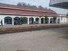
Derapur is well connected by trains and roads. Rura is nearest Railway Station (NCR) to Derapur town.

Rura is towards north at a distance of 14 km where super fast and express trains are available. It is connected towards east Kanpur Patna, Havrah and towards west Aligarh, Agra, Delhi etc. It is also connected by roads to Golden Quadrilateral National Highway of India at Mugisapur at a distance 6 km towards south. It is situated on the south bank of the river Sengur
Institutions
- Sub division and Tehsil
- Circle officer Police and Police Station
- State Bank of India,Bank of Baroda .
- Post Office and BSNL Exchange.
Educational institutions
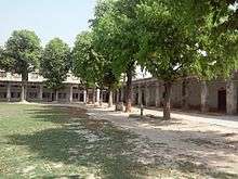
- Galuapur Inter College—A government aided most ancient and famous institution of sub division Derapur.
- Devi Sahay Sarvjanik Inter College
- Shyam Bihari Guda Devi Degree College
Notable Educator
- Asharfi Lal Mishra
 20141231 124639 Educator of Utter Pradesh
Festivals
All national festivals, Holi, Diwali, Mahashivratri, Shri Krishna Janmashtami, Ramnavami, Makara Sankranti, Eid-ul-Fitr, Rakshabandhan, Hanuman jayanti and other local ones such as Nag-Panchmi, Navratri, Durga Puja are celebrated with enthusiasm. . Savitri vrat and Navratri vrat are main festival of women of town Derapur, At the time of savitri vrat women takes 101 round of banyan tree. Vijyadashmi is a most famous festival of the town Derapur. It is celebrated continuously 3 days. A fair is also organized for 15 days.
Art and culture

Gallery
-

Galuwapur Inter College
-

Holi -Holi
-

Water colours design -1
-
.jpg)
Water colours design (Nature)
Geography
Derapur is located at 26°25′0″N 79°48′0″E / 26.41667°N 79.80000°E. It has an average elevation of 124 meters (410 feet).