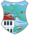
Debar Municipality
| Municipality of Debar Општина Дебар Komuna e Dibrës | |||
|---|---|---|---|
| Urban municipality | |||
| |||
 | |||
| Country |
| ||
| Region | Southwestern Statistical Region | ||
| Municipal seat | Debar | ||
| Government | |||
| • Mayor | Ruzhdi Lata (DUI) | ||
| Area | |||
| • Total | 145.67 km2 (56.24 sq mi) | ||
| Population | |||
| • Total | 19,542 | ||
| • Density | 134.15/km2 (347.4/sq mi) | ||
| Time zone | CET (UTC+1) | ||
| Area code(s) | ++389 46 | ||
| Website | http://www.dibra.gov.mk/ | ||
Debar (Macedonian: Дебар [ˈdɛːbar], Albanian: Dibra, Turkish: Debre) is a municipality in western part of Republic of Macedonia. Debar is also the name of the town where the municipal seat is found. Debar Municipality is part of the Southwestern Statistical Region.
Geography
The municipality borders Mavrovo and Rostuša Municipality to the northeast, Kičevo Municipality to the southeast, Centar Župa Municipality to the south, and Albania to the west.
Villages
Besides the central town Debar, the municipality consists of the following villages: Banište, Bomovo, Dolno Kosovrasti, Džepište, Gari, Gorno Kosovrasti, Hame, Konjari, Krivci, Mogorče, Osoj, Otišani, Rajčica, Selokukji, Spas, Tatar, Tatar Elevci, and Trnanik.
Demographics
According to the last national census from 2002 this municipality has 19,542 inhabitants.[1]
Ethnic groups in the municipality include:
- Albanians = 11,348 (58.1%)
- Macedonians = 3,911 (20.0%)
- Turks = 2,684 (13.7%)
- Roma = 1,080 (5.5%)
- others.
Mother tongues in the municipality include:
- Albanian = 12,051 (61.6%)
- Macedonian = 5,973 (30.5%)
- Turkish = 1,358 (6.9%)
- Roma = 50 (0.25%)
Demographic development of Debar municipality within today borders.[2]
| Census year | Total | Macedonians | % | Albanians | % | Turks | % | Roma | % | Vlachs | Serbs | Bosniaks | Other |
|---|---|---|---|---|---|---|---|---|---|---|---|---|---|
| 1953 | 10258 | 3392 | 33.07 | 5819 | 56.73 | 776 | 7.56 | 83 | 0.81 | 2 | 114 | 0 | 72 |
| 1961 | 11162 | 2025 | 18.14 | 6476 | 58.02 | 2002 | 17.94 | 0 | 0.00 | 0 | 86 | 0 | 573 |
| 1971 | 13802 | 2022 | 14.65 | 8793 | 63.71 | 2414 | 17.49 | 0 | 0.00 | 0 | 106 | 0 | 467 |
| 1981 | 16952 | 2358 | 13.91 | 9981 | 58.88 | 1130 | 6.67 | 1030 | 6.08 | 0 | 37 | 0 | 2416 |
| 1994 | 19010 | 4266 | 22.44 | 10935 | 57.52 | 1875 | 9.86 | 1103 | 5.80 | 1 | 34 | 0 | 796 |
| 2002 | 19542 | 3911 | 20.02 | 11348 | 58.09 | 2684 | 13.74 | 1080 | 5.53 | 2 | 22 | 3 | 492 |
References
External links
| ||||||||||||||||
Coordinates: 41°31′N 20°32′E / 41.52°N 20.53°E

