Coronel Oviedo
| Coronel Oviedo | |||
|---|---|---|---|
| |||
 Coronel Oviedo | |||
| Coordinates: 25°27′S 56°27′W / 25.450°S 56.450°W | |||
| Country | Paraguay | ||
| Department | Caaguazú Department | ||
| Population (2006) | |||
| • Total | 52,400 | ||


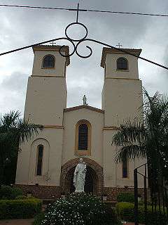
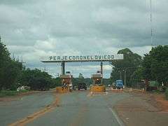
Coronel Oviedo (Spanish pronunciation: [koɾonel oˈβjeðo]) is a city in east-central Paraguay. It is the capital of the Caaguazú Department, about 150 kilometers east of Asunción, and was founded in 1758.[1]
The city has a population of about 52,400 (2006 Estimate) and is the hometown of former president Nicanor Duarte Frutos. Coronel Oviedo is an important transit point, as it lies halfway between Asunción and Ciudad del Este. In addition, it sits at the intersection of highways Ruta 2, Ruta 7 and Ruta 8.
The moniker for the city is the "Capital of Work" or capital de trabajo in Spanish.
The original name of the city at the time of its founding was "Nuestra Señora del Rosario de Ajos" or "Our Lady of the Rosary of Garlic", as the cultivation of garlic was a prominent local cash crop and formed a significant base for trade in the city. The city is the seat of the Roman Catholic Diocese of Coronel Oviedo.[2]
Climate
| Climate data for Coronel Oviedo, Paraguay | |||||||||||||
|---|---|---|---|---|---|---|---|---|---|---|---|---|---|
| Month | Jan | Feb | Mar | Apr | May | Jun | Jul | Aug | Sep | Oct | Nov | Dec | Year |
| Average high °C (°F) | 33 (92) |
32 (90) |
32 (89) |
29 (85) |
26 (78) |
24 (76) |
24 (76) |
27 (80) |
27 (81) |
30 (86) |
31 (88) |
33 (91) |
29 (84.3) |
| Daily mean °C (°F) | 26.7 (80.1) |
26.3 (79.3) |
25 (77.0) |
21.9 (71.4) |
19.4 (66.9) |
16.9 (62.4) |
17.3 (63.1) |
18.5 (65.3) |
19.9 (67.8) |
22.6 (72.7) |
24.3 (75.7) |
26 (78.8) |
22.07 (71.71) |
| Average low °C (°F) | 22 (71) |
21 (69) |
20 (68) |
18 (64) |
14 (57) |
13 (56) |
12 (53) |
13 (56) |
14 (58) |
18 (64) |
18 (65) |
21 (69) |
17 (62.5) |
| Average precipitation mm (inches) | 157 (6.2) |
150 (5.9) |
112 (4.4) |
142 (5.6) |
135 (5.3) |
104 (4.1) |
61 (2.4) |
79 (3.1) |
102 (4.0) |
165 (6.5) |
163 (6.4) |
145 (5.7) |
1,515 (59.6) |
| Average precipitation days (≥ 0.1 mm) | 10 | 10 | 9 | 9 | 8 | 9 | 7 | 7 | 9 | 11 | 10 | 10 | 109 |
| Average relative humidity (%) | 70 | 72.6 | 73.9 | 76.3 | 78.1 | 78.6 | 73.8 | 71.7 | 69.8 | 69.4 | 68.5 | 68.4 | 72.6 |
| Source #1: Weatherbase (monthly mean temperatures and humidity) [3] | |||||||||||||
| Source #2: World Weather Online (all data except for monthly mean temperatures and humidity) [4] | |||||||||||||
See also
References
- ↑ http://www.britannica.com/EBchecked/topic/138335/Coronel-Oviedo
- ↑ http://www.gcatholic.org/dioceses/diocese/coro3.htm
- ↑ "Coronel Oviedo, Paraguay". Retrieved June 14, 2014.
- ↑ "Coronel Oviedo Monthly Climate Average, Paraguay". Retrieved June 14, 2014.
Coordinates: 25°25′S 56°27′W / 25.417°S 56.450°W
|

