Cordillera Quimsa Cruz
| Cordillera Quimsa Cruz | |
|---|---|
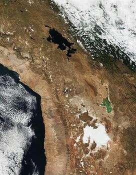
 The Cordillera Quimsa Cruz is situated south-east of Lake Titicaca and north of Lake Uru Uru | |
| Highest point | |
| Peak | Jach'a Khunu Qullu |
| Elevation | 19,029 ft (5,800 m) |
| Coordinates | 17°0′S 67°20′W / 17.000°S 67.333°W |
| Dimensions | |
| Length | 35 km (22 mi) |
| Width | 12 km (7.5 mi) |
| Geography | |
| Country | Bolivia |
| State/Province | Altiplano |
| Range coordinates | 17°00′S 67°10′W / 17°S 67.17°WCoordinates: 17°00′S 67°10′W / 17°S 67.17°W |
| Parent range | Andes |
| Geology | |
| Type of rock | granite |
The Cordillera Quimsa Cruz is a mountain range in the La Paz Department in Bolivia situated south east of Lake Titicaca and north of Lake Uru Uru, measuring about 35-40 km in length and 12 km at its widest point. It is the continuation of the Cordillera Real of Bolivia extending in a north to south-eastern direction from Asiento pass south of Illimani to Tres Cruces pass.[1]
Kimsa Cruz or Quimsa Cruz in hispanicized spelling is a partly Aymara (kimsa three),[2] partly Spanish (cruz cross) expression meaning "three crosses".
Mountains
The highest elevations are Jach'a Khunu Qullu (5,800 m), Wayna Khunu Qullu (5,640 m) and Gigante (5,748 m). Other notable peaks are:[3][4][5]
|
|
See also
References
- ↑ Echevarría, Evelio, Cordillera Quimsa Cruz, Bolivia, Alpine Journal (2006), p. 152-162
- ↑ Radio San Gabriel, "Instituto Radiofonico de Promoción Aymara" (IRPA) 1993, Republicado por Instituto de las Lenguas y Literaturas Andinas-Amazónicas (ILLLA-A) 2011, Transcripción del Vocabulario de la Lengua Aymara, P. Ludovico Bertonio 1612 (Spanish-Aymara-Aymara-Spanish dictionary)
- ↑ Bolivian IGM map 1:50,000 6142-IV 'Yaco'
- ↑ IGM map 1:50,000 6043-I Araca
- ↑ "Cairoma". INE, Bolivia. Retrieved October 28, 2014.