Contamana
| Contamana | |
|---|---|
|
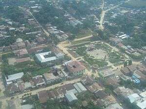
View of the town | |
 Contamana Location in Peru | |
| Coordinates: 7°21′02″S 75°00′33″W / 7.350528°S 75.009189°W | |
| Country | Peru |
| Region | Loreto |
| Province | Ucayali |
| Elevation[1] | 134 m (440 ft) |
| Population (2007)[2] | 15,036 |
| Time zone | PET (UTC-5) |
| Website | www.muniucayali.gob.pe |
Contamana is a town in the Loreto Region in northeastern Peru. It is the capital of both Ucayali Province and Contamana District and has an urban population of about 15,036 (as of 2007[2]). It has one airport.
Contamana can be accessed by both plane and boat. It takes 10 hours coming from Pucallpa in the south and a few days coming from Iquitos in the north. A small plane can be chartered roundtrip from either destination for around $300 US dollars. The flight takes about 1.5 hours from the south or north. The boat ride can be very long and boring at times, though they do stop for lunch along the way in one of the small villages coming from Pucallpa. Coming from Iquitos, the boat takes about 4 days. The town of Contamana is very safe. There is no crime there.
There are a few good restaurants, which open at 5pm. All the food is homemade, organic and very tasty. There is an open market that you can buy breakfast at in the morning. The food is also good there. Lots of fish varieties, rice, vegetables and other natural foods that are prepared by local vendors.
There are also a couple of banks and very inexpensive hotels, with and without air conditioning $25-$35 USD per night.
Siesta's are common in the town from 2-5pm. Most shops and restaurants are closed between these hours. Even if you want to stay awake, the sun and the jungle air will automatically lull you to sleep between these hours.
Contamana is by far, the cheapest place to purchase Shipobo mural art. What may cost hundreds of dollars in Iquitos, Pucallpa or Cusco, will only cost you about $30 to $50 US dollars. Beautiful hand stitched murals that tell a truly amazing story of the Shipibo Indians that have lived in Peru for thousands of years.
For those interested in Ayahuasca, just ask one of the taxi drivers and they will take you to see a shaman where you will be provided the medicine at a very low cost (compared to Iquitos, Puerto Maldonado, Pucallpa or Cusco). For females, you'll want to be accompanied by a male companion during ceremony, someone that you know.
The town is small and the people are friendly. It is very family oriented. There is almost no tourism. The one attraction is Aguas Caliente. A taxi can take you up into the mountains from the center of town. Once there, a tour guide will walk you through a path for about 3 miles to get to the Aguas Caliente. By this point, you are deep into the amazon rain forest mountains. This is one of the most beautiful and serene spots one can experience on earth. Untouched by man with a "spirit" vibration. The night skies are incredible. You can stay overnight at the Aguas Caliente if you so choose. Just ask the tour guide and they will give you a tent. He will also bring a couple of meals in for you. There is very nice large outdoor veranda above the jungle floor, safe from animals that come out at night to drink from the spring.
Should you decide to venture beyond the main Aguas Caliente area, there are 2 path in which to take. One is through the water and the other up a long hill. The paths will take you to either a big waterfall with hot water or through a meandering stream where only a few have ventured. Fish, birds, huge butterflies, trees and plants that are utterly breathtaking. You can lose yourself for hours on these nature paths. The end of the paths are where Sierra Del Divisor National Park begins.
Both of these paths require Black rubber boots. These boots can be purchased in Contamana and are "necessary" in order to go to Aguas Caliente. The water is very hot in places. Long sleeve shirts and pants are also required, as there are many mosquitos up there in the mountains.
References
- ↑ "Official Contamana Infopage". Retrieved 2015-11-08.
- 1 2 "Censo Nacional de Población y Vivienda 2007". Retrieved 2015-11-08.
External links
- Portal Oficial de Contamana - Municipalidad Provincial de Ucayali - Ucayali Province Council official website
- Fotos de Contamana
Coordinates: 7°20′00″S 75°01′00″W / 7.33333°S 75.01667°W
