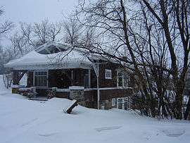
Confederation SDA, Saskatoon
| Confederation SDA | |
|---|---|
| Country | Canada |
| Province | Saskatchewan |
| City | Saskatoon |
| Area | |
| • Water | 0 km2 (0 sq mi) 0% |
| Population (2000) | |
| • Total | 52,732 |
| 60,832 projected 2010 | |
| Postal Code | S7M, |
| Area code(s) | Area code 306 |


Confederation Suburban Development Area (SDA) is an area in Saskatoon, Saskatchewan (Canada). It is a part of the west side community of Saskatoon. It lies (generally) north of the outskirts of the City and the Rural Municipality of Corman Park No. 344, west of downtown Saskatoon, and the Core Neighbourhoods SDA, south of the North West Industrial SDA, and east of the new Blairmore SDA.
Neighborhoods
Recreation Facilities
- Cosmo Civic Centre & Ice Arena[1]
Shopping
- Confederation Park Mall[2]
- Pleasant Hill Plaza
- Westgate Plaza
- Westgreen Plaza
See also
Education
Confederation SDA is home to the following schools:
Separate Education
Secondary Schools
Elementary schools
- St. Edward School
- École Henry Kelsey
- St. Mary Community School
Public Education
Secondary Schools
- Bedford Road Collegiate
- Mount Royal Collegiate
- Mount Royal West
Secondary Schools of Saskatoon
Elementary schools
- College Park School
- Confederation Park School
- Fairhaven School
- Howard Coad School
- King George School
- Pleasant Hill School
- W.P. Bate School
Library
Carlyle King Branch[3]
Transportation
22nd Street (Highway 14) is a major thoroughfare through Saskatoon Highway 14 connects with Asquith, Biggar Wilkie, Unity, and Macklin en route to Alberta. The Circle Drive ring road also passes through the area.
City Transit
The following routes serve the area, all meeting at the bus terminal at Confederation Mall.
- 1 Westview – Wildwood
- 2 Meadowgreen – 8th Street
- 3 Riversdale – College Park
- 4 Dundonald – Willowgrove
- 5 Fairhaven – Briarwood
- 22 City Centre – McCormack
- 23 Hampton Village – Shaw Centre
- 50 Pacific Heights – Lakeview
- 60 Confederation – Lakeridge
Location
 |
Corman Park No. 344 / North West Industrial SDA |
 | ||
| Blairmore SDA | |
Core Neighbourhoods SDA | ||
| ||||
| | ||||
| Corman Park No. 344 |
References
- ↑ City of Saskatoon · Departments · Community Services · Leisure Cosmo Civic Centre URL accessed January 27, 2007
- ↑ Confederation Park URL accessed January 27, 2007
- ↑ Saskatoon Public Library Carlyle King Branch Library URL accessed January 27, 2007
- ↑ Selling an Idea or a Product URL accessed January 27, 2007
External links
- City of Saskatoon City of Saskatoon · Departments · Community Services · City Planning · ZAM Maps
- Populace Spring 2006