Coffeyville Municipal Airport
Coordinates: 37°05′39″N 095°34′19″W / 37.09417°N 95.57194°W
| Coffeyville Municipal Airport Coffeyville AAF | |||||||||||||||
|---|---|---|---|---|---|---|---|---|---|---|---|---|---|---|---|
|
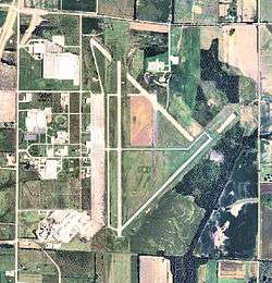
2008 USGS airphoto | |||||||||||||||
| IATA: CFV – ICAO: KCFV – FAA LID: CFV | |||||||||||||||
| Summary | |||||||||||||||
| Airport type | Public | ||||||||||||||
| Owner | City of Coffeyville | ||||||||||||||
| Serves | Coffeyville, Kansas | ||||||||||||||
| Location | Cherokee Township, Montgomery County, near Coffeyville, Kansas | ||||||||||||||
| Elevation AMSL | 754 ft / 230 m | ||||||||||||||
| Runways | |||||||||||||||
| |||||||||||||||
| Statistics (2005) | |||||||||||||||
| |||||||||||||||

Coffeyville Municipal Airport (IATA: CFV, ICAO: KCFV, FAA LID: CFV) is a city-owned airport four miles northeast of Coffeyville, in Montgomery County, Kansas.[1]
Facilities
The airport covers 1,227 acres (497 ha) and has two asphalt runways: 17/35 is 5,872 x 100 ft (1,790 x 30 m) and 4/22 is 4,000 x 75 ft (1,219 x 23 m).[1]
In the year ending September 19, 2005 the airport had 5,550 aircraft operations, average 15 per day: 99% general aviation and 1% military. 40 aircraft were then based at the airport: 85% single-engine, 10% multi-engine and 5% ultralight.[1]
History
- For the World War II use of the airport, see Coffeyville Army Airfield
During World War II the facility was Coffeyville Army Airfield and was a United States Army Air Forces AAF Flying Training Command training field 1942-1945.
Aircraft operated were Vultee BT-13A Valiants, BT-14s and BT-15s. The airfield performed Basic Pilot School instruction, the second phase of the three phase training program for pilots.
The facility was closed and turned over to civil authorities in 1947; Continental DC-3s stopped there in the 1950s.
See also
References
External links
- Resources for this airport:
- FAA airport information for CFV
- AirNav airport information for KCFV
- ASN accident history for CFV
- FlightAware airport information and live flight tracker
- NOAA/NWS latest weather observations
- SkyVector aeronautical chart, Terminal Procedures
