Christiansburg, Ohio
| Christiansburg, Ohio | |
|---|---|
| Village | |
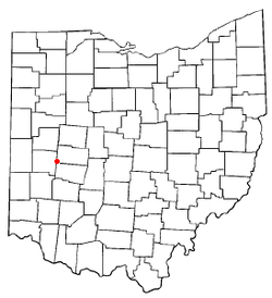
 Location of Christiansburg, Ohio | |
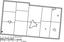
 Location of Christiansburg in Champaign County | |
| Coordinates: 40°3′21″N 84°1′31″W / 40.05583°N 84.02528°WCoordinates: 40°3′21″N 84°1′31″W / 40.05583°N 84.02528°W | |
| Country | United States |
| State | Ohio |
| County | Champaign |
| Township | Jackson |
| Area[1] | |
| • Total | 0.22 sq mi (0.57 km2) |
| • Land | 0.22 sq mi (0.57 km2) |
| • Water | 0 sq mi (0 km2) |
| Elevation[2] | 1,115 ft (340 m) |
| Population (2010)[3] | |
| • Total | 526 |
| • Estimate (2012[4]) | 516 |
| • Density | 2,390.9/sq mi (923.1/km2) |
| Time zone | Eastern (EST) (UTC-5) |
| • Summer (DST) | EDT (UTC-4) |
| ZIP code | 45389 |
| Area code(s) | 937 |
| FIPS code | 39-14296[5] |
| GNIS feature ID | 1060962[2] |
Christiansburg is a village in Champaign County, Ohio, United States. The population was 526 at the 2010 census.
History
An early settler to Jackson Township was Joshua Howell,[6] the founder of Christiansburg, who came from around Christiansburg, Virginia in 1808, with his wife Mary and eight children; Joshua, John, Thomas, James, Daniel, Jermiah, Abigail, and Nancy. He located on Section 31, which is within the corporate limits of Christiansburg. He and his sons built a crude log cabin, near a large spring of water. A tract of land was cleared for food for the family. The Howells planting a fruit bearing orchard.
The Howells had a large sugar camp where they made large quantities of sugar every year to sell to the early settlers. Daniel Howell (one of the sons), had been married in Virginia; he brought his wife and family to Ohio and he entered 80 acres (320,000 m2) of land west of town by the West Fork Honey Creek, where he built a log cabin, In 1818 he built a brick house which still exists.
After nine years the younger Joshua Howell conceived the idea for a town. He created a diagram of the town, consisting of 42 lots. The town was started at his sugar camp, extended south four blocks south, and east and west three blocks. He felled the trees, dug the stumps, laid out streets and named them north to south Westville, Piqua, Urbana, Troy and Pike. From east to west Monroe, Miami (now called Main) and Dayton Streets. Three years later, there were only six log huts, and for 12 years the town grew slowly.
In 1829 William McKrea arrived from Scotland with his family and opened a store. Because of his business ability the hamlet began to grow. He erected a small building on the north east corner of Main and Second Street which was the first frame structure in the village. His stock consisted of groceries, dried meats, fruits, nails, glassware, hardware, medicine, millinery, and pewter ware.
After McCrea opened his store the population doubled, inviting other business enterprises. Among the first was a tavern across the street from the McCrea's Store, operated by Abiel Smith, who was from Maine. Other industries that started during the 1830s was a tannery, was run by William Kelley from 1832 to 1850. It was located close to the ditch that runs to the West Fork Honey Creek near the northeast corner of First and Main. John Rogers operated a wagon shop on the northwest corner of Main and Pike. Charles Rogers also had a wagon shop. In 1818 Jesse Julian had a small blacksmithing shop near the village. In 1835 to 1840 another tavern owned by David Kyle was opened. Noah French, who came from Pennsylvania, was a cabinet maker and made coffins that were needed within a radius of 50 miles (80 km) of Christiansburg.
In 1842 the village of Christiansburg changed its name to Addison and in 1915 the name of the town changed back to Christiansburg.
Geography
Christiansburg is located at 40°3′21″N 84°1′31″W / 40.05583°N 84.02528°W (40.055737, -84.025251).[7]
According to the United States Census Bureau, the village has a total area of 0.22 square miles (0.57 km2), all of it land.[1]
Demographics
| Historical population | |||
|---|---|---|---|
| Census | Pop. | %± | |
| 1920 | 473 | — | |
| 1930 | 482 | 1.9% | |
| 1940 | 536 | 11.2% | |
| 1950 | 666 | 24.3% | |
| 1960 | 788 | 18.3% | |
| 1970 | 724 | −8.1% | |
| 1980 | 593 | −18.1% | |
| 1990 | 599 | 1.0% | |
| 2000 | 553 | −7.7% | |
| 2010 | 526 | −4.9% | |
| Est. 2014 | 507 | [8] | −3.6% |
The median income for a household in the village was $32,500, and the median income for a family was $38,125. Males had a median income of $31,719 versus $25,588 for females. The per capita income for the village was $16,877. About 7.1% of families and 6.7% of the population were below the poverty line, including 10.4% of those under age 18 and 3.8% of those age 65 or over.
2010 census
As of the census[3] of 2010, there were 526 people, 217 households, and 143 families residing in the village. The population density was 2,390.9 inhabitants per square mile (923.1/km2). There were 252 housing units at an average density of 1,145.5 per square mile (442.3/km2). The racial makeup of the village was 96.0% White, 0.6% Native American, 0.2% Asian, 1.1% from other races, and 2.1% from two or more races. Hispanic or Latino of any race were 1.3% of the population.
There were 217 households of which 29.5% had children under the age of 18 living with them, 47.5% were married couples living together, 12.9% had a female householder with no husband present, 5.5% had a male householder with no wife present, and 34.1% were non-families. 28.1% of all households were made up of individuals and 13.4% had someone living alone who was 65 years of age or older. The average household size was 2.42 and the average family size was 2.94.
The median age in the village was 39.6 years. 25.1% of residents were under the age of 18; 6.3% were between the ages of 18 and 24; 24.9% were from 25 to 44; 26.9% were from 45 to 64; and 16.9% were 65 years of age or older. The gender makeup of the village was 49.2% male and 50.8% female.
Notable natives
- Marion A. Ross, one of the Andrews Raiders and posthumous recipient of the Medal of Honor[10]
References
- 1 2 "US Gazetteer files 2010". United States Census Bureau. Retrieved 2013-01-06.
- 1 2 "US Board on Geographic Names". United States Geological Survey. 2007-10-25. Retrieved 2008-01-31.
- 1 2 "American FactFinder". United States Census Bureau. Retrieved 2013-01-06.
- ↑ "Population Estimates". United States Census Bureau. Retrieved 2013-06-17.
- ↑ "American FactFinder". United States Census Bureau. Retrieved 2008-01-31.
- ↑ The History of Champaign County, Ohio: Containing a History of the County; Its Cities, Towns, Etc. W.H. Beers & Company. 1881. p. 438.
- ↑ "US Gazetteer files: 2010, 2000, and 1990". United States Census Bureau. 2011-02-12. Retrieved 2011-04-23.
- ↑ "Annual Estimates of the Resident Population for Incorporated Places: April 1, 2010 to July 1, 2014". Retrieved June 4, 2015.
- ↑ "Census of Population and Housing". Census.gov. Retrieved June 4, 2015.
- ↑ Sgt. Maj. Marion Ross, Andrews Raid, 2001. Accessed 2009-04-05.
External links
| |||||||||||||||||||||||||||||
