Rurichinchay
| Rurichinchay | |
|---|---|
| Chinchey | |
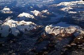 Aerial view of the Cordillera Blanca as seen from the southeast showing Ranrapallqa and Rurichinchay in the left part of the image | |
| Highest point | |
| Elevation | 6,309[1] m (20,699 ft) |
| Listing | List of mountains in the Andes |
| Coordinates | 9°22′57″S 77°19′47″W / 9.38250°S 77.32972°WCoordinates: 9°22′57″S 77°19′47″W / 9.38250°S 77.32972°W |
| Geography | |
 Rurichinchay Peru | |
| Location | Ancash, Peru |
| Parent range | Cordillera Blanca |
Rurichinchay (Quechua), also known as Chinchey, is a 6,309 m (20,699 ft) high mountain in the Cordillera Blanca in the Andes of Peru. It is located in the Ancash Region, Carhuaz Province, Aco District, in the Huaraz Province, Independencia District, and in the Huari Province, Huari District.[1][2]
Rurichinchay is also the name of the lake northeast of the mountain at 9°20′31″S 77°19′04″W / 9.34194°S 77.31778°W and the name of the river which originates at the lake. It flows to the southeast.[2]
See also
References
- 1 2 "Nevado Rurichinchay". IGN, Peru. Retrieved April 13, 2015.
- 1 2 escale.minedu.gob.pe - UGEL map of the Huaraz Province (Ancash Region)
This article is issued from Wikipedia - version of the Monday, December 07, 2015. The text is available under the Creative Commons Attribution/Share Alike but additional terms may apply for the media files.